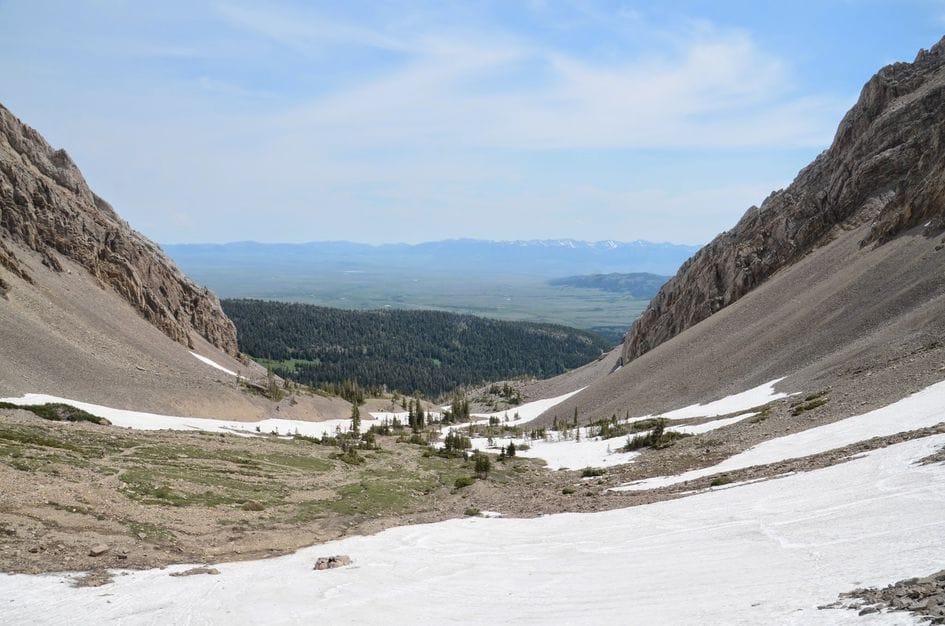
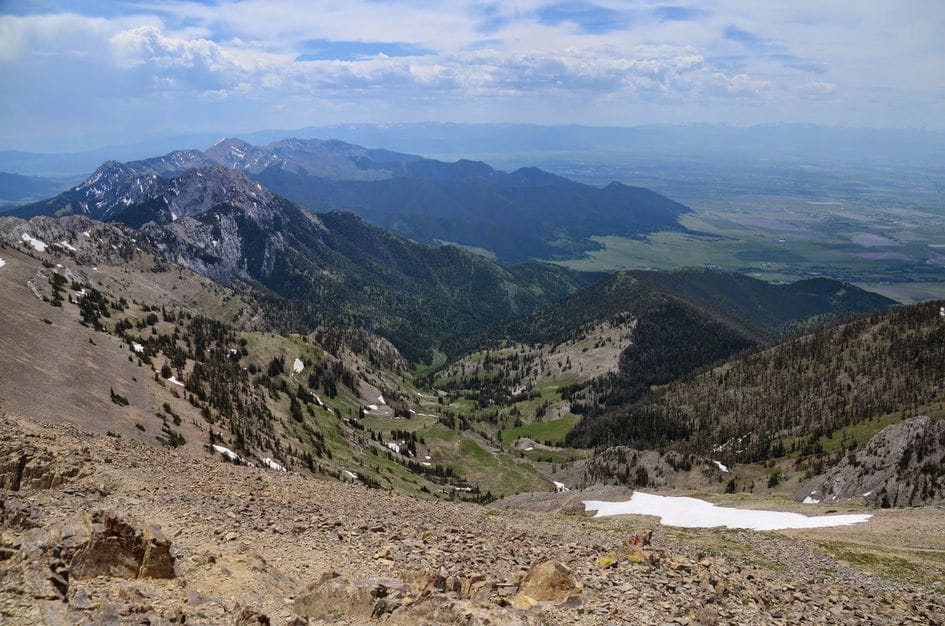
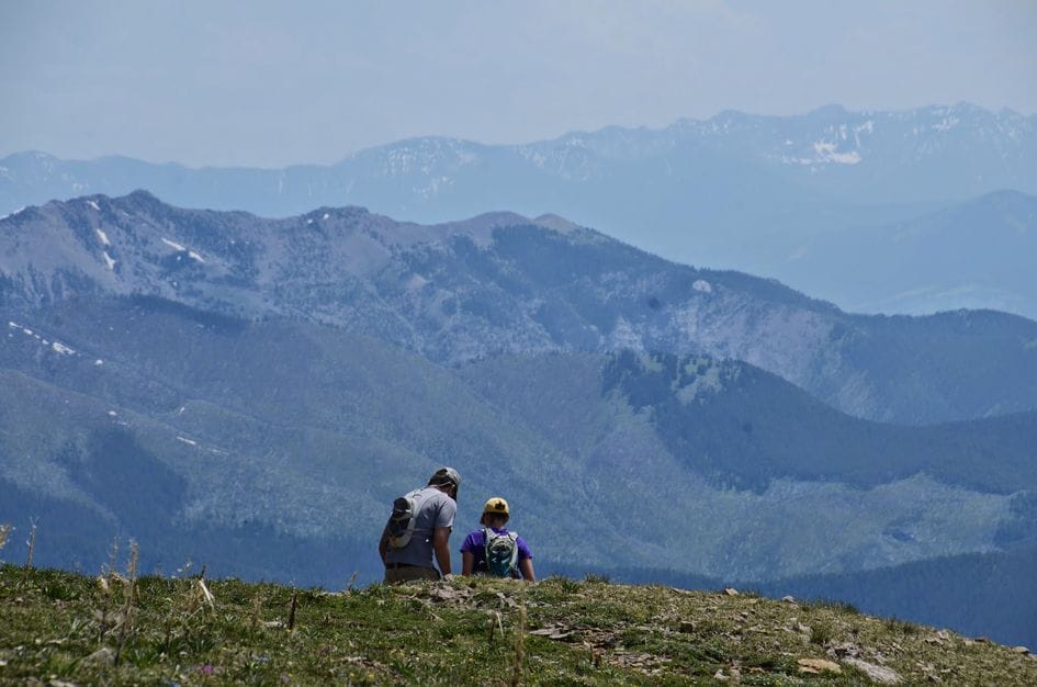
The highest peak in a mountain range tends to give you the best view of it, and Sacagawea is no exception. From the summit you can see the full length of the Bridgers north and south, plus five distinct mountain ranges spread out in every direction. The Gallatin Valley below, Bozeman visible in the distance, the Crazies to the northeast. It is the kind of view that makes sense of the landscape in a way that lower peaks don't.
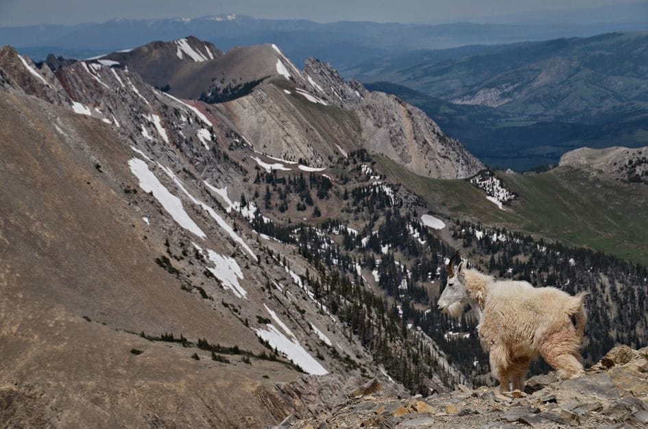
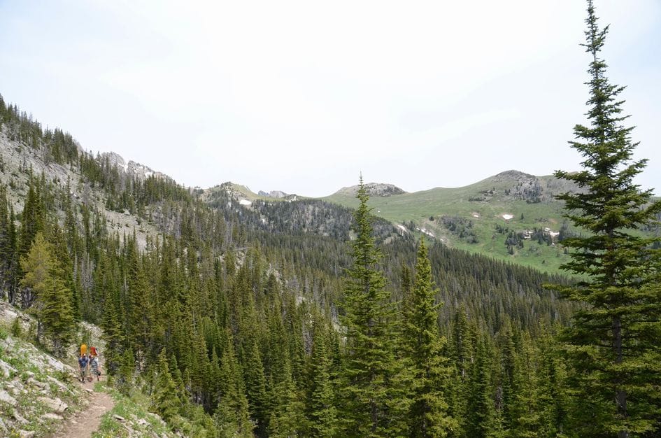
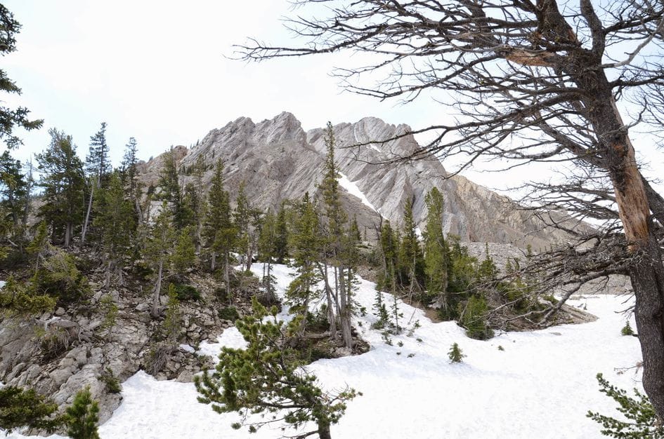
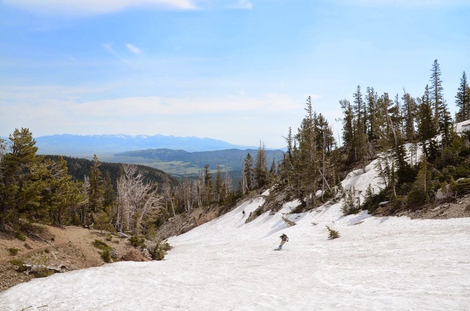
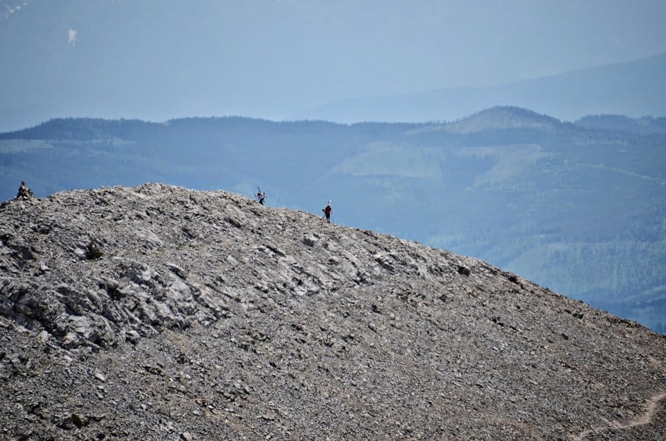
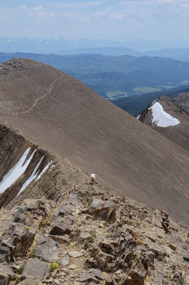
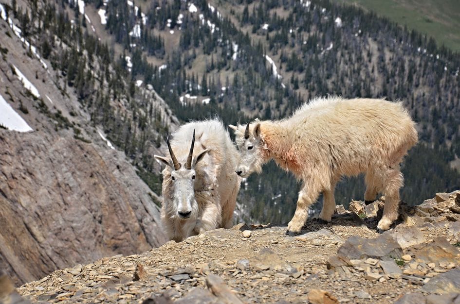
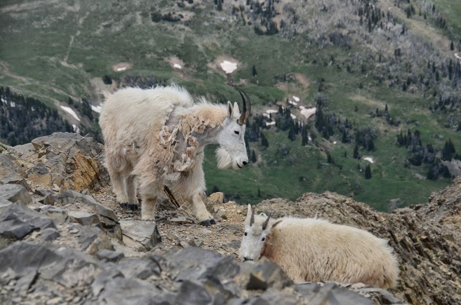
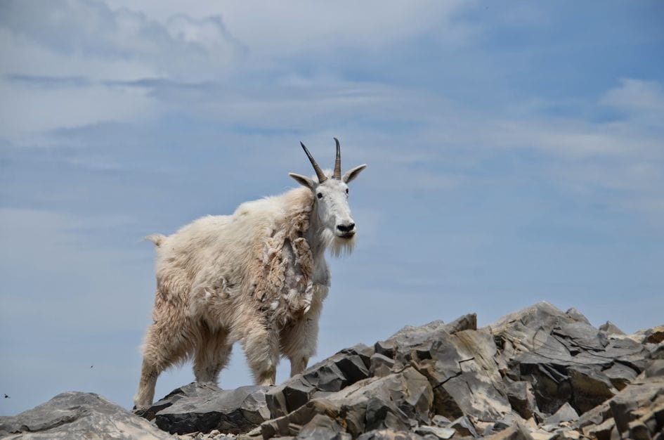
The approach is not long, but it does not ease you in. The trail climbs from the campground at Fairy Lake through forest and then into an open basin that holds snow well into summer, drawing backcountry skiers from Bozeman who hike up in June to ski back down. Mountain goats are on the ridge consistently, accustomed enough to humans that they don't spook easily. If the gate is open and you want the best single-summit view in the Bridger Range, this is it.
The trailhead is located in the Fairy Lake Campground, so there is parking in the campground and near the trail.
There is a bathroom right at the trailhead and another one close by near the campground.
The potential for spotting mountain goats combined with summer snow for backcountry skiers makes this trail a popular destination.
Fairy Lake Road is very rough. If you have a high-clearance vehicle, it's worth taking it on this drive. If you need to, you'll be able to make it with your car, but be prepared to bottom out once or twice. Be Advised: There is a gate roughly two-thirds of the way up Fairy Lake Road. According to the USFS Fairy Lake Campground Site, the gate is open July 1st through September 15th. If in doubt, give the Forest Service in Bozeman a call: 406-587-6701.
You'll be out of service range before you reach Fairy Lake and for the majority of the hike. You may get glimpses of service near the peak.
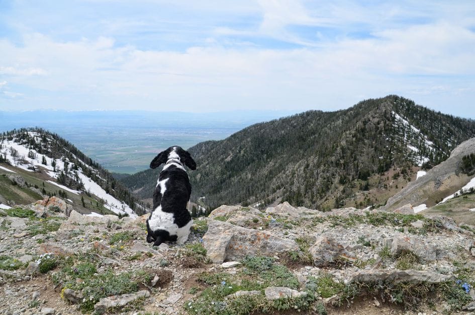
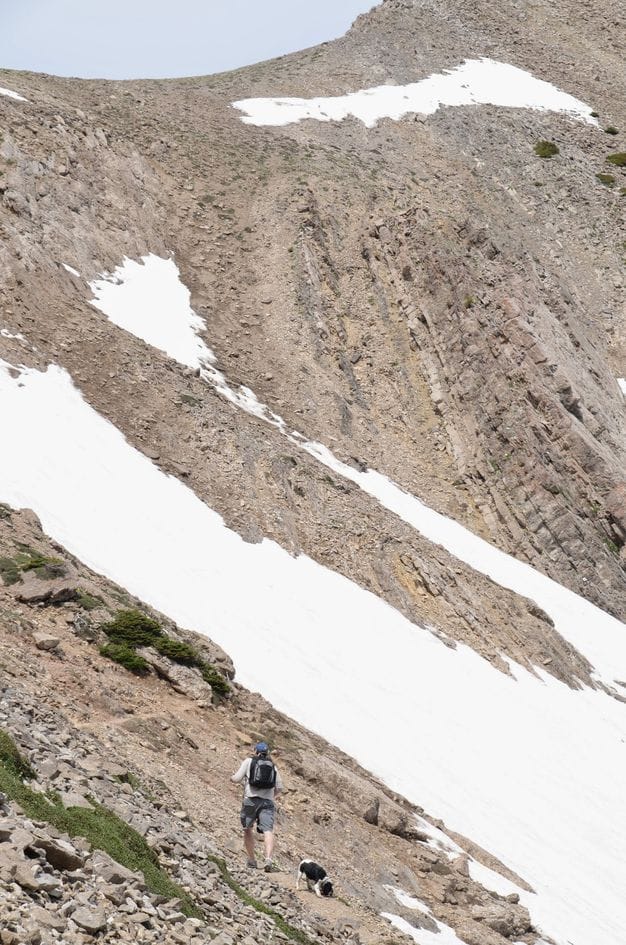
The trail is short, but steep and you're fully exposed to the sun for the majority of the hike. Bring your dog along if it doesn't mind hydrating by eating snow and won't pick a fight with the mountain goats.
28 Miles from Bozeman, MT. 57 Minutes
From Bozeman, head north on Bridger Canyon Drive. Drive for 20 miles or so and take a left onto Fairy Lake Road, which will be just over Battle Ridge Pass. After 6 or so miles of jumbling around on Fairy Lake Road, you'll arrive at the Fairy Lake Campground (and the trailhead). Be Advised: There is a gate roughly two-thirds of the way up Fairy Lake Road. According to the USFS Fairy Lake Campground Site, the gate is open July 1st through September 15th. If in doubt, give the Forest Service in Bozeman a call: 406-587-6701.
Fill up your water bottle at the campground well or pump directly out of Fairy Lake. You will get some runoff in the warmer summer months, but don't rely on it as a water source during the hike.
64 oz consumed per person
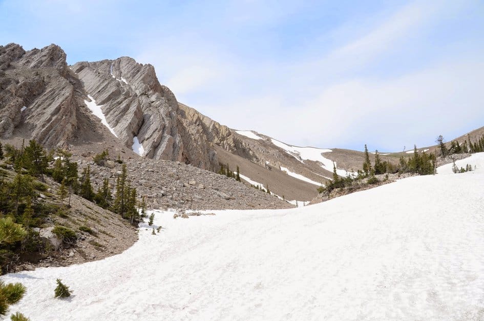
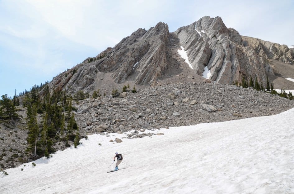
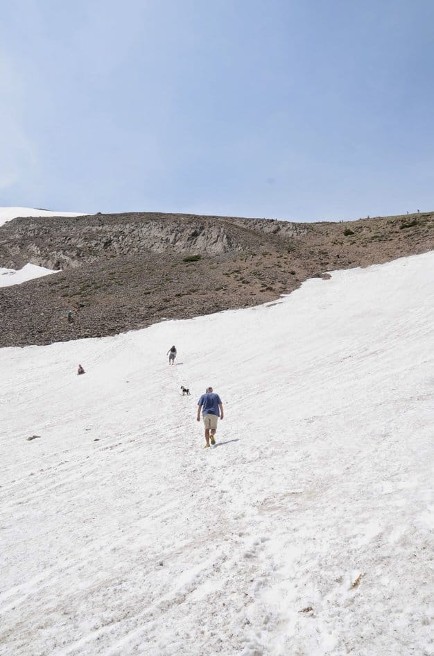
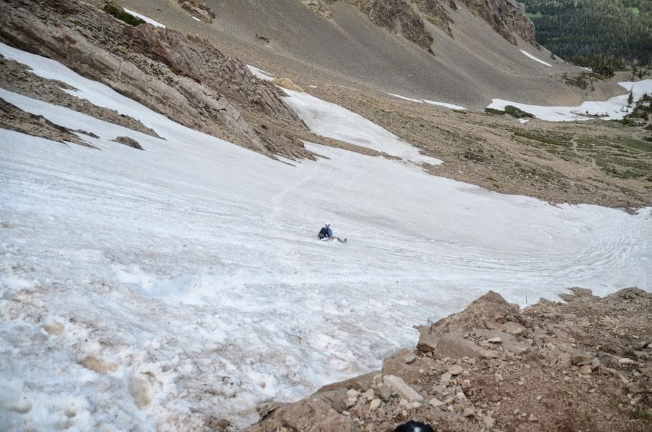
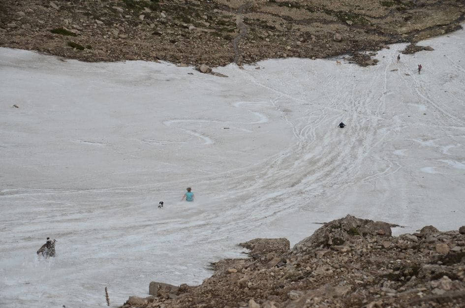
The beginning of the trail is in good condition, but once you reach the basin the trail becomes steep, uneven, and hard to follow if there is snow. Navigation won't be a problem since the lack of trees always allows you to keep the peak in sight. If you're feeling brave some hikers choose to take the shortcut back by sliding down the basin (this can be dangerous and is not recommended). Expect snow into mid-July and again in late September.
Because of the high elevation, the temperature will likely stay on the cooler side. But, being a ridge hike, you'll be exposed to sun and wind. Be prepared with layers for changing conditions and wear boots to keep your feet dry in the snow. Trekking poles will give you an advantage on the steepest parts of the hike.
Footwear: Hiking Boots
Not required to bring food on this hike. If you choose to bring a snack or lunch you may want to eat it before getting to the peak because it can be steep and crowded at the top.
Leave your bug spray at home, unless you plan on camping at Fairy Lake.
The trail starts out in the trees, but once you reach the basin you will be fully exposed to the sun and wind for the remainder of the hike.
The Sacagawea Trailhead is conveniently located inside of the Fairy Lake Campground if you want to spend the night before or after your hike. Once you're on the trail, the lack of trees, water and a constant incline make for less than desirable camping.
Corbly Gulch/Limestone Trail
When you achieve the ridge but before ascending to the peak, you can continue straight westward and switchback down Limestone Trail 4.1 miles to the Corbly Gulch Trailhead.
North Cottonwood Creek Trail
Similar to the trail connection towards Corbly Gulch, look for this when you hit the ridge but before you head up to the actual peak. North Cottonwood Creek Trail will head Northwest down the west-facing slope of the Bridgers.
The Ridge/The M
The Fairy Lake Trailhead is often what people consider the beginning of The Ridge Hike, which is a 20-mile path along the spine of the Bridgers. Once you reach the peak, there's an obvious trail to follow south that will eventually reach The M.
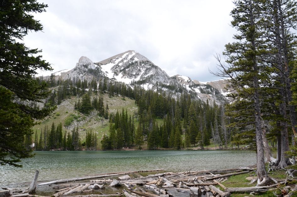
Fairy Lake
While driving to the trailhead for Sacagawea Peak, you'll pass another trailhead sign for Fairy Lake. Take the short walk down a small hill to a path that loops around the entire lake. It's a worthwhile side trip from the main hike.
Shafthouse Trail
The Shafthouse Trail branches North from Fairy Lake Road prior to reaching the Fairy Lake Campground. If you've hit Elf Lake (a tiny lake to your left immediately before the campground), then you've gone too far. The Trailhead for the Shafthouse Trail will be on the right of Fairy Lake Road, with a small parking area to the left.
Hardscrabble Peak
When you achieve the ridge but before ascending to the peak, head North to Hardscrabble Peak.
Beartooth Publishing's Bozeman Area Map covers this whole hike.
July 1 through September 15, which is when the access road gate is open. The basin holds snow into July and draws backcountry skiers in June, but the gate being closed eliminates the drive for most visitors before July.
Mid-July through August: basin largely clear of snow, mountain goats on the ridge, summit views at their best, full 360-degree visibility on clear days.
Early July and September: July may still have snow in the basin for glissading, September is quieter with sharp clear-day views.
Before July 1 or after September 15: the access gate is closed and you'd need to hike Fairy Lake Road, adding significant distance. Check with the Forest Service (406-587-6701) if in doubt.
July 1 through September 15 according to USFS. Conditions can extend or shorten this window. Call the Bozeman Forest Service office at 406-587-6701 to confirm before making the drive early or late in the season.
Yes. Mountain goats are frequently seen on the ridge and summit. They are accustomed to hikers and often stay close. Keep your distance, do not feed them, and know that they can still be unpredictable at close range.
No, not for most hikers. The basin looks like good glissade terrain but the slope angle and run-out are dangerous without self-arrest skills and an ice axe. Several accidents have happened here. Stay on the trail on the way down.
Very rough. High-clearance is strongly recommended. Low-clearance vehicles can make it but will likely bottom out on the rougher sections. The road is about 6 miles of rocky, rutted two-track.
The Gallatin Range, the Crazy Mountains, the Tobacco Root Mountains, the Spanish Peaks, and the Madison Range, plus the full Gallatin Valley with Bozeman visible below. It is one of the broader views available from any single summit near Bozeman.
Plug 4.5 miles and 1,950 feet of elevation gain into our free hiking time calculator for a personalized estimate.