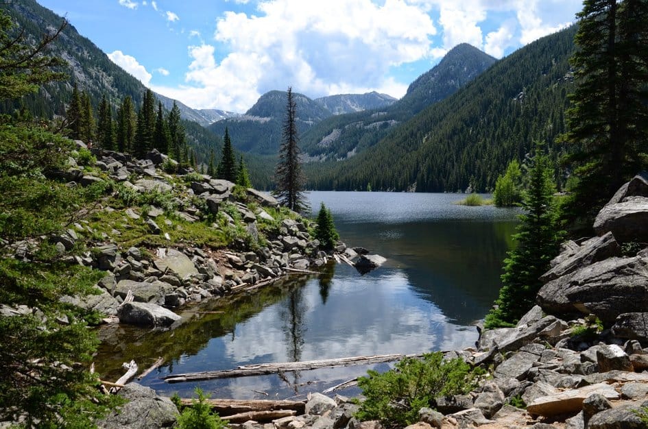
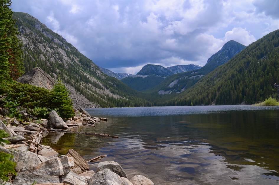
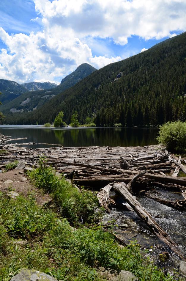
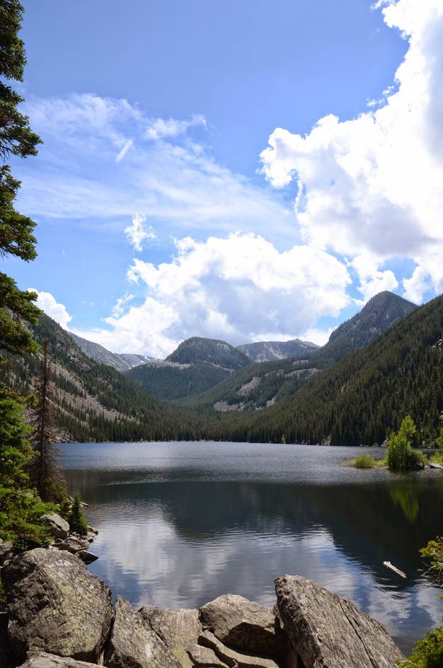
Lava Lake gets the traffic it does because it delivers. The 47-acre lake is substantially larger than most alpine lakes accessible on a day hike, the forested trail through the Cascade Creek drainage is shaded and pleasant the whole way, and arriving at a lake you can swim in on a July afternoon is a reliable summer reward.
The trail is well-beaten and shared with a steady stream of hikers and dogs all season. What it does well is scale. The lake is big enough that you can walk the shoreline and find a quieter spot, and the trail up Table Mountain from the lake opens more options if you want to keep going. Arrive early for parking. The trailhead access requires a right-turn only off Highway 191, so approach from the north.
There are a couple of designated parking areas for hikers, but during the summer and especially on weekends, finding an open spot will be a challenge.
There is a parking lot on the east side of the river for the Gallatin Riverside Trailhead, but crossing the highway by foot is dangerous and not recommended. Get there early to nab a spot.
The bathroom is right next to the trailhead. You can't miss it.
Lava Lake is one of the most popular hikes in the Gallatin Canyon, so be prepared to see a steady flow of people on your way up to the Lake and on your way back. Even if you get an early start there is bound to be a few groups of backpackers staying near the lake.
Smooth, but windy highway miles all the way to the exit.
You won't have any phone service on this hike.
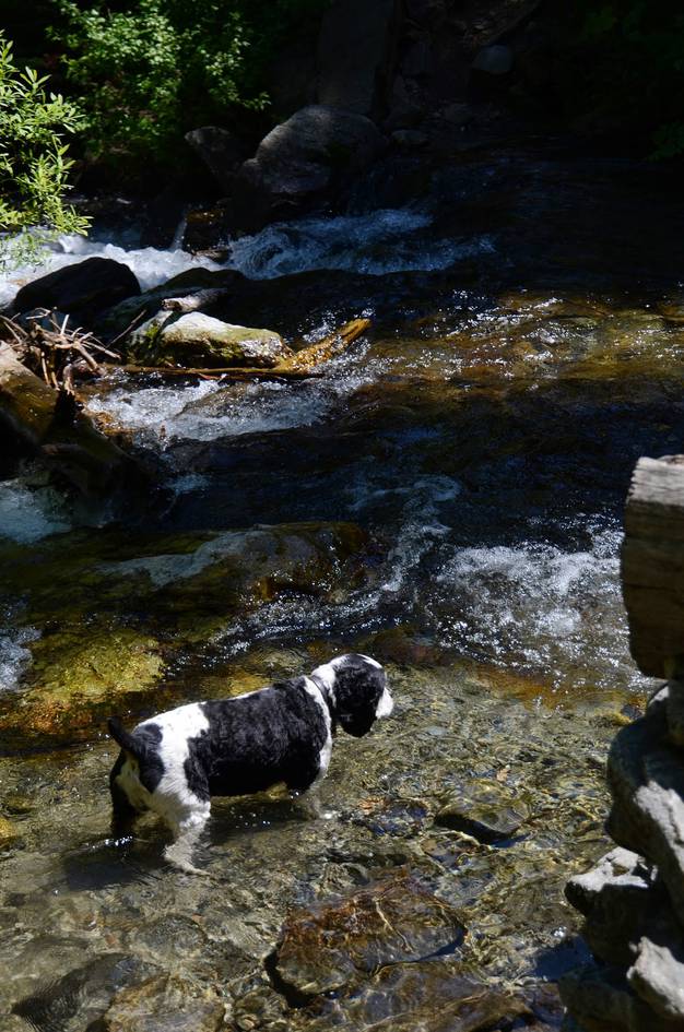
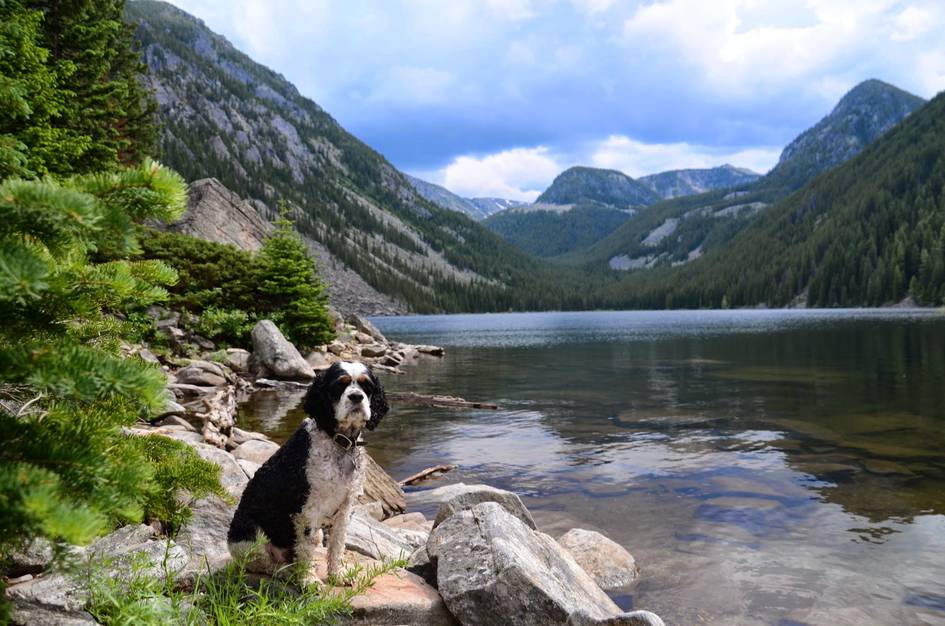
This hike provides ideal outdoor conditions for your dog: consistent water, shade and a giant lake to play in at the top.
Because of the level of dog friendliness, you will run into a lot of dogs. If your pooch prefers the company of humans he/she might get overwhelmed on this hike.
28 Miles from Bozeman, MT. 37 Minutes
From Bozeman, head south on US-191/Gallatin Road past Gallatin Gateway for about 20 miles.
Veer right off of US-191 when you see the Lava Lake Trailhead sign. There is a bridge right where the highway takes a sharp 90 degree turn and crosses the river. The turnoff is immediately north of the bridge, so if you're coming from Bozeman and you cross it you've gone too far.
Once you exit US-191 you will follow a gravel road for a few hundred yards to an obvious trailhead sign for Lava Lake.
Be Advised: You can only make a right-hand turn to get to the trailhead off of the highway, so this means that if you are approaching from the South you have to drive past the access road to the signed "Lava Lake Turnaround" and head back to approach from the North.
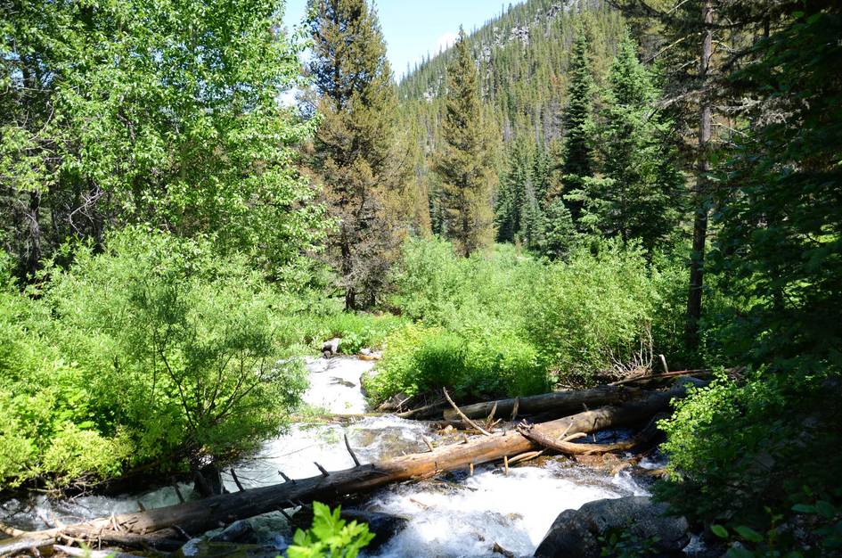
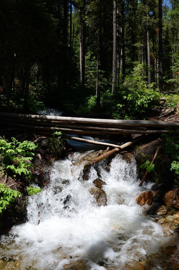
This trail runs alongside and intersects Cascade Creek several times throughout the hike, not to mention ends at a lake. Opportunities for water purification are plentiful.
48 oz consumed per person
The wide dirt trail is well beaten and easy to find. The path can get a bit rocky and you will have to be careful not to trip on the tree roots that consistently spread over the trail.
Expect snow into mid-May and again in late September.
There is a lot of shade on this hike, so you might be able to skip the necessary sun protection until you get to the lake. Shorts and a t-shirt would be fine in the warmer months because you won't be trekking through any tall grass on the trail. Consider bringing a swimsuit and towel just in case you feel like going for a dip in the lake.
Footwear: Tennis Shoes OK
This is a short hike and food is not required. However, it's highly recommended to bring a small lunch or snack to eat up at the lake.
In the thicker parts of the trees and near the lake you may experience a light amount of mosquitoes and flies.
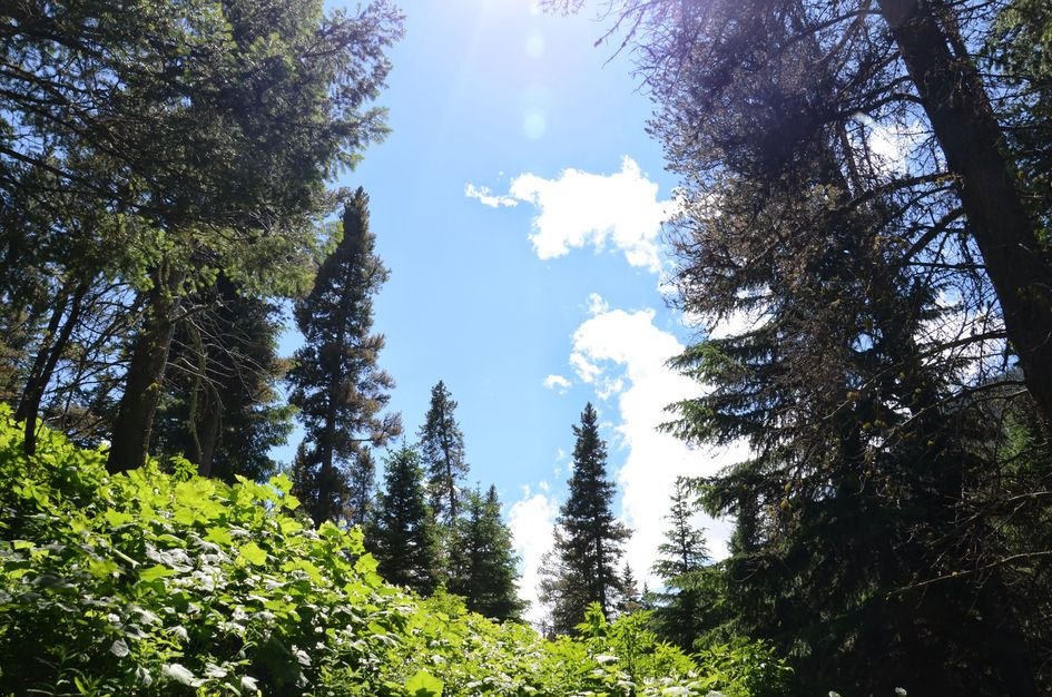
The entire trail leading up to the lake is shaded by trees. You will also be able to find shade in the trees surrounding the lake.
Lava Lake is a popular choice for backpackers. You'll see a few well-used campsites near the lake - but there will be competition for them.
Be Advised: Lava Lake has a restriction prohibiting campfires within 1/2 mile of the lake. Stove fires are permitted.
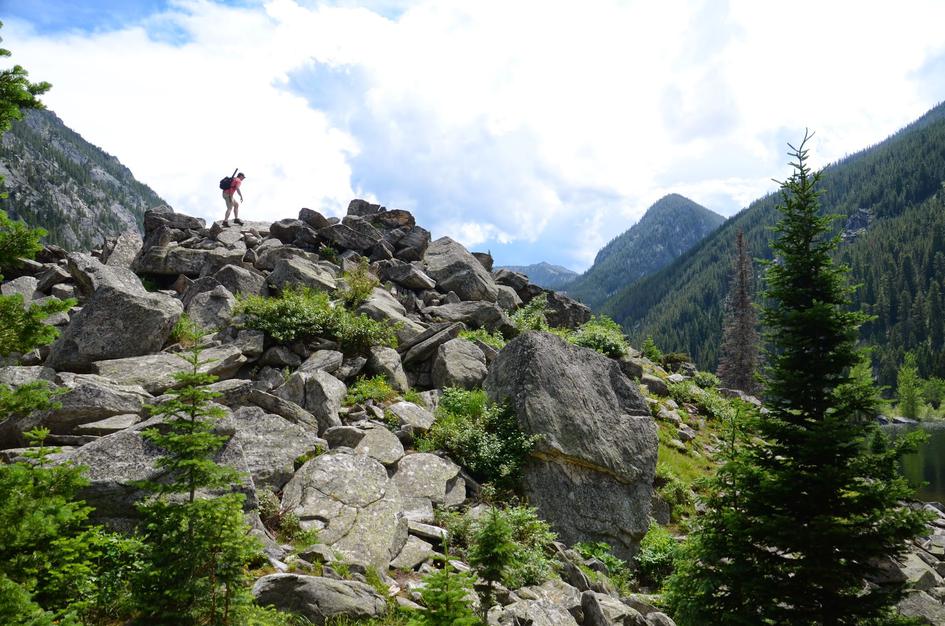
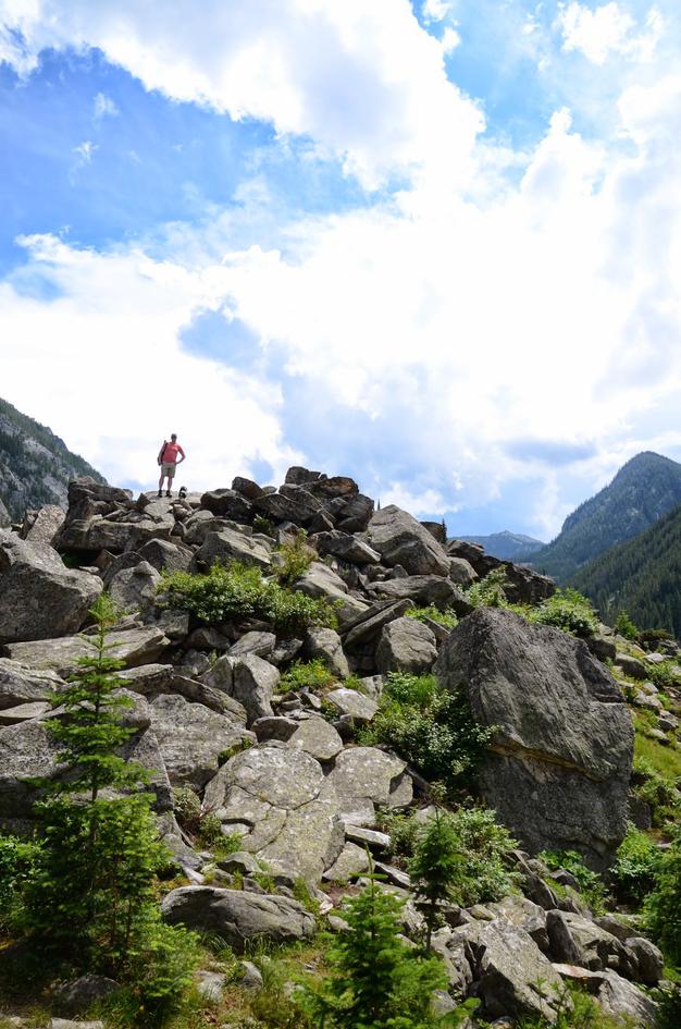
Table Mountain
When you get to the lake you'll see the trail takes a sharp left and starts to climb. This leads you to the ridge of Table Mountain. From here you'll intersect with the Asbestos Mine Trail, the Deer Creek Trail, and the Hellroaring Creek Trail leaving you with plenty of options for finishing a trip.
Jumbo Lake (Unofficial)
Head to the inlet of the lake on the very Southern tip and the trail continues. From here you can head Southwest up to Jumbo Lake or either of the other two drainages South of Lava Lake. Make sure to scout this out on Google Maps or elsewhere first as it's not an officially maintained path.
Beartooth Publishing's Big Sky Area covers this entire trail.
Lava Lake is best from mid-May through October. The creek alongside makes it pleasant in any warm month. July is peak swimming season and peak crowding. Wildflowers bloom along the lower trail in late May and June.
July through August: lake is warm enough for swimming, trail is fully clear of snow, wildflowers past but water is high and creek is lively.
Late May through June and September: fewer people, wildflowers on the lower trail in May, fall color and cooler temperatures in September.
Snow can linger on the trail into mid-May. Late October through April conditions are cold and the trail can be muddy or icy.
Yes. The 47-acre lake warms enough for swimming by mid-July. It is one of the main reasons hikers make the trip in summer. Find a spot along the shoreline away from the main trail for more room.
The Lava Lake trailhead is off US-191 in the Gallatin Canyon between Bozeman and Big Sky. If you are coming from Bozeman, the turnoff is immediately before the highway bridge near the sharp bend. If you are coming from the south, use the signed Lava Lake Turnaround and approach from the north.
The trail sits between Bozeman and Big Sky on Highway 191. From Bozeman it is about 28 miles and roughly 37 minutes. It is also one of the more convenient alpine lake hikes for Big Sky visitors.
Yes. The lake holds fish and is a popular fishing destination. Bring your Montana fishing license.
No campfires within half a mile of the lake. Stove fires are permitted. Check current fire restrictions with the Forest Service before your trip.
Very crowded on summer weekends. It is one of the most-visited trails in the Gallatin Canyon because of its location between Bozeman and Big Sky and its family-friendly distance. Go on a weekday or arrive before 9am on weekends.
The lot is small and fills fast on summer mornings. There is no practical overflow option — arriving before 9am is the only reliable strategy. If approaching from the south, watch for the Lava Lake Turnaround sign so you can approach from the correct direction.
Plug 5.5 miles and 1,451 feet of elevation gain into our free hiking time calculator for a personalized estimate.