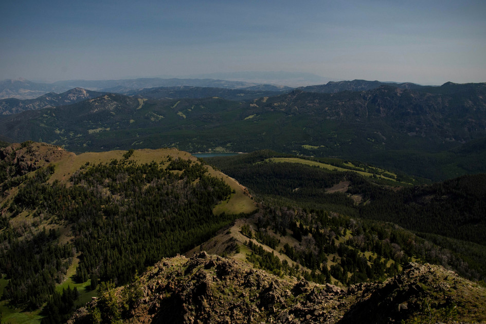
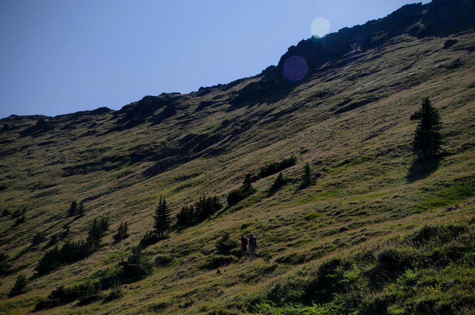
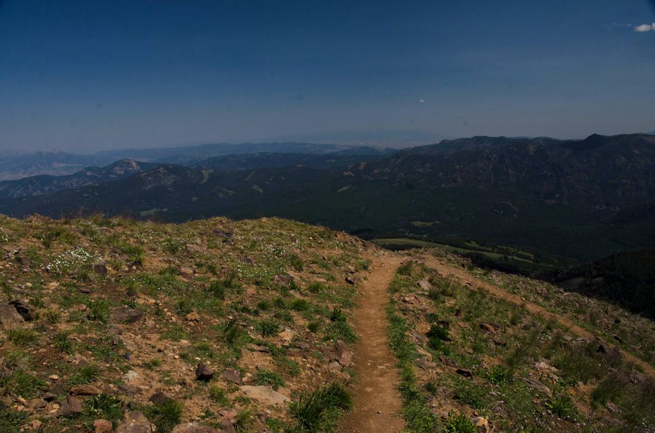
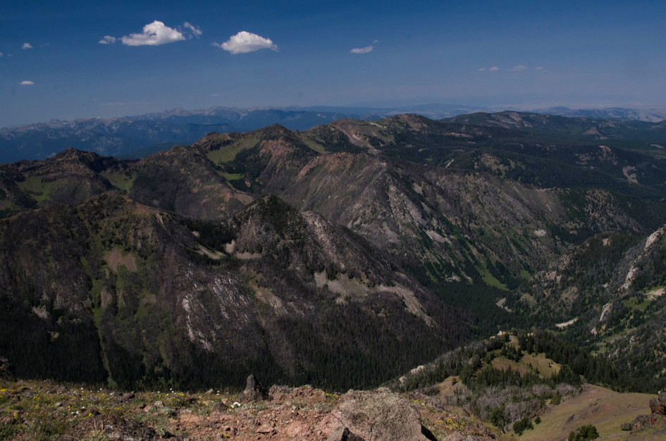
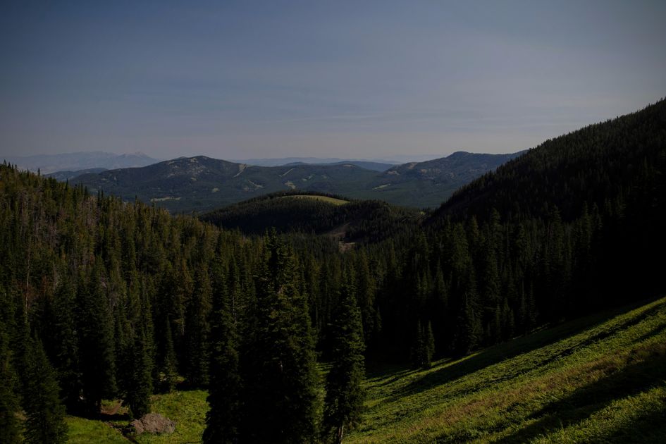
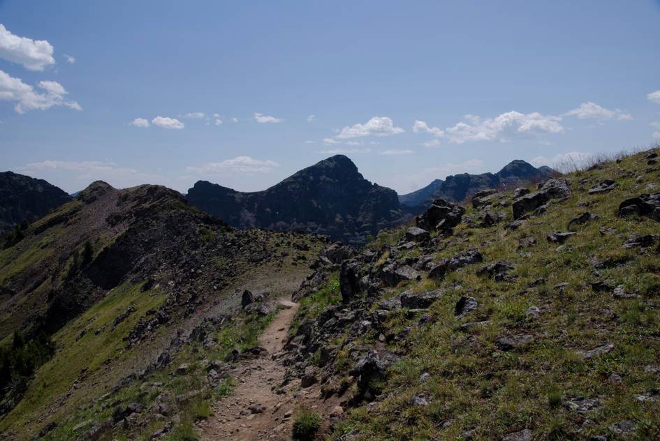
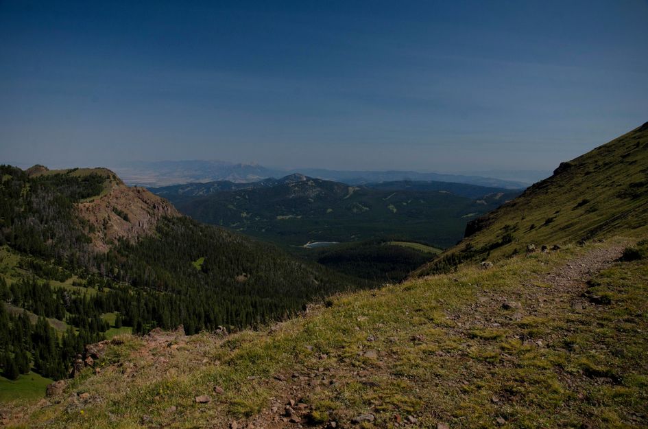
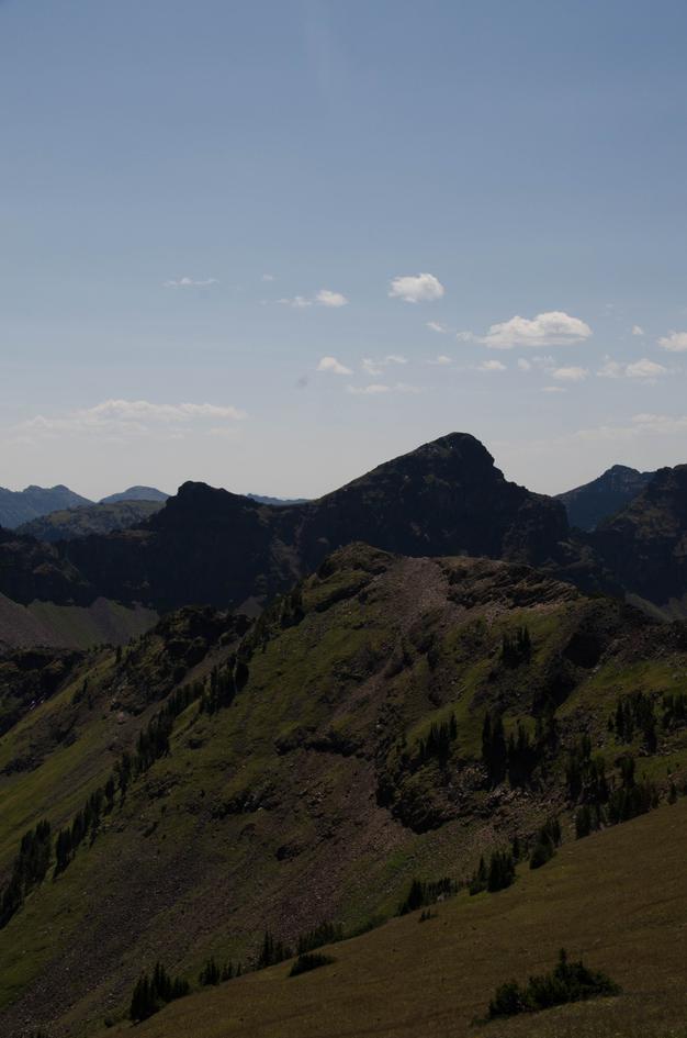
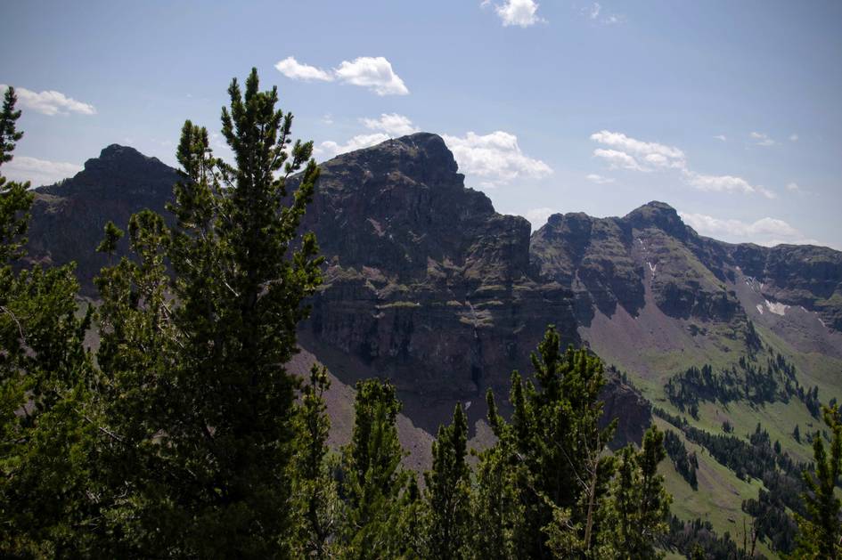
Mount Blackmore is one of the closer 10,000-foot summits to Bozeman, and the view from the top justifies the strenuous rating. Hyalite Reservoir is visible directly below, the Gallatin Range spreads in every direction, and the transition from dense forest to open alpine terrain on the upper switchbacks is one of the more dramatic elevation changes in the canyon.
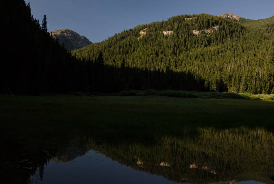
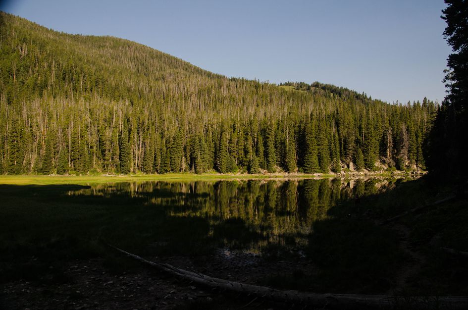
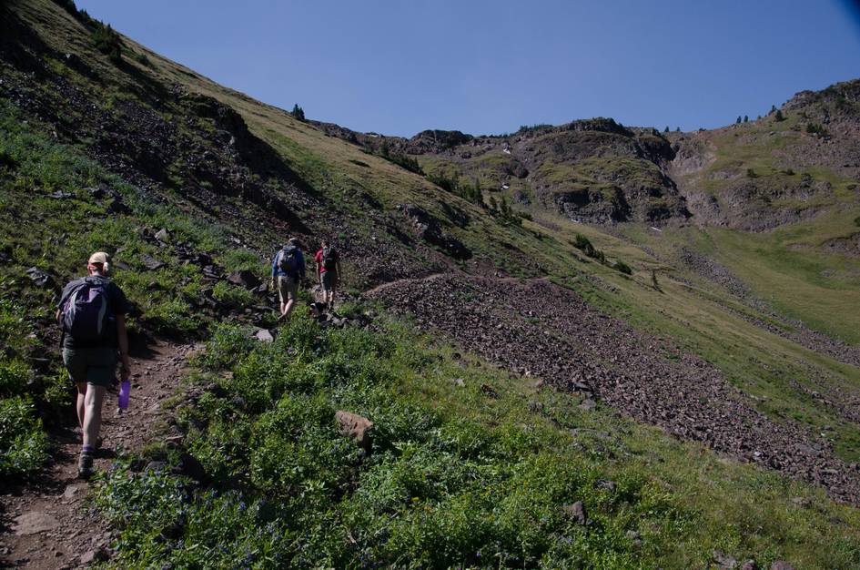
Blackmore Lake, about 3 miles in, is a solid turnaround point if anyone in your group decides the peak isn't for them. The lake sits in forest with a clear reflection of the mountain above. If you are going for the summit, the key logistics to know are the water situation (fill up at the last stream crossing before the meadow, there is nothing above it) and the exposure on the upper trail (sunglasses, sunscreen, and extra water are not optional).
There are large, paved parking lots at both the Blackmore Trailhead and the main Hyalite Reservoir parking area.
There's a vault toilet at both the Blackmore Trailhead and the main Hyalite Reservoir parking area.
This is a popular, well-known hike, but due to its difficulty you will still enjoy moments of peace and quiet on the trail.
The road up to Hyalite is windy and slow, but paved and in great condition.
Many points of strong service exist in the last couple miles of the hike as you get higher up.
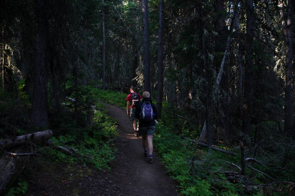
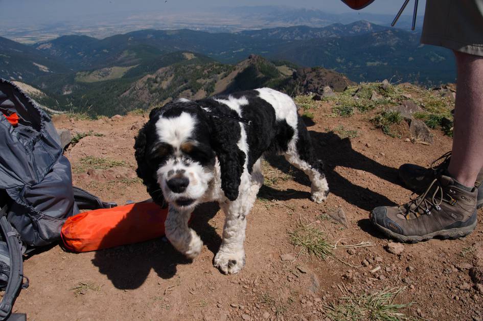
There is plenty of shade and water for the first half of the hike, making it safe for most dogs. The last few miles can be hot and tiring for your pup, so make sure to bring extra water and use caution.
18.2 Miles from Bozeman, MT. 35 Minutes
From Bozeman, drive south on 19th Street for about 5 miles. Follow the curve to the right and drive for another mile or so, following the signs to take a left onto Hyalite Canyon Road.
There are two trailheads that you can use to access the Mount Blackmore trail. If you're planning on getting to the peak, then you might want to consider the trailhead that starts from the main reservoir parking lot. This will knock a mile or so off of the hike each way. The longer option would be to start from the Blackmore parking lot that is just short of the reservoir by a mile or so.
Be Advised: Hyalite Canyon Road is closed annually between April 1st and May 15th. You will not be able to reach this hike by car during this time.
There are stream crossings and a small lake that give you the opportunity to purify water along this hike. But, be advised: as you cross the stream exiting the woods and entering the meadow, you have reached your last opportunity to purify water. From here on out, the hike is dry and strenuous - be sure to take advantage.
96 oz consumed per person
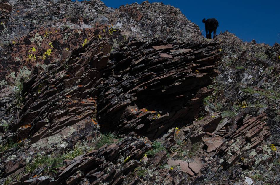
Especially early on, the trail is wide and well-groomed. Once you start climbing to the ridge the trail gets a bit rougher, but is still manageable.
Expect snow on the trail all the way into July and again in late September.
Sun protection is necessary for the last few miles of this hike. Wear either light synthetic fabrics or lots of sunscreen. Be prepared for wind and cooler temps at the ridge with an extra layer. DO NOT FORGET SUNGLASSES.
The ankle support from boots is necessary for the steep inclines up and down. There are also muddy spots and shallow water crossings.
Footwear: Hiking Boots
This is a fairly long and strenuous hike. Food will be necessary to maintain your energy. It's worth bringing a couple of snacks and at least one meal (sandwiches, etc.)
The very top of Blackmore Peak has the potential for a high amount of flies and bugs. Bring some bug spray just in case.
The first half of the hike is almost completely shaded by trees, but the last part will have no shade and you will be fully exposed.
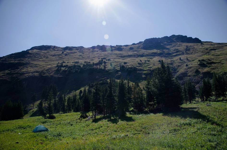
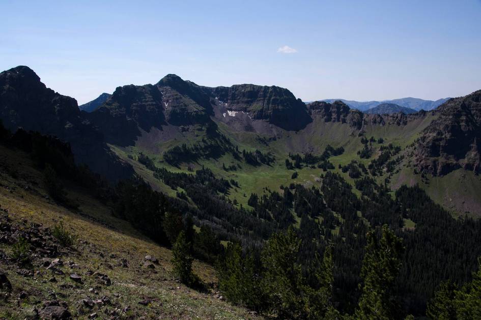
The first 4 to 5 miles of this hike offer some options as the trail winds completely through national forest. Look near Blackmore Lake for a couple of well-used sites. Otherwise, venture from the trail to find some solitude.
Blackmore Lake
A popular hike and stopping point on this trail is Blackmore Lake. You could turn around here if you decide you're not up for the strenuous peak hike.
Cottonwood Creek
When you hit the ridge, instead of taking a right to head to the peak, follow the trail straight back down the mountain. In 3 1/2 miles you'll hit a trail connection. Take a right to follow Cottonwood Creek to the South Cottonwood Trailhead.
Storm Castle Creek
See above. At the intersection with the Cottonwood Creek trail, instead of taking a right, stay left. Another 6 miles will connect you with the Storm Castle network of trails.
Beartooth Publishing's Bozeman Area Map includes this trail all the way to the peak.
Late June through September is the best window. Snow can linger on the upper trail through July. The road is closed April 1 through May 15 and the upper sections stay icy well into early summer.
July through August: summit clear of snow, trail fully accessible, wildflowers on the lower slopes, cell service on the upper ridge.
Late June and September: June requires caution on snow patches above treeline, September is cool and clear with lighter foot traffic.
Before mid-June: snow on the upper trail and steep icy sections above the meadow make the summit dangerous for most hikers. Also avoid the road April 1 through May 15.
At the stream crossing where the trail exits the forest and enters the open meadow. After that point the trail is dry all the way to the summit. Fill up there regardless of how much water you think you have.
Yes. The lake is about 3 miles in and sits in a shaded basin with a clear reflection of the peak above. It is a reasonable 6-mile round trip destination if the summit push is too much.
Yes. Expect snow on the upper trail through late June and sometimes into early July. The steep sections above treeline can be icy before midsummer and again in late September.
Starting from the main Hyalite Reservoir parking area cuts roughly a mile each way off the hike. If you are going for the summit and want to save mileage, the reservoir start makes sense. The Blackmore Trailhead adds distance but offers dedicated parking.
The first half is good for dogs with water and shade in the forest. The upper trail is exposed, hot, and dry above the last water source. Bring extra water for your dog and use real judgment in warm weather.
Plug 11.6 miles and 3,284 feet of elevation gain into our free hiking time calculator for a personalized estimate.