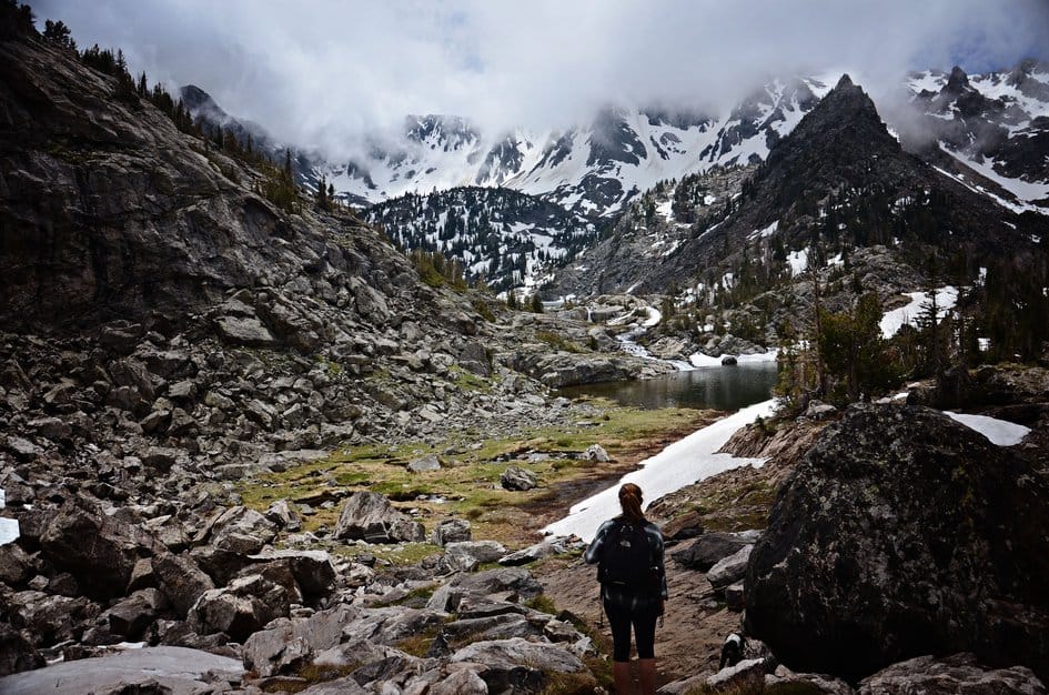
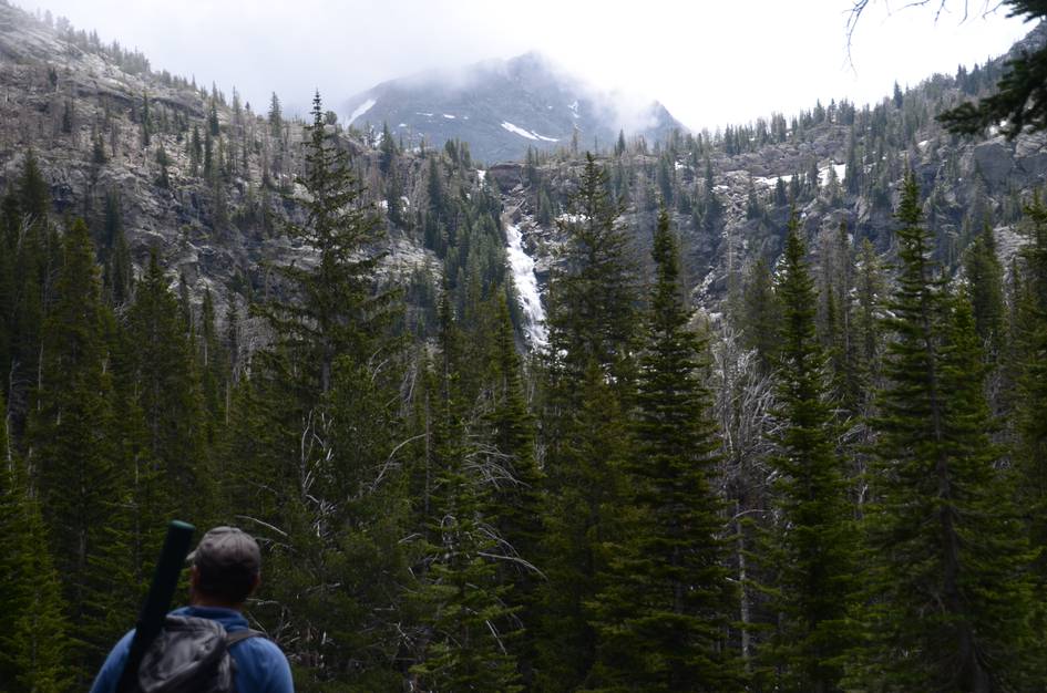
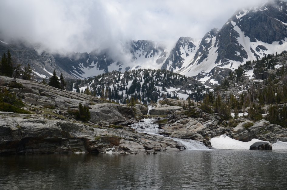
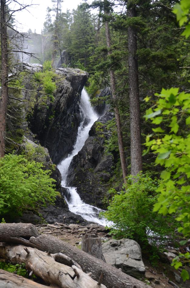
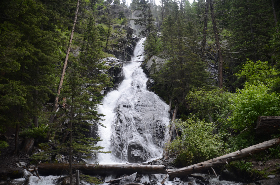
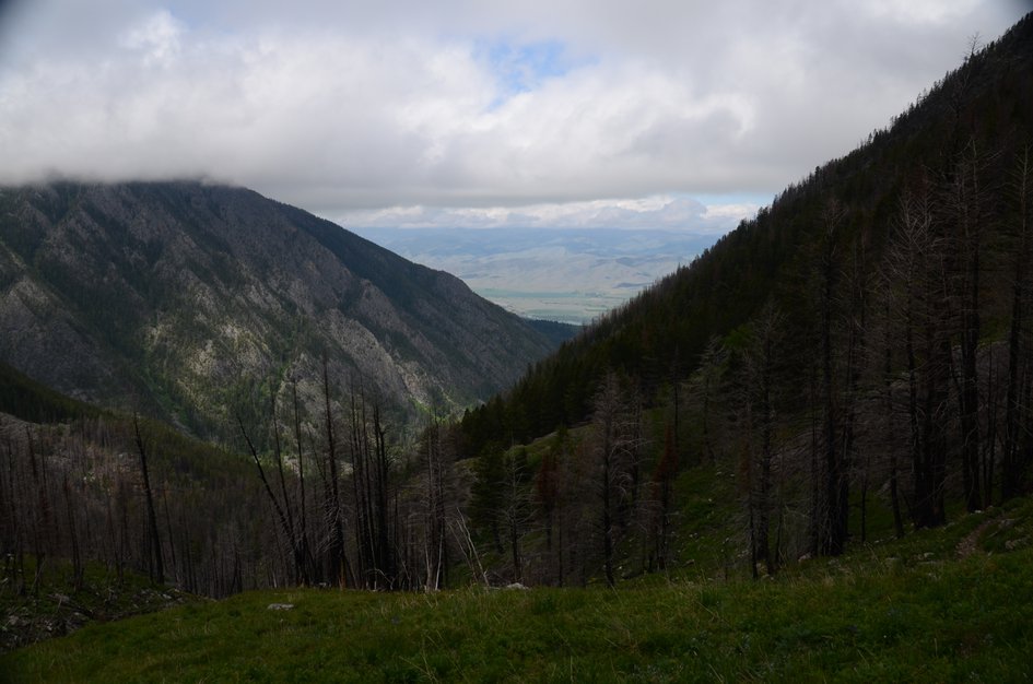
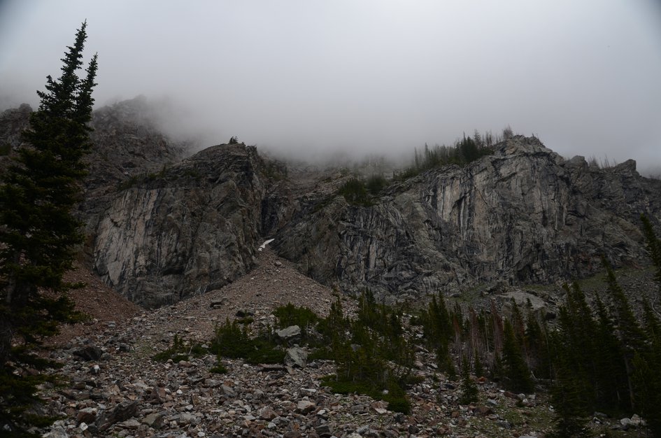
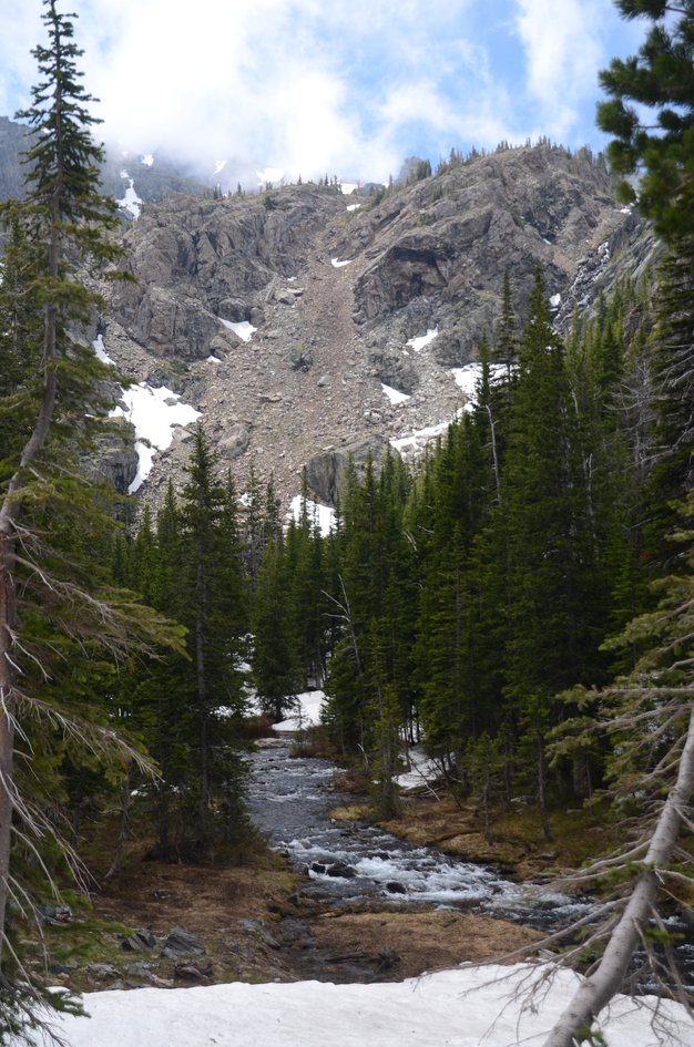
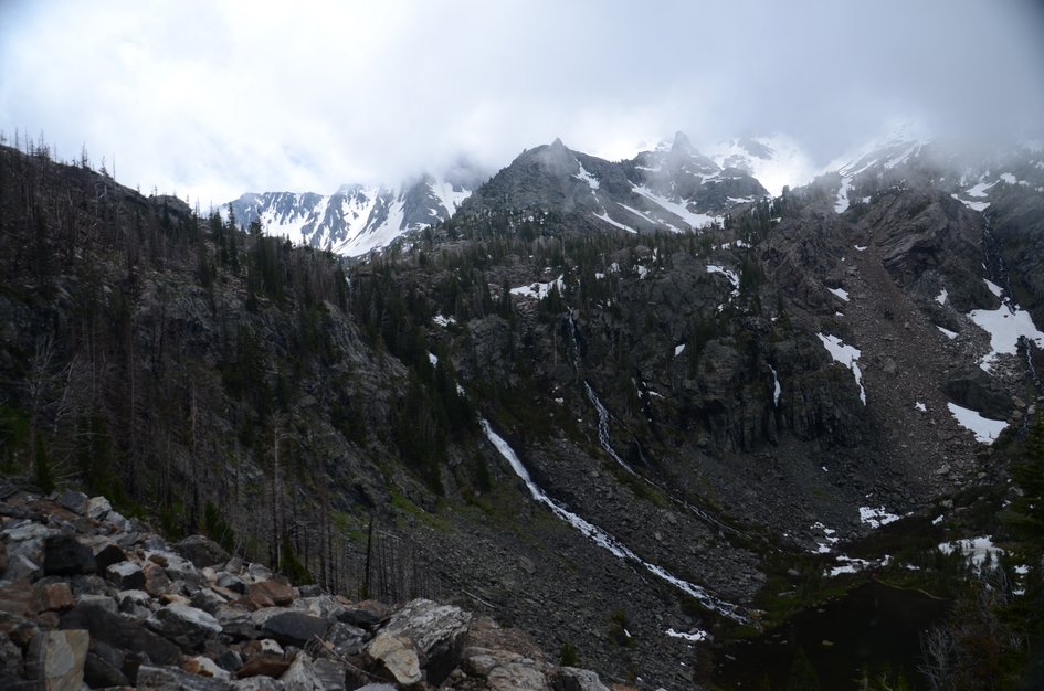
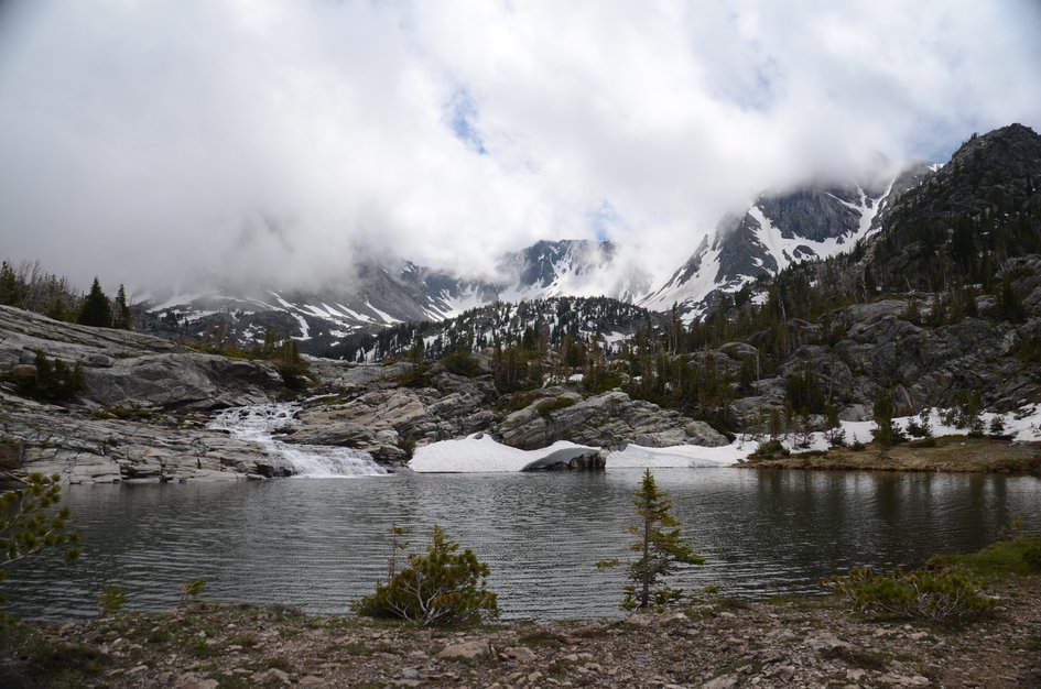
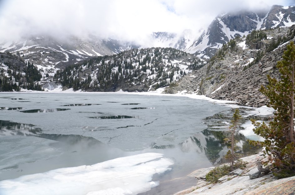
Pine Creek Lake sits in one of the more dramatic alpine settings accessible by trail in Montana. The granite headwall behind the lake is massive, with waterfalls dropping from it into the water and snow patches lingering on the upper walls even in August. The first mile lulls you with the flat Pine Creek Falls walk, and then the trail turns upward and doesn't stop.
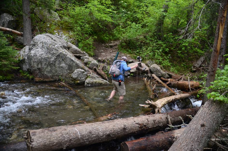
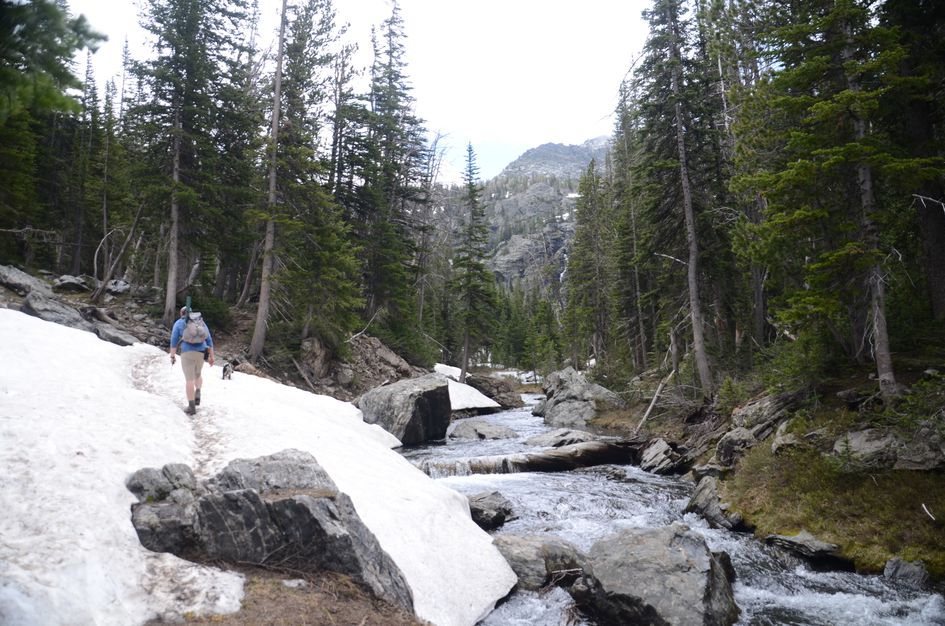
The creek crossings are the variable that most trail descriptions understate. In early season, several of them are knee-deep with real current, and trekking poles and water shoes make the difference between a controlled crossing and a wet stumble on cold rock. By late July most of the crossings are manageable rock hops. The lake at the end earns the strenuous rating. You can see why people come back.
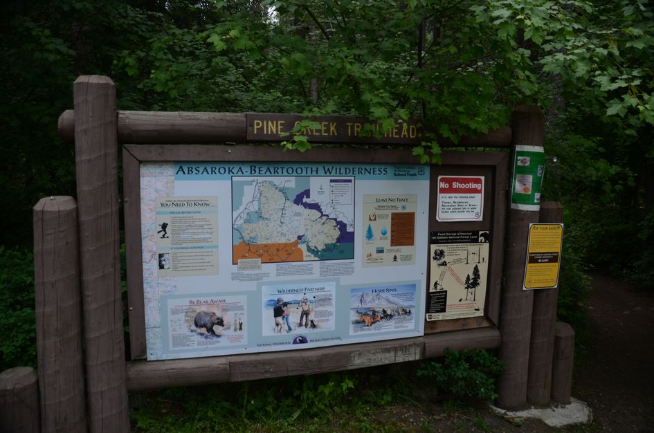
The trailhead will appear busy due to the short and popular hike to the falls, but you should have no trouble finding a spot.
The trailhead is located at the Pine Creek Campground which has a vault toilet. You'll drive past it on your way to your parking spot.
Traffic will feel heavy for the first mile of the hike leading up to falls. It will thin out from there, but despite its difficulty this hike sees its share of people due to the sheer beauty of it.
Once you're on Luccock Park Road, it gets a bit narrow and windy, but nothing rough—pavement the entire way.
You'll be out of service the entire route on the way to Pine Creek Lake.
There is plenty of shade and water along the trail for your pooch, but leave him at home if he can't swim or exert himself for long periods of time.
39 Miles from Bozeman, MT. 47 Minutes
From Bozeman, head East towards Livingston on Interstate 90. When you get to Livingston, take exit 333 for US-89 South through Paradise Valley.
Head South for about three miles. When you see a sign for Carter's Bridge Fishing Access, take the left onto MT-540. You'll be on this road for almost 8 miles until you see some signs on your left for Luccock Park. Take the left onto Luccock Park Road crossing the cattle guard, drive another three miles and you'll hit a dead-end at the Pine Creek Campground and Trailhead.
This trail runs alongside and intersects Pine Creek several times throughout the hike, not to mention ends at a lake. Opportunities for water purification are plentiful.
80 oz consumed per person
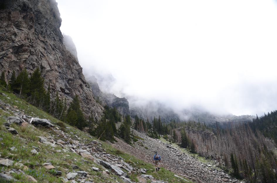
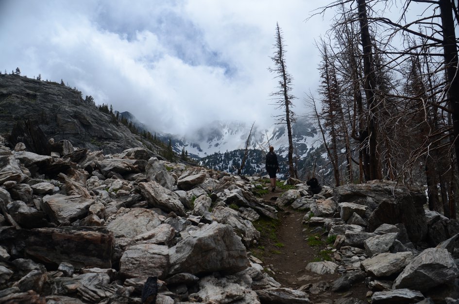
The majority of the trail is in good condition and is always easy to find. However, there is a high number of deep stream crossings and some particularly steep sections of trail that can make the hike tricky at times.
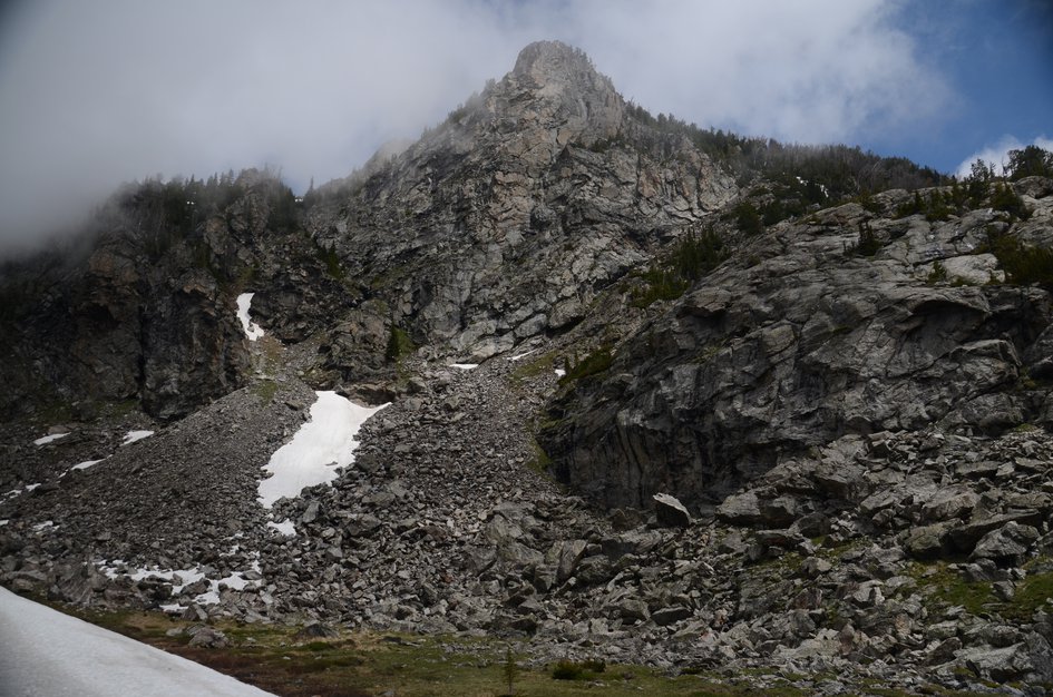
Expect snow into June and again in late September which could add a significant amount of difficulty to the hike.
Especially early in the year, this hike involves several water crossings, some of which are knee-deep. Consider bringing water shoes, a small towel and trekking poles to aid in these crossings. Additionally, the hike gains a significant amount of elevation. The weather at the top has potential to be much colder than at the trailhead—bring extra layers and be prepared.
Footwear: Hiking Boots
Due to the length and difficulty of this hike, you'll need nourishment to keep your energy up. It's recommended to bring a small lunch to eat up at the lake as well as some trail snacks to munch along the way.
Due to the water and forest there's potential for bugs on this hike depending on the weather and time of year. Bring your bug spray in case.
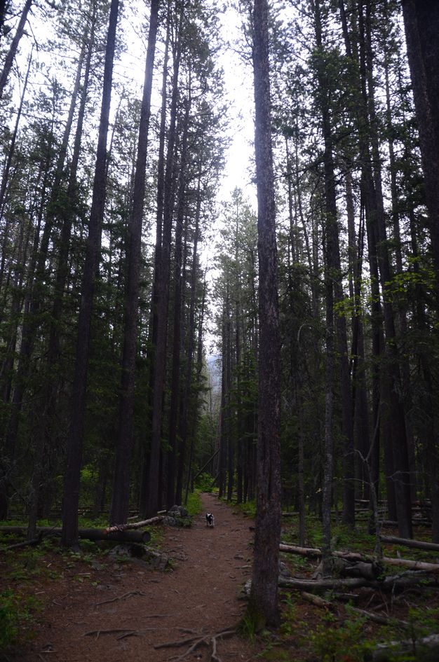
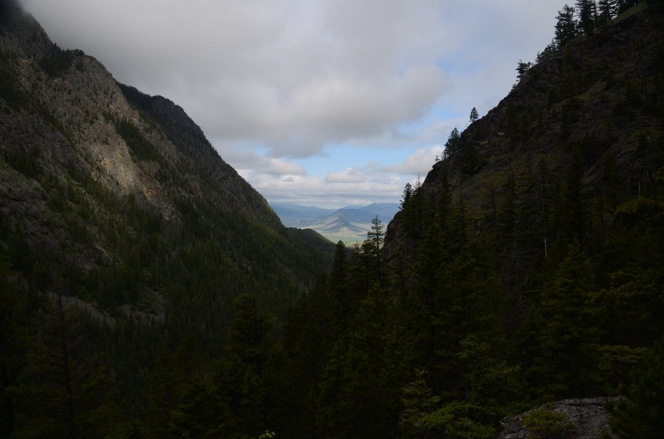
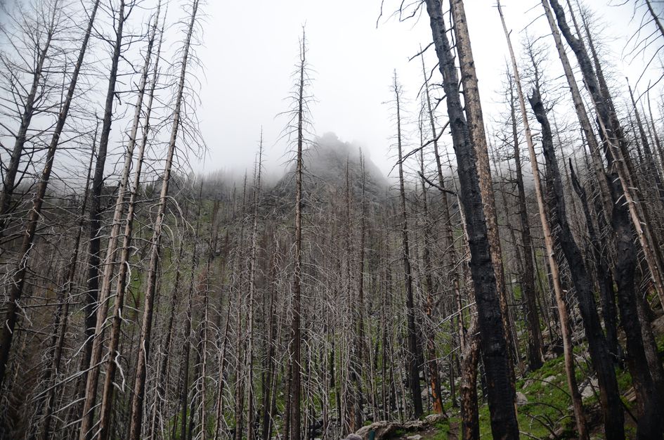
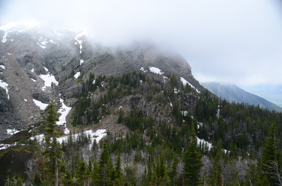
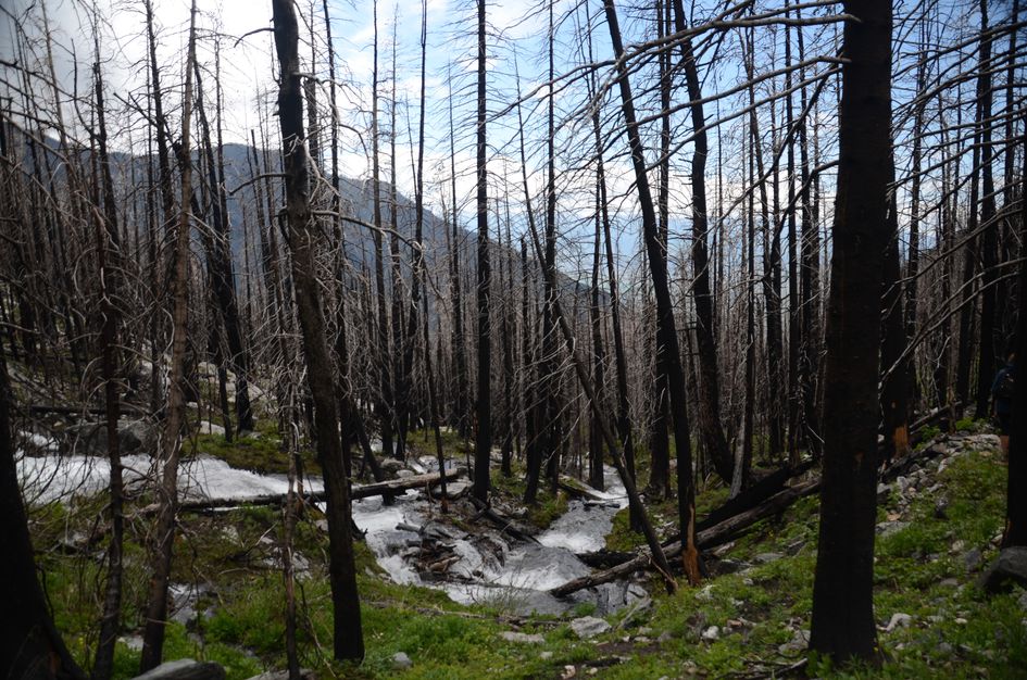
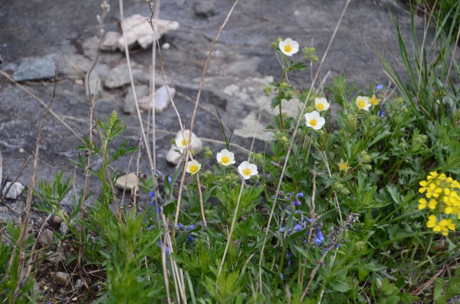
There's a fair amount of shade and cover on this hike preventing you from being too exposed. Especially when you're lower, the hike runs through a thick conifer forest. As you get higher, you enter some burn, and eventually get above the majority of the treeline and cover thins.
Pine Creek Lake is a popular overnight spot to backpack to. You'll find plenty of tent sites due to moderate amounts of use, but you may also be facing competition for them. A relative lack of trail connections makes the lake ideal for single-night trips. Don't forget your fishing pole, FWP stocks the lake with Yellowstone Cutthroat.
If sleeping in a tent isn't your thing, the Forest Service operates a campground located right at the trailhead.
George Lake
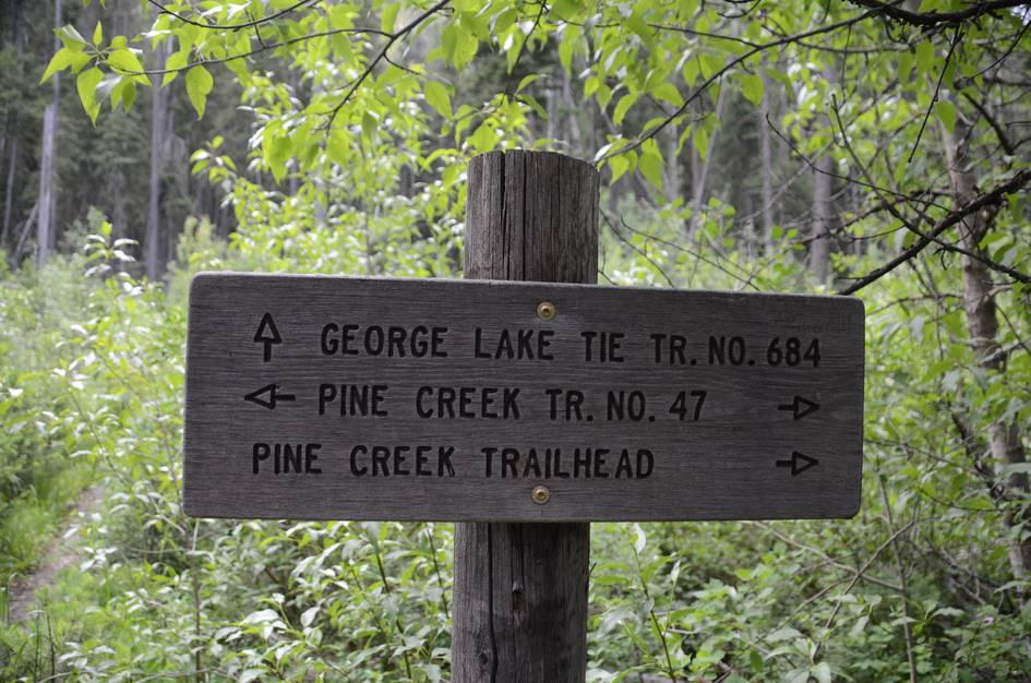
Quickly after starting the hike to Pine Creek from the Trailhead, you'll see a sign for George Lake to your right. It's a dead-end five-mile trek. George Lake also has its own trailhead at the west end of Pine Creek Campground.
Pine Creek Falls
A popular version of this hike ends one mile in at Pine Creek Falls. It's a flat, easy hike with a beautiful destination, perfect for families and photography.
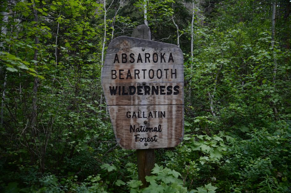
Beartooth Publishing's Absaroka Beartooth Wilderness Map covers this whole hike. Their cover photo on this map even highlights Pine Creek Lake!
Late July through September is the best window. Snow can linger on the trail into June, creek crossings are manageable rock hops by late July, and the lake basin is clearer of snow by August. September brings cooler temps and no crowds.
Late July through August: crossings are manageable, trail clear, lake basin accessible, Yellowstone Cutthroat trout in the lake.
September: significantly fewer hikers, cooler temperatures, excellent conditions. Snow may return by early October.
Before late June: snow on the upper trail and knee-deep creek crossings with serious current. Not recommended for most hikers before mid-July.
In early season (before late July), several crossings are knee-deep with real current and require trekking poles for balance. By late July most become manageable rock hops. Trekking poles and water shoes or sandals are worth bringing regardless of the date.
Yes. The lake is stocked with Yellowstone Cutthroat trout. Bring your Montana fishing license. Evening fishing near the inlet at the base of the waterfall is the most productive spot.
Yes. It is a popular overnight destination with established campsites near the lake. Bear country — hang your food or use a canister. Pine Creek Campground at the trailhead is a Forest Service car camping option if you want a basecamp.
9 hours for the day hike is realistic at an average pace with time at the lake. Most people who do it as a day hike wish they had backpacked it. The sustained elevation gain of 3,389 feet means no shortcuts on time.
Before mid-July most years, snow on the upper trail and high creek crossings make the route unsuitable for most hikers. Late June trips require experience with snow travel and stream crossings.
Plug 11 miles and 3,389 feet of elevation gain into our free hiking time calculator for a personalized estimate.