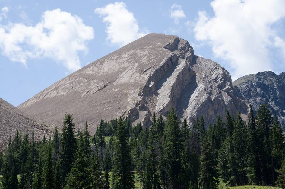
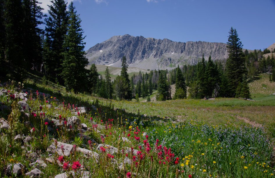
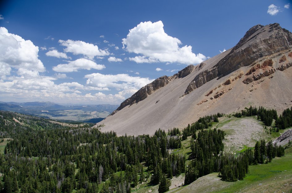

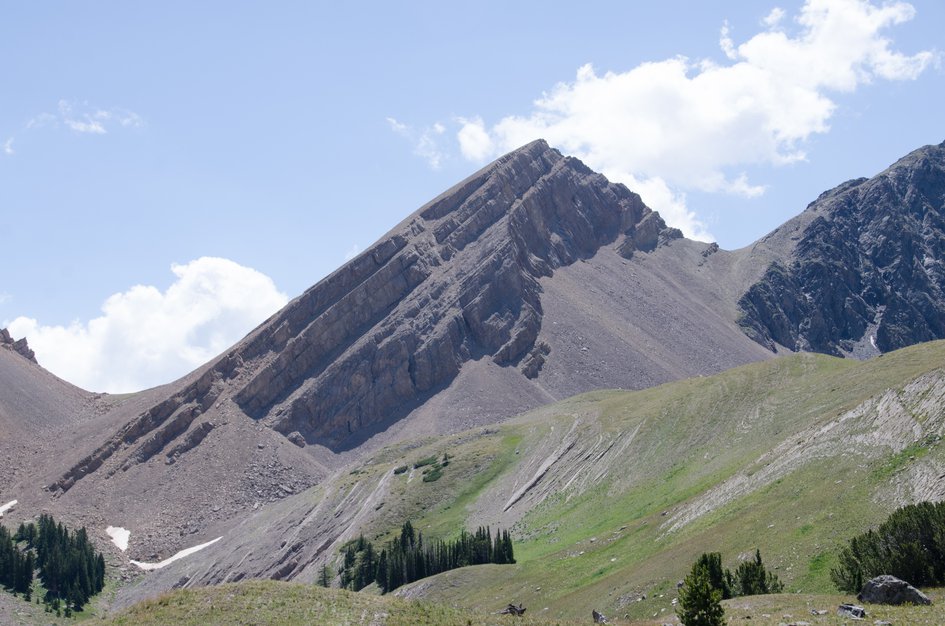
Tumbledown Lake earns its remoteness. Ten miles of gravel road past the Nine Quarter Circle Ranch keeps casual traffic away, and the trail itself asks for a full day. What you get in exchange is the Madison Range without the Big Sky crowds, a wildflower basin that opens up at the top of a steep 3-mile climb, and a lake that does something you have probably never seen a lake do before.
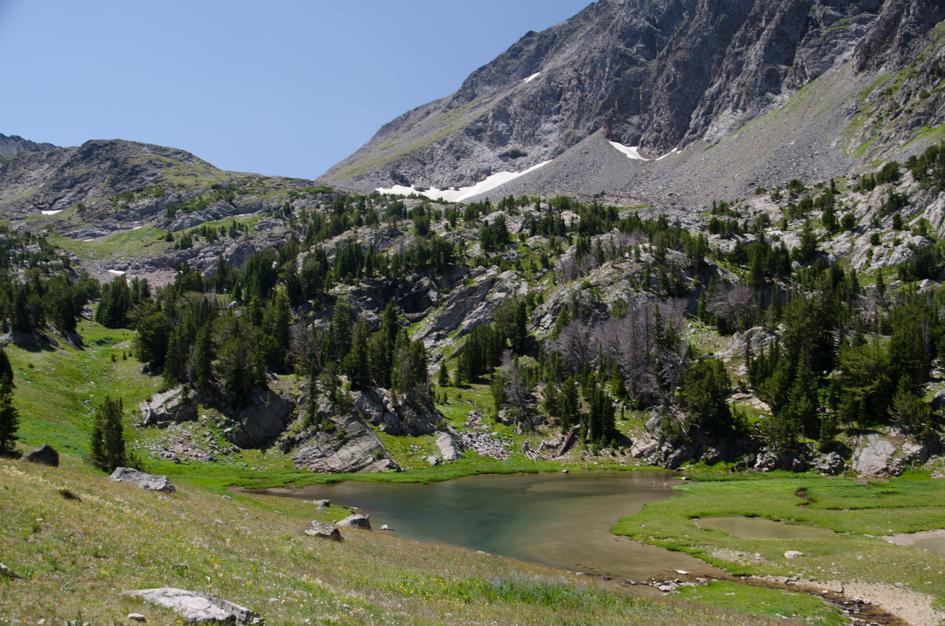
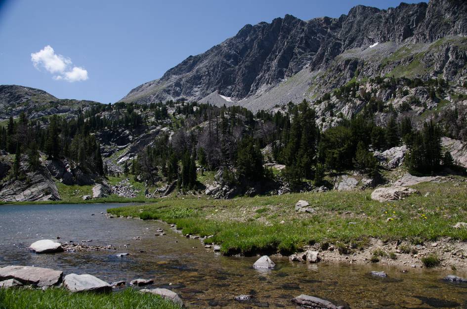
The outlet at Tumbledown Lake drains into what appears to be a hole in the ground. Water disappears into rock rather than flowing down a visible channel. Walk around the shoreline and find it before you leave. Most people who miss it wish they had looked.
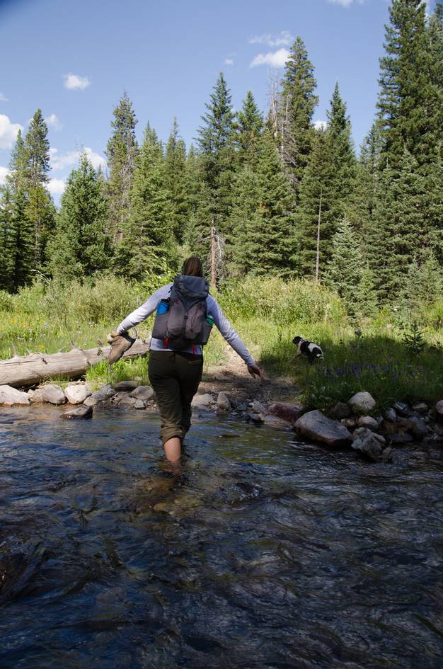
The stream crossings early in the hike are real, not a rock hop, and removing your shoes is the expected move. Stash your extra shoes near the crossing rather than carrying them the whole way. Plan to be out before afternoon if you are going in shoulder season. Snow shows up early up here and the basin is fully exposed.
The trailhead is located within a campground, so there are several designated parking areas along with several spots just for hikers.
Plan ahead. There is a bathroom at the Lower Wapiti trailhead that you will pass about 5 miles east of the Upper Taylor Fork trailhead.
The trailhead is located about 10 miles off of Hwy 191 which seems to be a deterrent for a lot of tourists. You will definitely encounter other hikers on the trail, but you will also be able to enjoy long periods of peace and quiet.
There's roughly ten miles of well-maintained gravel road while approaching the trailhead.
There will not be any cell service on the Verizon network. You will need a paper map for navigation—do not rely on your phone.
Plenty of shade and water to keep your dog hydrated and cool.
You may consider bringing a leash in case you encounter any wildlife along the trail.
66 Miles from Bozeman, MT. 111 Minutes
From Bozeman, head south on US-191 past Big Sky for 55 miles. When you cross a small river, look at the green sign on your right. If it says "Taylor Fork", you're close to your next turn.
Once you cross the Taylor Fork, take your next right. It's a nondescript gravel road with a sign for "Nine Quarter Circle Ranch". Once you make this turn, you have about ten miles of maintained gravel left.
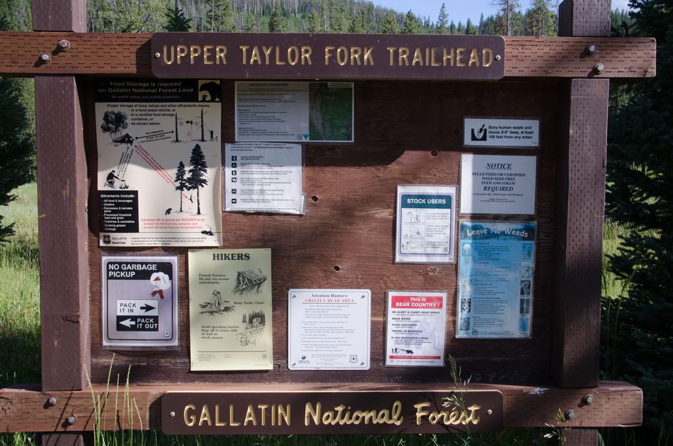
Stay on Taylor Fork Road (NF-134) for 7.7 miles. Note that the road crosses through private land, but it is a public road. After the 7.7 miles you'll see a sign that directs you down and to the left onto FS-1347 towards the Upper Taylor Fork/Lightning Creek Trailhead.
Head another 3 miles and you'll see the trailhead and parking area to your left.
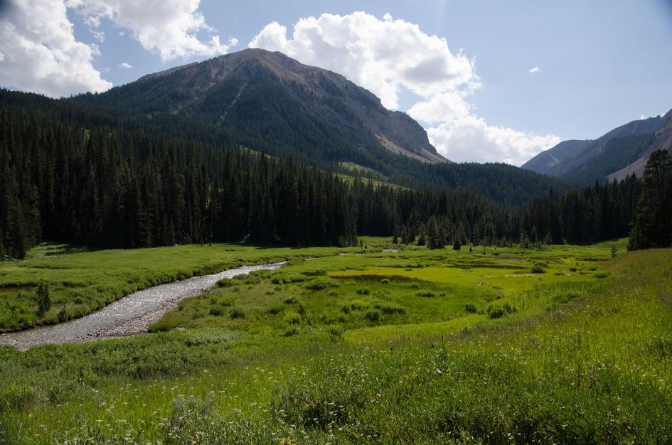
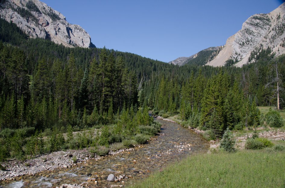
The trail runs along a creek, crosses a river and ends at a lake. There is no shortage of water if you're planning on pumping.
80 oz consumed per person
The trail is well beaten and easy to follow. There may be some muddy spots if it has rained recently and you should be prepared for several water crossings that will force you to remove your shoes/boots.
Expect snow into July and beginning again in late September.
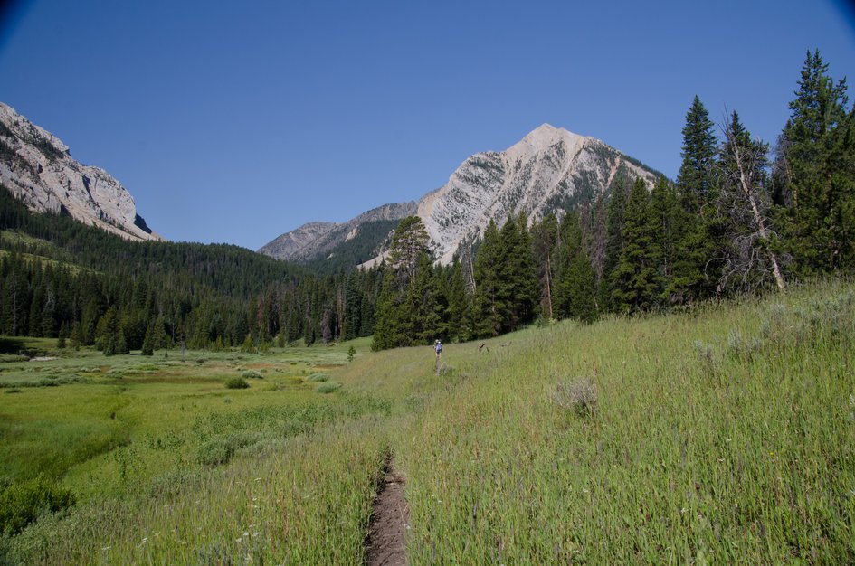
Sun protection is a good idea as about half of the hike is exposed. Additionally, much of the trail is grassy. Light synthetics, including long pants will be a good idea. Be prepared for wind and cooler temps as you reach the higher elevations with extra layers.
There are two stream crossings early on in the hike. Consider bringing water shoes to keep your feet from slipping or getting cut on the rocks. You can stash the extra shoes near the creek so you don't have to carry them for the whole hike.
Footwear: Hiking Boots
This is a long day hike that will require a lunch or a large snack or two.
The trail takes you through tall grass and trees so there is a potential for bugs, but if you forget the bug spray you will probably be fine without it.
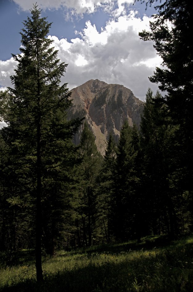
You will be in and out of shade for the majority of this hike. When you reach the basin you will be fully exposed to the sun and the wind.
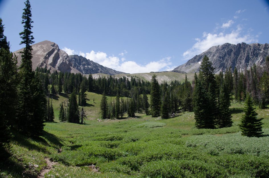
The large basin at the end of the hike provides ample camping spots surrounded by views of towering peaks. The lake is a convenient water source, but a little too shallow for fishing.
If you're planning on staying the night, be prepared for intense winds and use proper bear safety. The bear spray guide is the practical carry-and-planning reference to read before this kind of remote Madison Range trip.
Taylor Falls
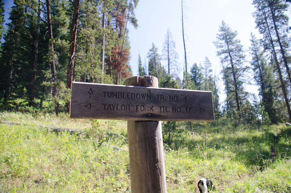
Rather than hooking a right up the hill on trail #4, continue onward on #17 for .3 miles for a beautiful view of Taylor Falls.
#6330
An official alternative to the unofficial trail below, #6330 heads North towards another network of trails on the North side of the Taylor Hilgard Unit.
No Man Lake (Unofficial)
When standing at Tumbledown Lake, you can see a pass to your Northeast and some foot trails that lead up to it. Hike over this pass and down the valley to eventually meet up with trail #6329 and the potential to see some lakes. Note, this is not an official trail, scout it out on Google Maps first and be sure of your route-finding abilities.
Beartooth Publishing's Big Sky Area covers this trail and those around it.
Late July through September. The upper basin holds snow into July and the two stream crossings early in the hike run high during snowmelt. The wildflowers in the basin are at their best in late July and August.
Late July through August: basin clear, wildflowers at their best, stream crossings manageable, light foot traffic.
September: cooler temperatures, late-season colors in the lower forest, excellent solitude in the basin.
Before late July: the upper basin retains snow and the stream crossings run strong enough to be genuinely challenging. Snow can return in September in heavier years.
Yes. The two crossings early in the hike require removing your shoes. They are real fords, not rock hops, especially before August. Bring water shoes or sandals for the crossing and stash them near the creek so you do not carry extra weight.
The lake outlet drains into what appears to be a hole in the ground rather than flowing downhill through a visible channel. Water disappears into rock. Walk around the shoreline and find it before leaving — most people who miss it regret not looking.
The lake is noted as too shallow for fishing. It is better as a swimming and scenery destination than a fishing destination.
From Highway 191, you drive 10 miles of maintained gravel road past the Nine Quarter Circle Ranch. The road is in generally good condition but adds over an hour to the access time. No high-clearance required.
Yes, with planning. Plenty of water and shade on the trail. The stream crossings early on are dog-friendly. Consider a leash for wildlife encounters in the lower meadow sections.
Plug 11 miles and 2,179 feet of elevation gain into our free hiking time calculator for a personalized estimate.