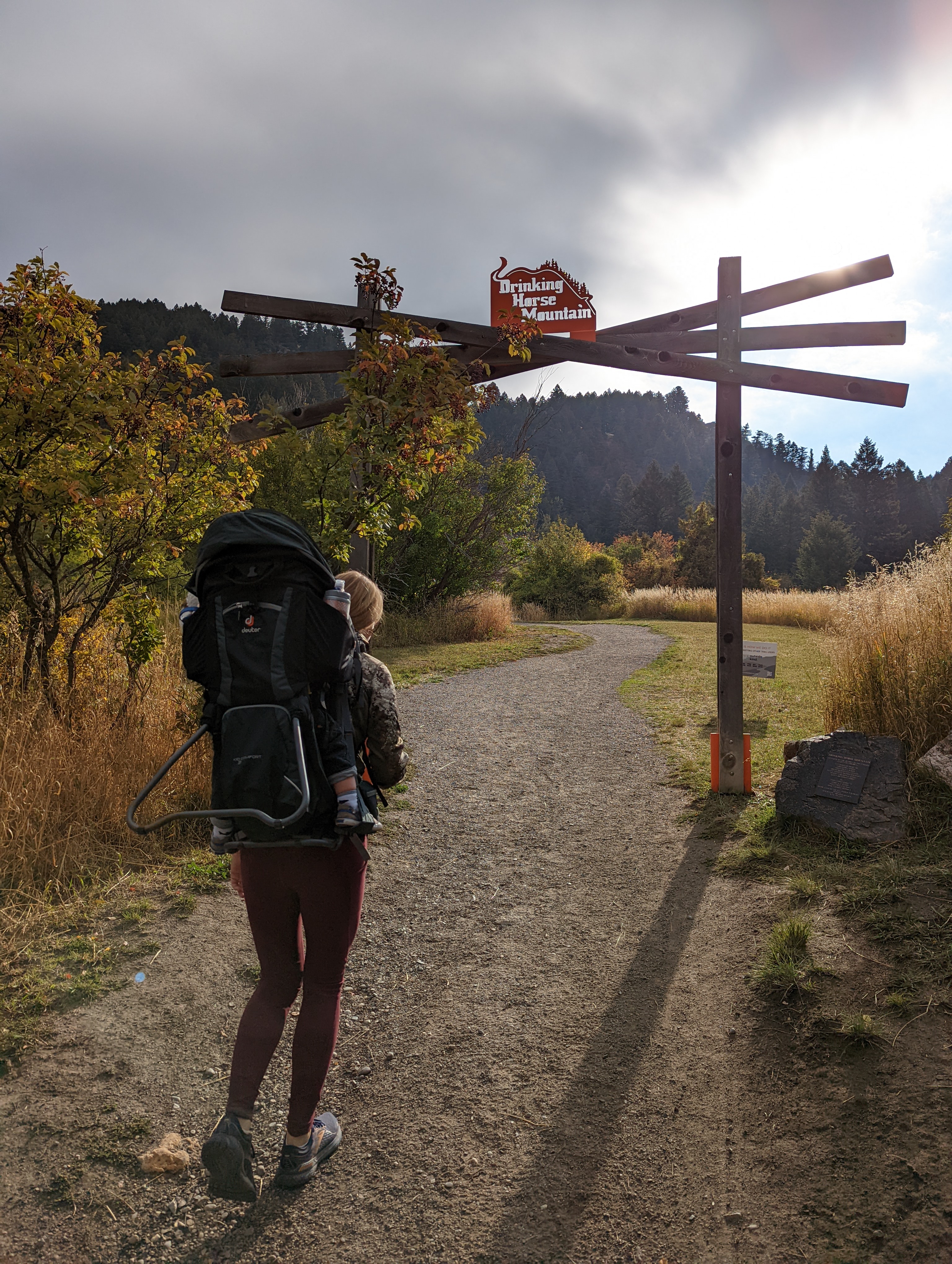
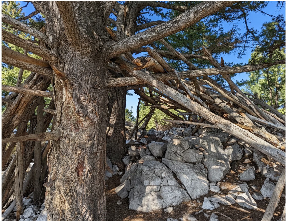
Drinking Horse gets less attention than the M, which is strange because the summit is better. You get more space, the same views, and the stick shelters that hikers have rebuilt over the years. On a weekend morning when the M lot is stacked, the Drinking Horse lot across the road often has room.
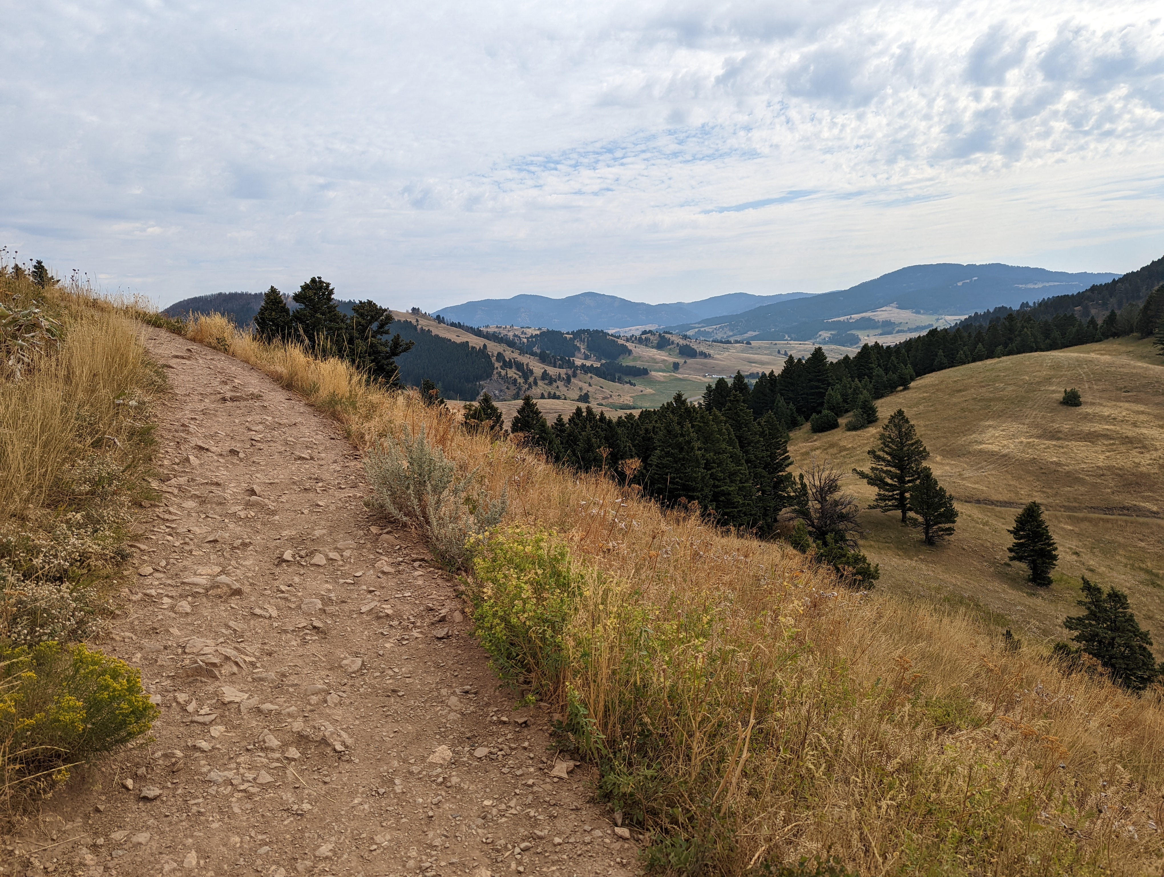
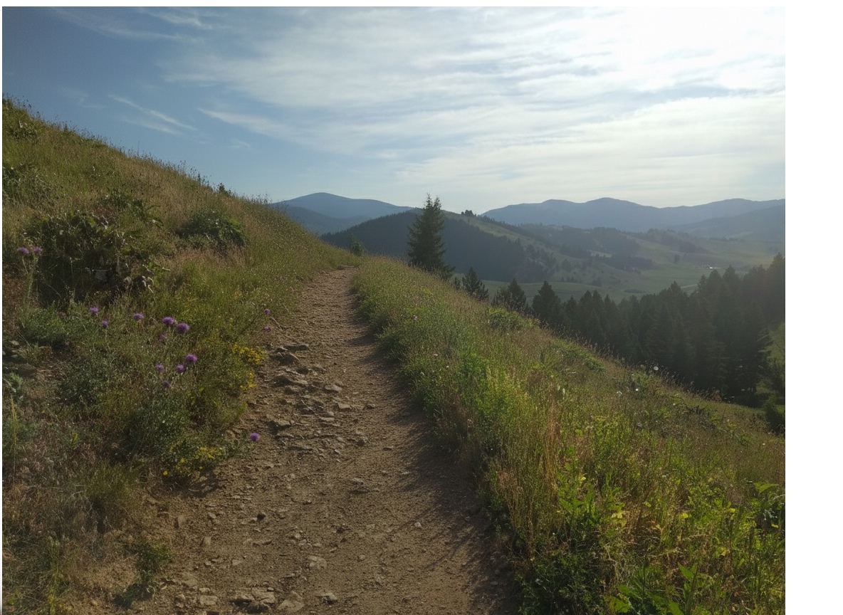
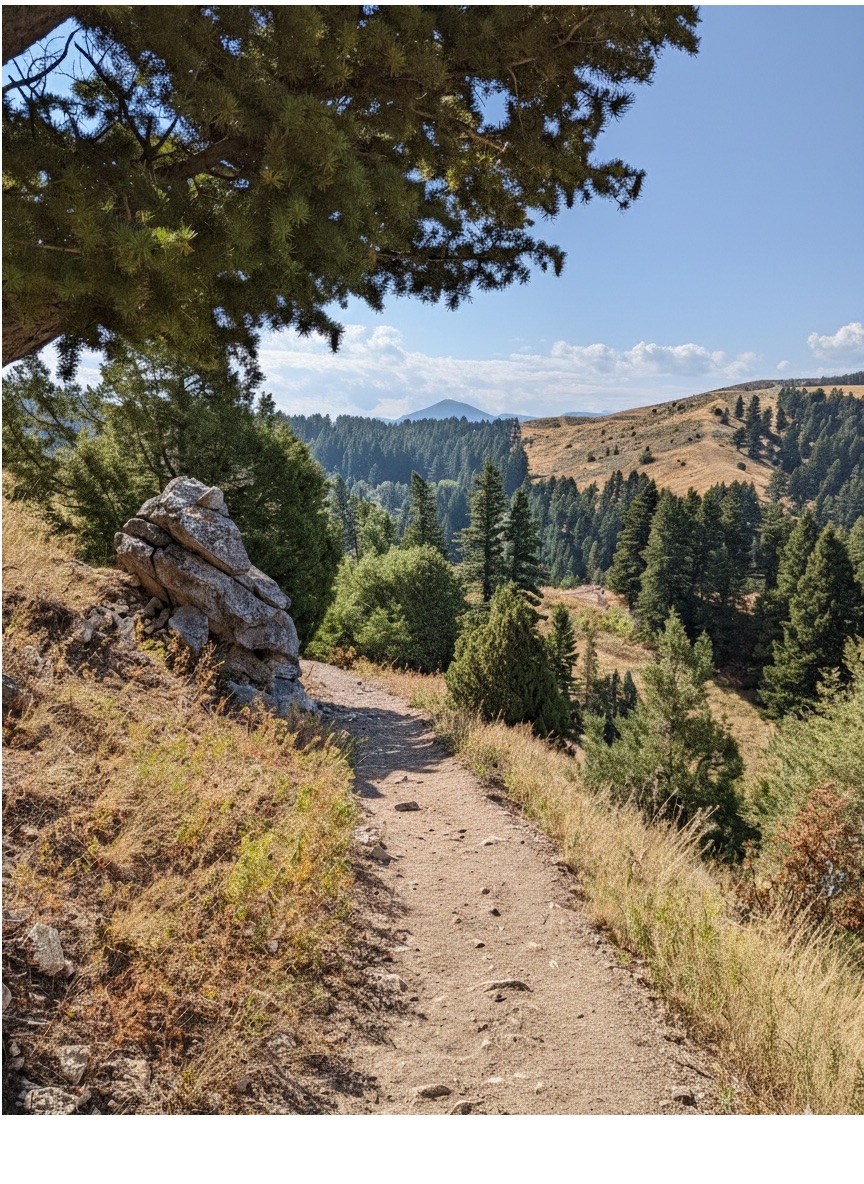
The trail is a loop with two route options: one more shaded and switchbacked to the left, one more gradual and exposed to the right. Most people go up one side and down the other. It's steep enough to be a real workout in a short distance, which makes it one of the better options when you have an hour and want to actually move. No lake, no waterfall, just a summit with good views and enough room to eat lunch.
The parking lot is smaller than the M's lot across the road, but since fewer people know about this trail, you'll usually find a spot. On busy weekends you might need to park along the road.
No bathroom at the trailhead. Take care of business before you leave Bozeman. In a pinch, there's a pit toilet across the road at the M trailhead.
Compared to the M, Drinking Horse is much quieter. Most people default to the M first, which means you'll have more of the trail to yourself here.
Paved road the entire way. Bridger Canyon Road is well-maintained and you'll be at the trailhead in 10 minutes from downtown.
You'll have cell service throughout the hike.
Dogs do well on this trail. Let them drink from the creek at the trailhead before you start since there's no water once you're on the trail. You'll see plenty of other dogs out here.
4.3 Miles from Bozeman, MT. 10 Minutes
From downtown Bozeman, head north on Rouse Avenue. Continue straight as Rouse becomes Bridger Canyon Road (Highway 86). Drive about 4 miles and look for the Drinking Horse Mountain trailhead on your left, directly across from the M trailhead parking lot. You can't miss it.
There is no water on the trail itself. A creek runs under the bridge at the start of the hike where dogs can drink before and after, but bring what you need for the climb.
32 oz consumed per person
The trail is well-maintained and easy to follow. It's a mix of dirt and rock with some steeper sections on the left route. The right route is more gradual but can get dusty in summer.
The right route is exposed and west-facing, so bring sun protection in summer. The left route has more shade. Layers are a good idea since the summit can be breezy.
Footwear: Trail Runners
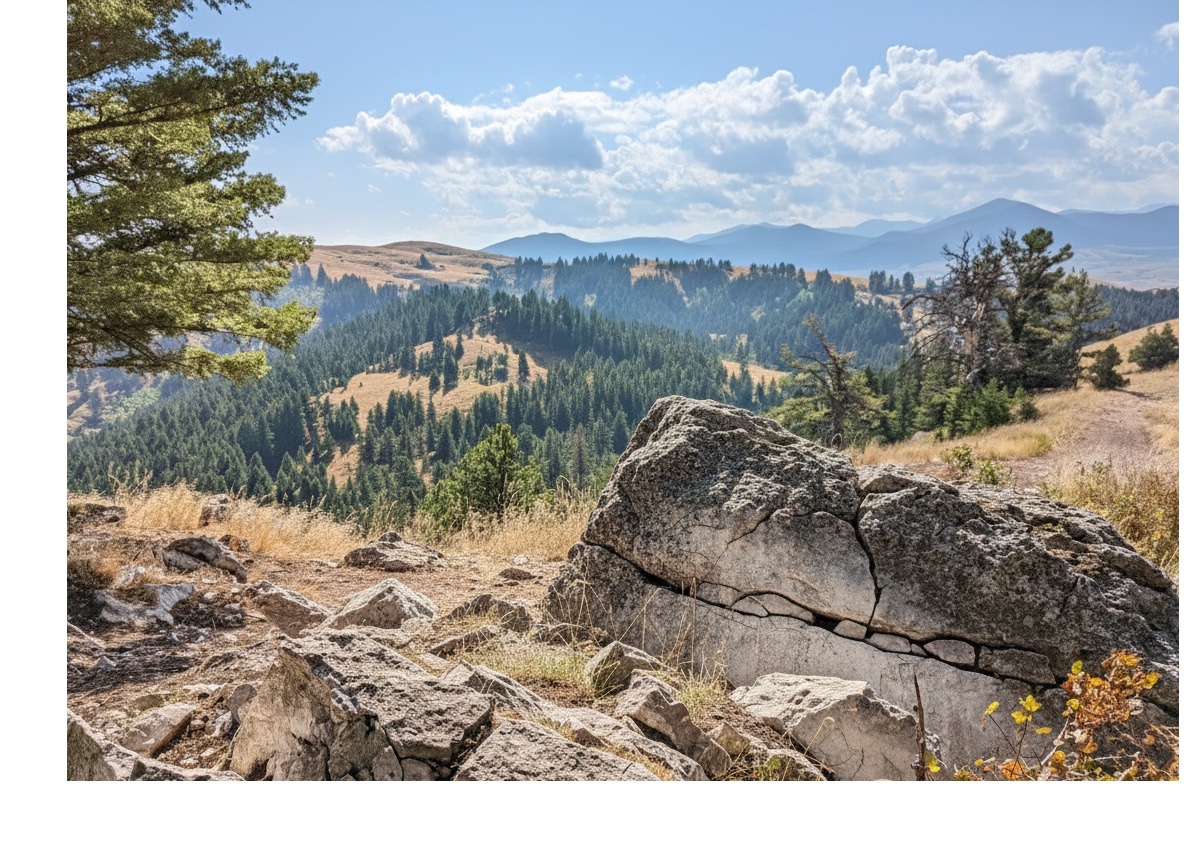
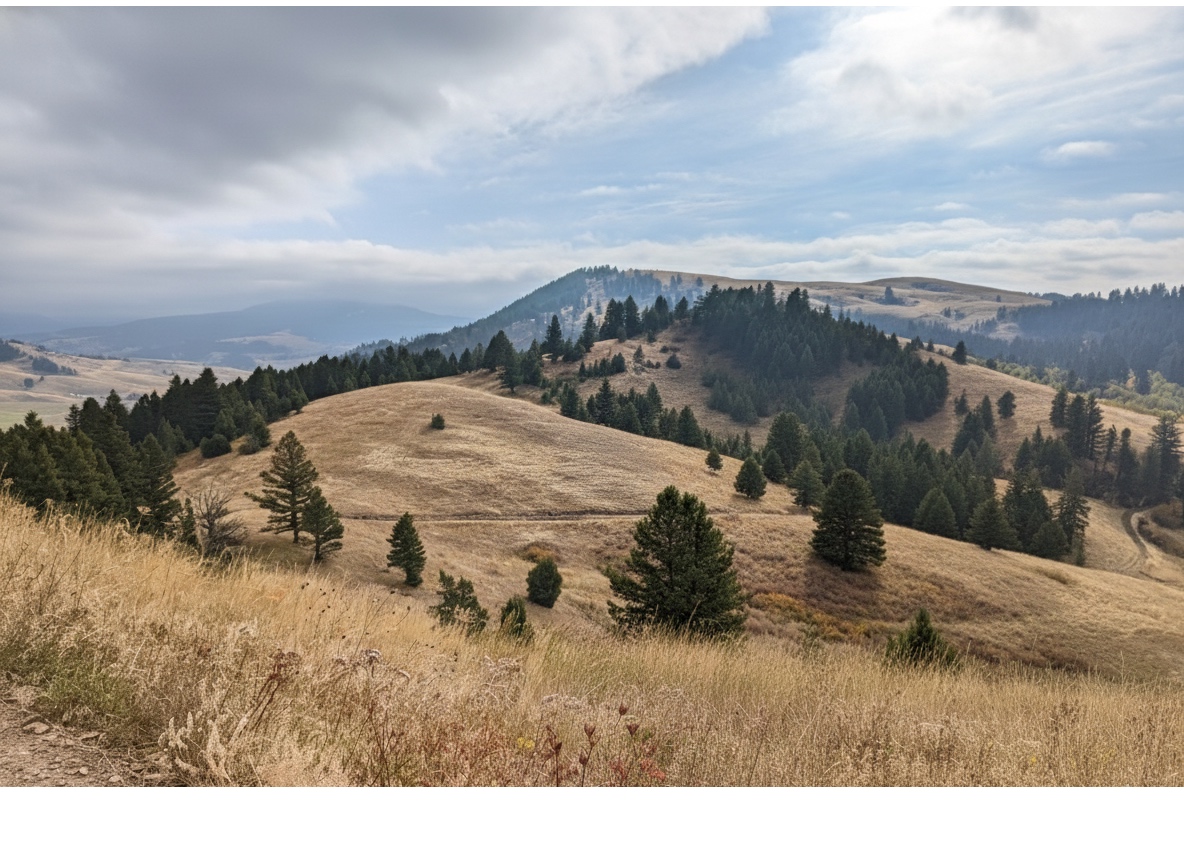
This is a great hike for a picnic lunch at the top. The summit has flat spots, boulders to sit on, and views in every direction. Pack a sandwich and plan to spend some time up there.
Not usually a problem, but bring bug spray in early summer just in case.
The left route has decent shade from pines. The right route is mostly exposed grassland. The summit is open with scattered trees.
This is a day hike only. The trail is too short and close to town for overnight camping.
The M Trail
The M trailhead is directly across Bridger Canyon Road. If you want to do both in one day, you can park at Drinking Horse and walk across the road to the M.
You don't really need a map for this one. The trail is well-marked and the loop is straightforward. If you want one anyway, Beartooth Publishing's Bozeman Area map covers it.
Drinking Horse is accessible year-round. The west-facing right route bakes in summer afternoons. Fall color appears on the lower slopes in late September. Winter is possible with microspikes on the steeper left route.
May through October: trail is clear and views are wide. Fall color starts in late September on the lower slopes.
April through May and late October: lighter crowds than the M, good wildflower bloom on the exposed right route in May.
December through March without microspikes — the steeper left route develops ice after freeze-thaw cycles and can be hazardous.
About the same overall. The M gains 805 feet in 1.5 miles while Drinking Horse gains 700 feet over 2.3 miles. The M is steeper, but the Drinking Horse loop design lets you ascend the harder side and descend the easier side.
Yes. The limestone M on Baldy Mountain is clearly visible from the Drinking Horse summit on a clear day.
No. There is a pit toilet across the road at the M trailhead if you need one before starting. Take care of business before leaving Bozeman.
The trail has no posted leash requirement, and most visitors let their dogs off-leash. Be aware of other dogs and cyclists on the trail.
Most people finish the full loop in 1 to 1.5 hours depending on how long they spend at the summit.
Plug 2.3 miles and 700 feet of elevation gain into our free hiking time calculator for a personalized estimate.