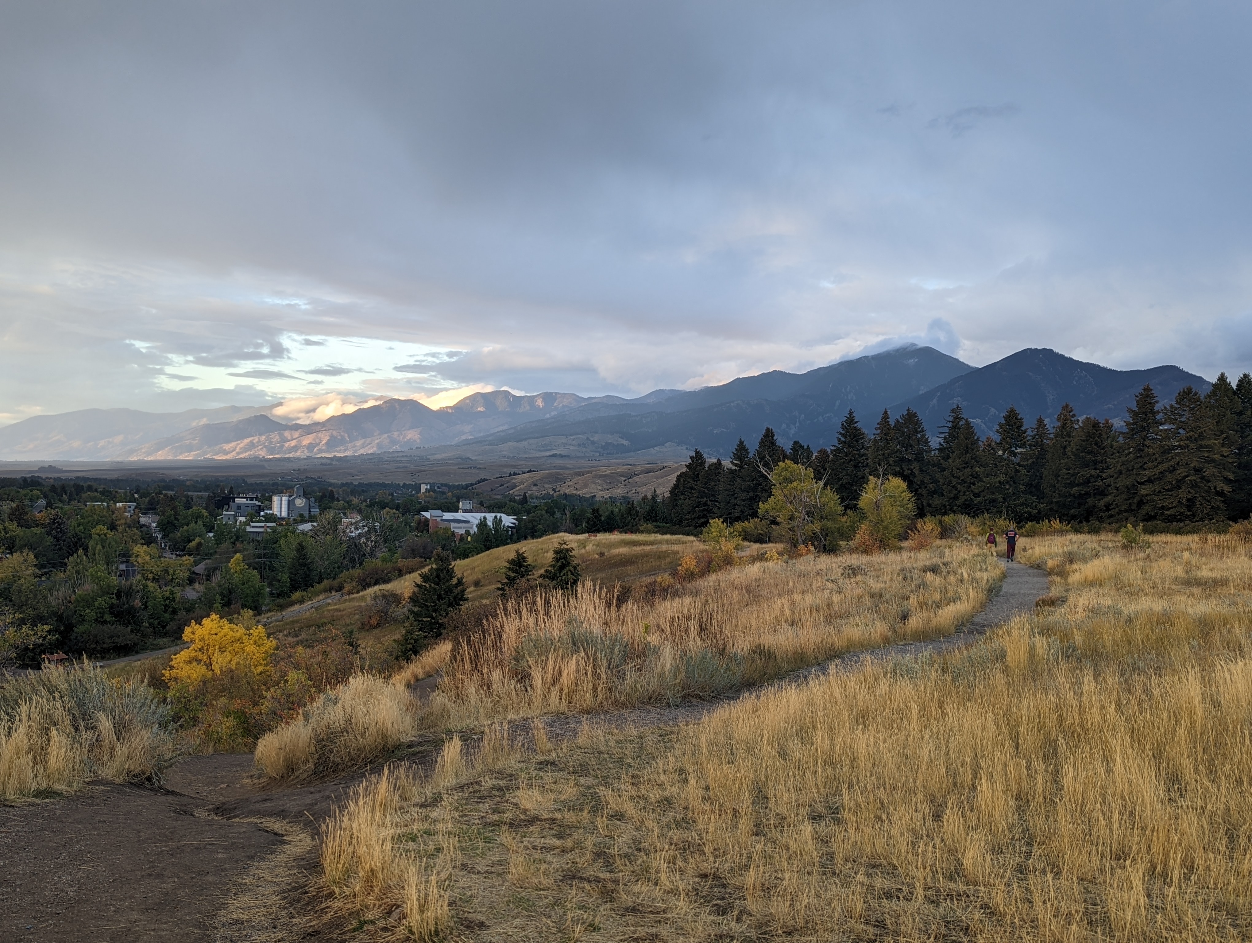
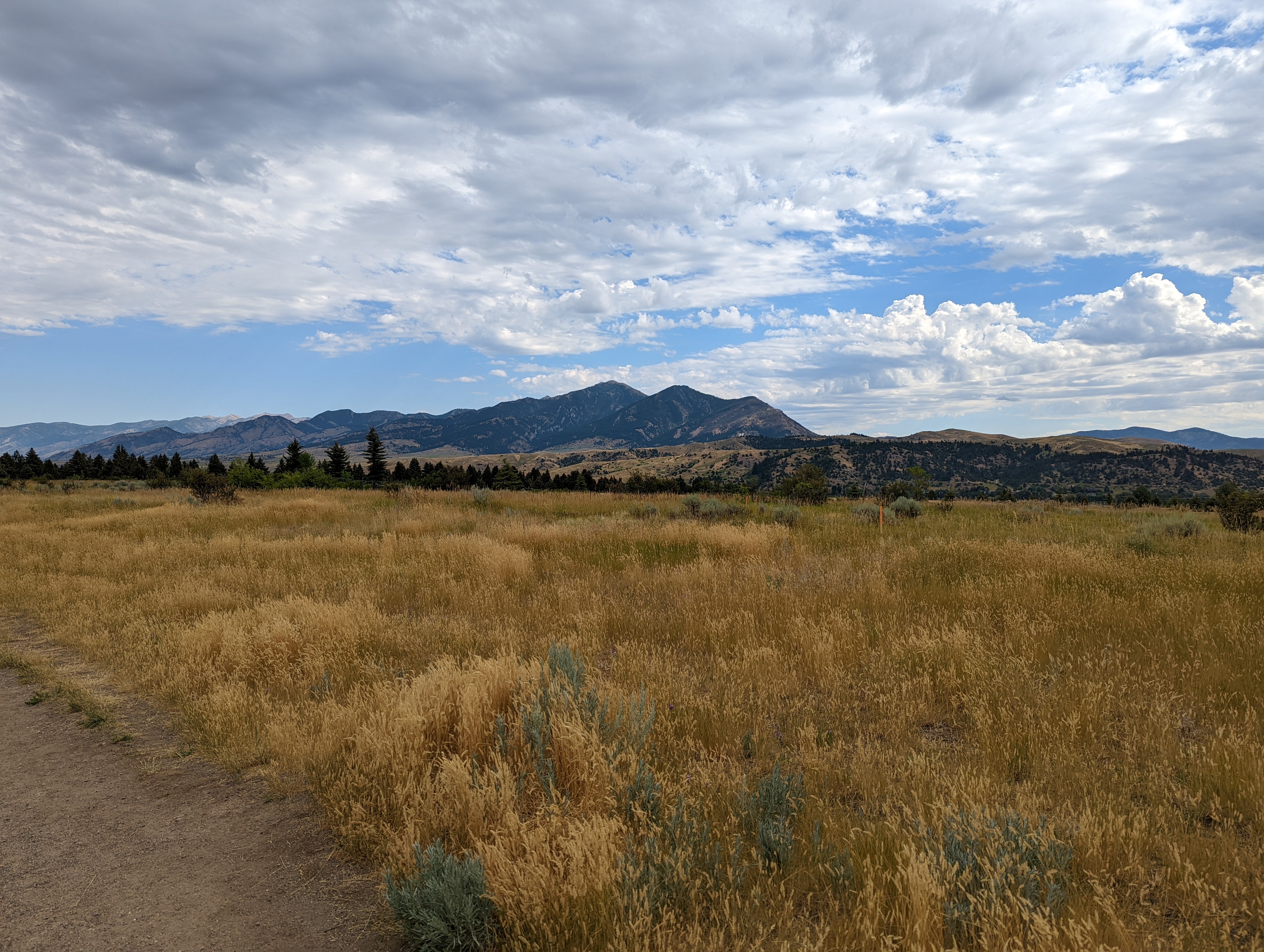
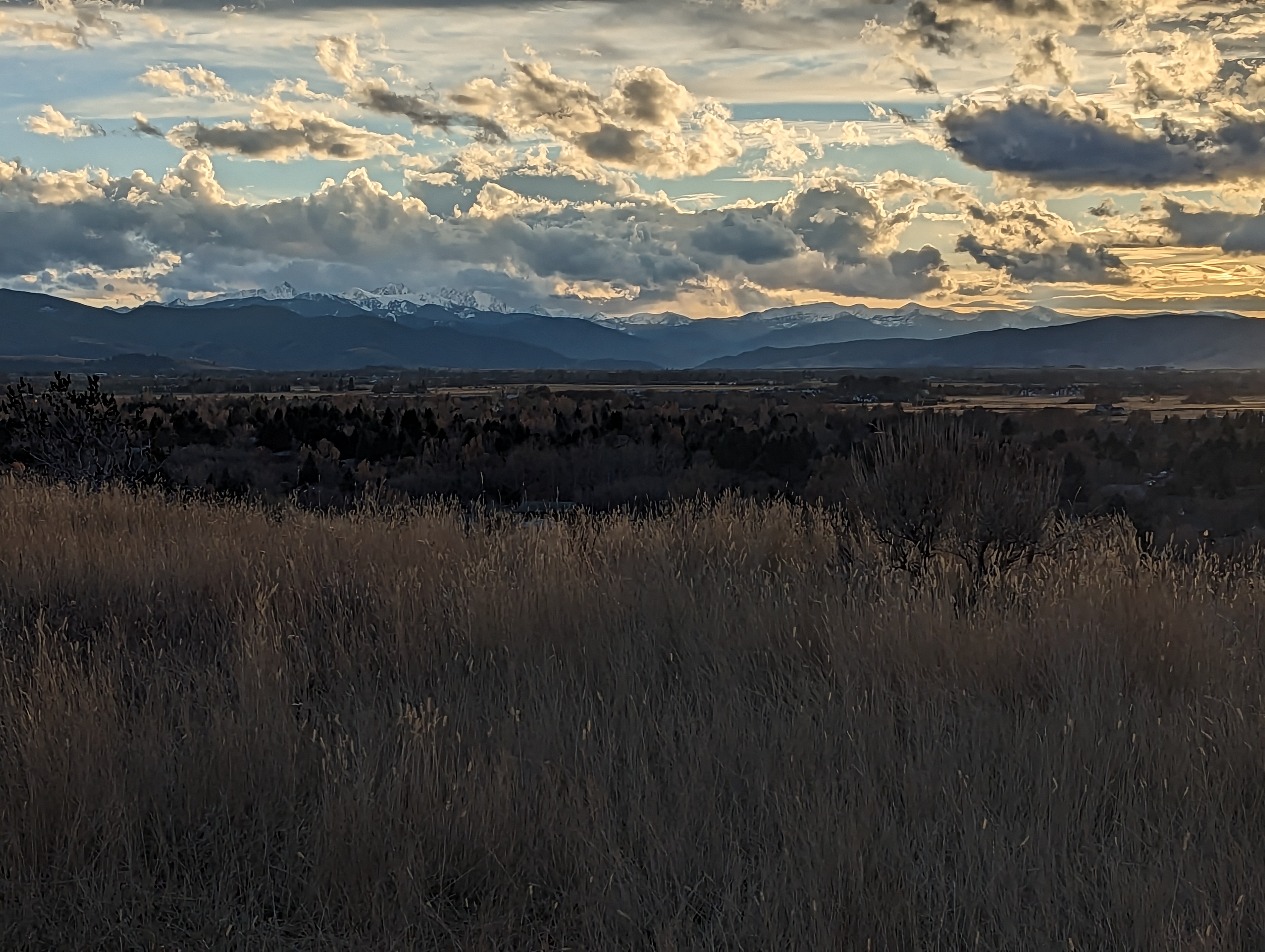
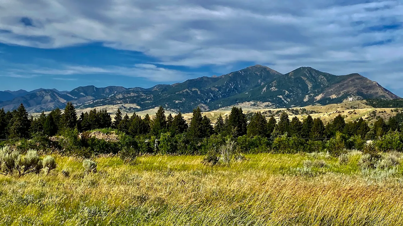
Peets Hill is Bozeman's living room. The hill sits half a mile from downtown, the views from the top take in the full Gallatin Valley and surrounding ranges, and sunset from either overlook is consistently worth making the climb for. The Medicine Wheel at the summit is a genuine piece of public art, with metal silhouette benches where each figure aligns with a specific peak visible from that spot. It rewards standing still for a few minutes.
The park's history is worth knowing. This land was platted for 612 homes in 1892 during Bozeman's push to become the state capital. GVLT's first community trails project kept it open, and in 2022 a public campaign with 700 donors secured the final 12 acres before a private buyer could close the deal. The two overlooks, accessible loop, and the Medicine Wheel all came from that campaign. A trail this close to town with this much history doesn't happen by accident.
The main lot at South Church Avenue and East Story Street is free and usually has spots, but fills up on weekday evenings and weekend mornings. The upper lot at Josephine Drive and Kenyon Drive is a better bet when the main lot is full, and it has a designated accessible space. The Bozeman Public Library lot to the south is also an option if you plan to approach via the Gallagator Trail.
Restrooms are open year-round at the upper Josephine Drive parking lot. There are no bathrooms at the main Church Avenue trailhead.
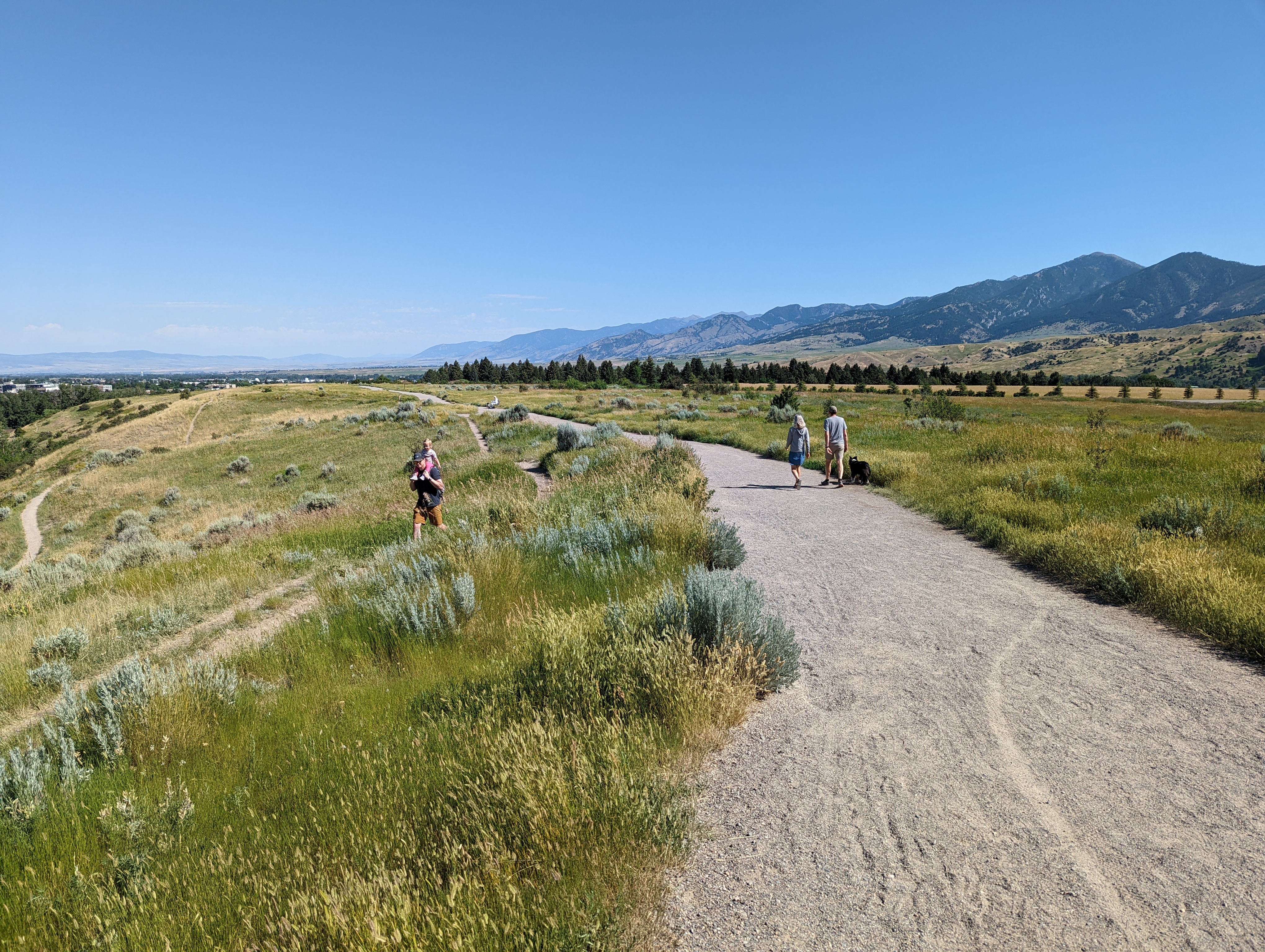
Peets Hill is one of the busiest urban green spaces in Bozeman. Expect steady foot traffic from early morning through evening, dog walkers, runners, photographers at golden hour, and families with sleds in winter. The off-leash policy means the trail can feel chaotic at peak times, especially on weekend mornings. If you want the hill mostly to yourself, a weekday morning in winter is your best shot.
Paved road the entire way. South Church Avenue is a residential street with no issues year-round.
Full cell service throughout. You are inside city limits.
Peets Hill is one of the most popular off-leash dog areas in Bozeman, and it shows. Dog waste stations are available at the trailhead. Only let your dog off-leash if their recall is reliable, because the distractions here are constant, other dogs crossing from every direction, people, kids, and plenty of excitement at the top. There is no water on the trail once you leave the base, so let your dog drink before you start.
0.5 Miles from Downtown Bozeman, MT. 3 Minutes
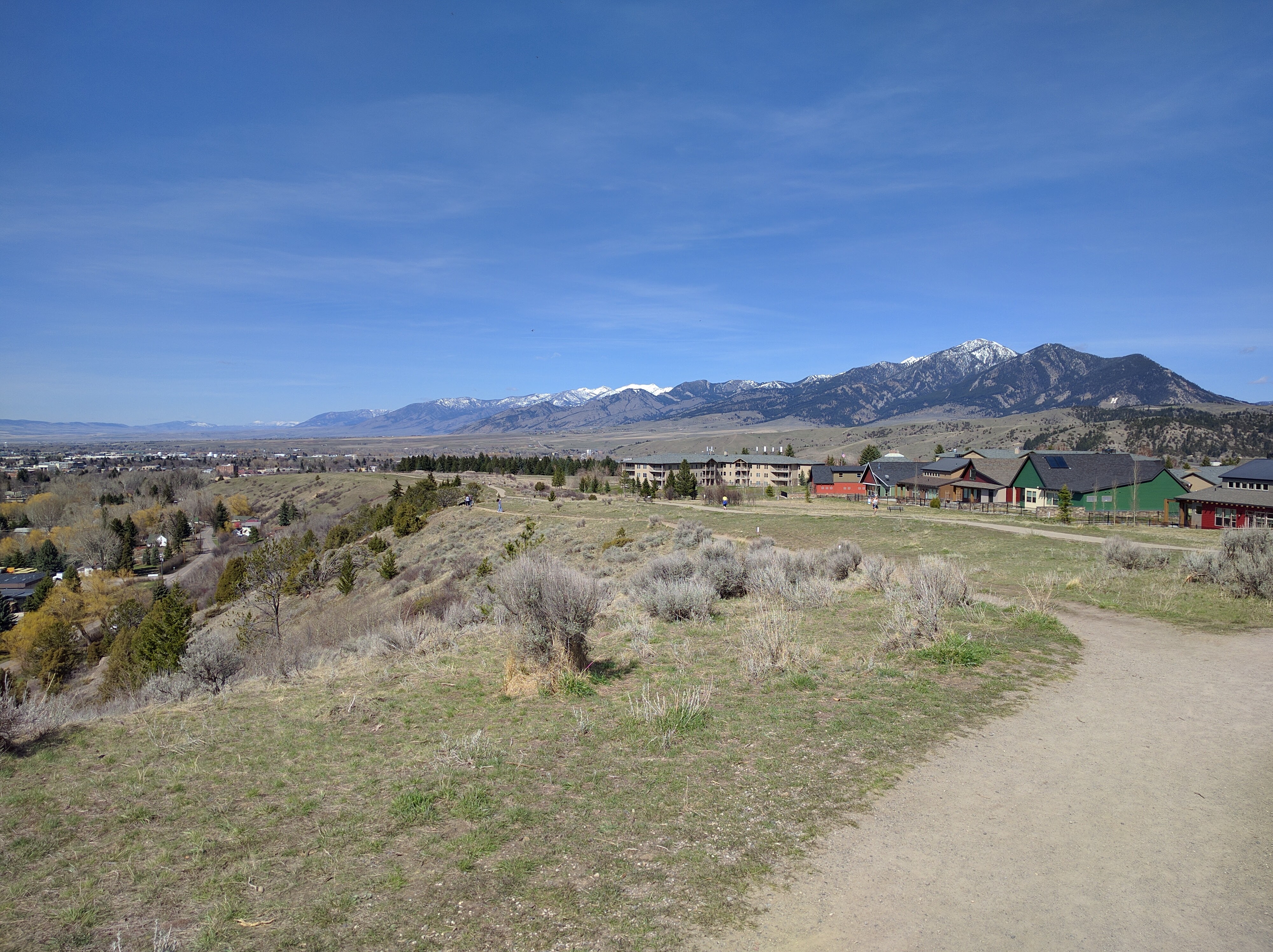
From downtown Bozeman, head south on South Church Avenue. The main parking lot is at the intersection of South Church Avenue and East Story Street. If you need accessible parking or want to skip the steep initial climb, the upper lot is at the intersection of Josephine Drive and Kenyon Drive, with a designated accessible space that connects directly to the flat loop trail on the ridge. You can also access the trail from the south end of the Bozeman Public Library parking lot via a paved section of the Gallagator Trail, which passes through Bozeman's Sculpture Park on the way up.
There is no water on the trail. A seasonal creek runs at the base of the hill, crossed by the Chris Boyd Bridge at the Church Avenue trailhead, where dogs can drink before and after. Bring what you need for the climb.
16 oz consumed per person
Summer and fall conditions are good. The wide gravel paths are well-maintained and easy to follow. Spring is messier, the trail turns muddy during the thaw and after rain, and reviews consistently mention slick conditions through April. In winter the steep sections pack down into ice, so microspikes are a good idea from December through March. Stick to the official gravel paths year-round and do not cut across the grass, the open hillside looks like fair game but the sagebrush and prairie ecosystem has taken real damage from people doing exactly that.
The hillside is open and exposed, so wind can be noticeable at the top even when it is calm in town. Bring a layer in spring and fall. In summer the exposed south-facing slope heats up fast, so start early or go in the evening.
Footwear: Sneakers
Pack a snack and head up at golden hour. The two overlooks make this one of the better sunset spots in Bozeman, and the easy grade and short distance make it a practical date night or family outing any time of year.
Not usually a problem. The open, exposed hillside does not hold bugs the way shaded creek corridors do.
The hill is mostly open grassland with scattered trees. There is minimal shade on the trail, which makes it warm in summer midday and gives it a completely different feel than the forested loops at Kirk Hill.
Day use only. No camping is allowed in city parks.
Main Street to Mountains
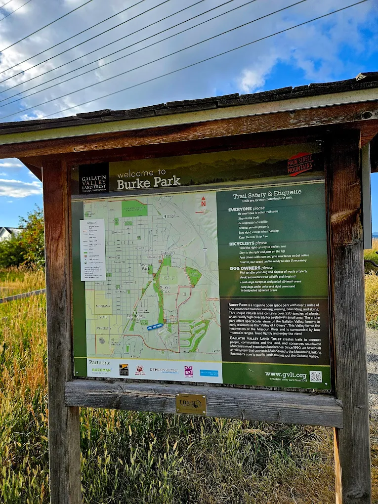
Burke Park is the centerpiece of Bozeman's Main Street to Mountains trail system, which connects downtown to the surrounding open spaces via a network of urban paths and greenways. Most of the connections below are part of this system.
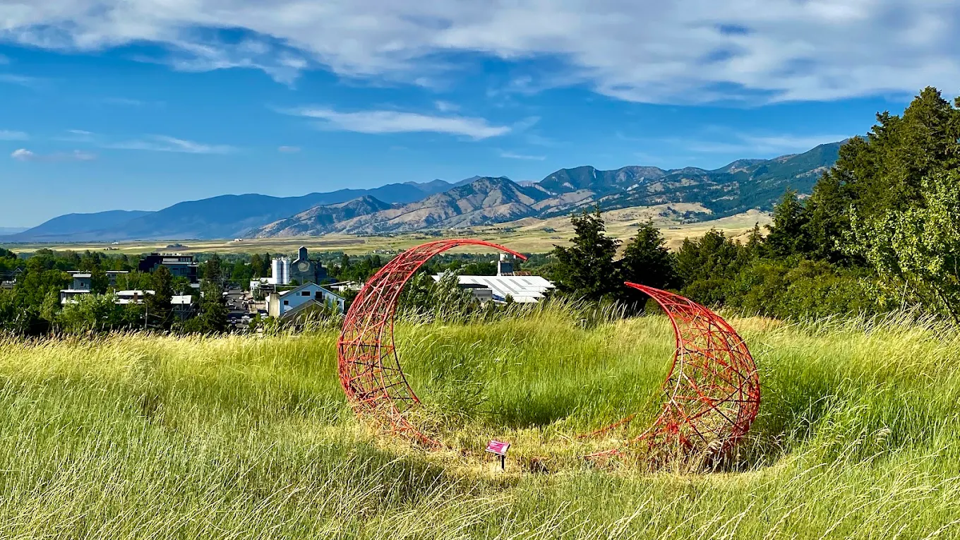
Gallagator Linear Trail & Bozeman Sculpture Park
The Gallagator Trail runs along Bozeman Creek at the base of Peets Hill. The Chris Boyd Memorial Trail connects the Church Avenue trailhead to the ridge, crossing the seasonal creek via the Chris Boyd Bridge. The Library approach comes in via a paved section of the Gallagator that passes through Bozeman's Sculpture Park, which is worth a slow walk on its own. The route from the Library to the park bridge is about half a mile and is easy to do on a bike. From the Gallagator you can continue north to Story Mill Community Park or south to the MSU campus trail network.
Lindley Park
The trail connects east to Lindley Park, adding a shaded creek-side stretch to the outing.
Highland Glen Trails
From Lindley Park you can continue into the Highland Glen trail network for more mileage through the neighborhood greenway.
You do not need a map for this one. The trail system is small and well-signed, and you can see the whole park from any point on the hill. If you want to explore the Gallagator connection or the broader neighborhood trail network, the City of Bozeman's parks map is available on their website.
Peets Hill is a year-round trail. Sunsets are worth timing any season. Spring brings mud after thaw, and summer afternoons can be warm on the exposed south-facing slope. Winter sledding is popular on the steep sections.
May through October: wildflowers in May, warm evenings for sunset visits in summer, fall color on the lower grassland in September.
March through April and November: quieter than peak season, but mud and ice are possible after weather events. Check conditions before going.
After heavy rain or snow the steep sections from the Church Avenue trailhead become slippery. The Josephine Drive accessible loop stays manageable when the main trail does not.
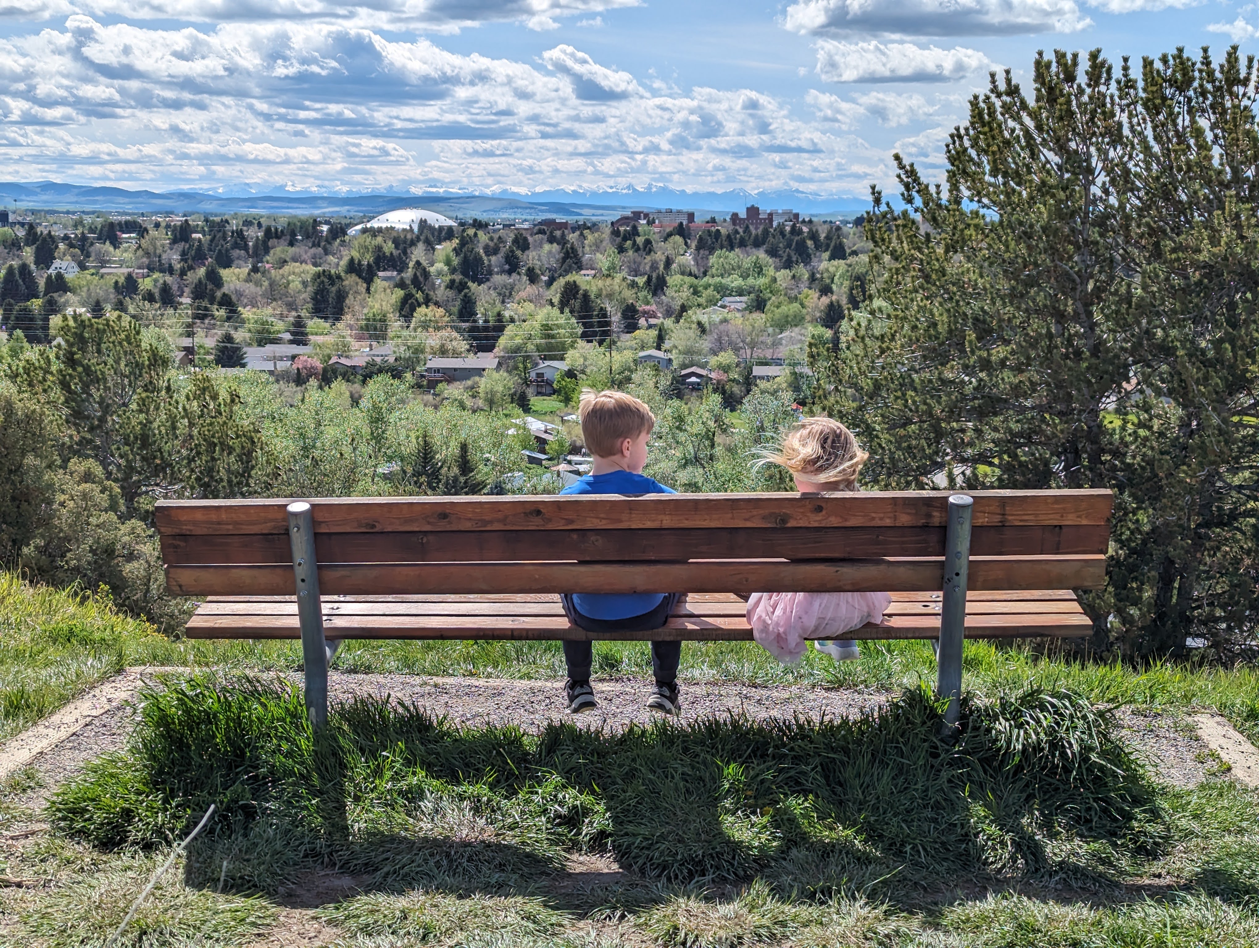
The upper loop from the Josephine Drive parking lot is the accessible option — flat gravel connecting the Medicine Wheel, both overlooks, and the best views without the steep initial pitch. Standard strollers will handle it. The main Church Avenue trailhead approach is not accessible.
Yes, Peets Hill is one of Bozeman's most popular off-leash areas. Off-leash is only a good idea if your dog's recall is reliable, since the trail is constantly busy with other dogs, people, and kids.
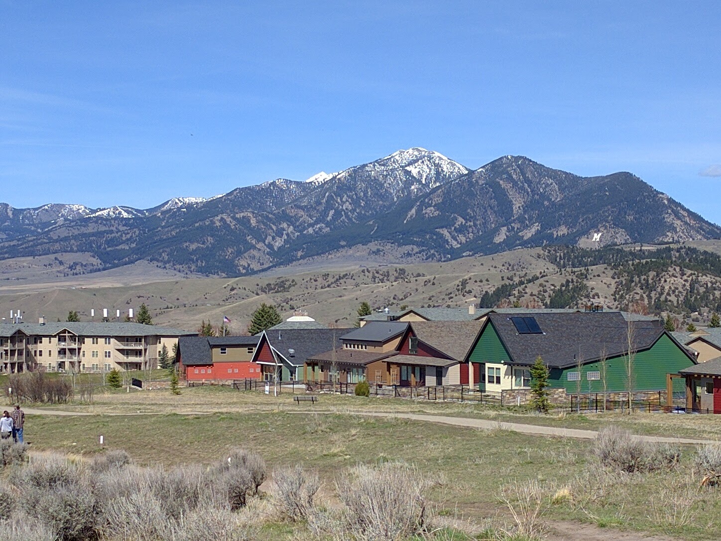
A concrete Native American Medicine Wheel with metal silhouette benches at the highest point on Burke Park. Each silhouette aligns with a specific peak in the Gallatin Valley visible from that spot. It is part of the 2022 improvements funded by a 700-donor public campaign.
Peets Hill is half a mile from downtown Bozeman and bikeable from most of the city via the Gallagator Trail. The Library parking lot connects to the trail via a paved Gallagator section through Bozeman's Sculpture Park.
Yes, especially at sunset. The view explains Bozeman's geography — the city below you, the Bridgers to the north, the Gallatin Range to the south. The Medicine Wheel at the top is a genuinely interesting installation that most visitors don't know about in advance.
Plug 1 miles and 102 feet of elevation gain into our free hiking time calculator for a personalized estimate.