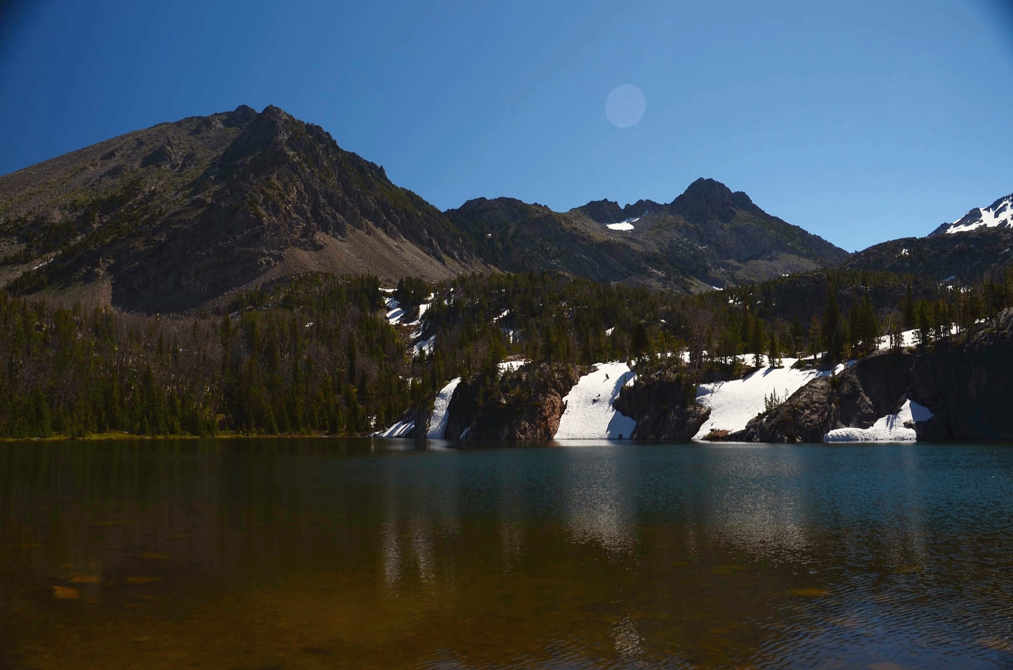
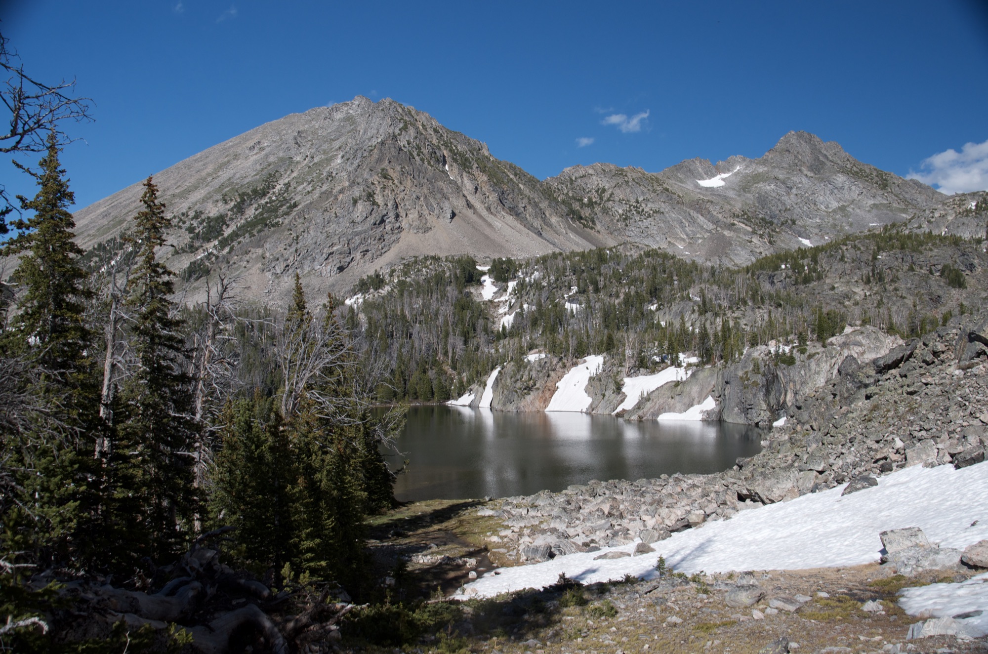
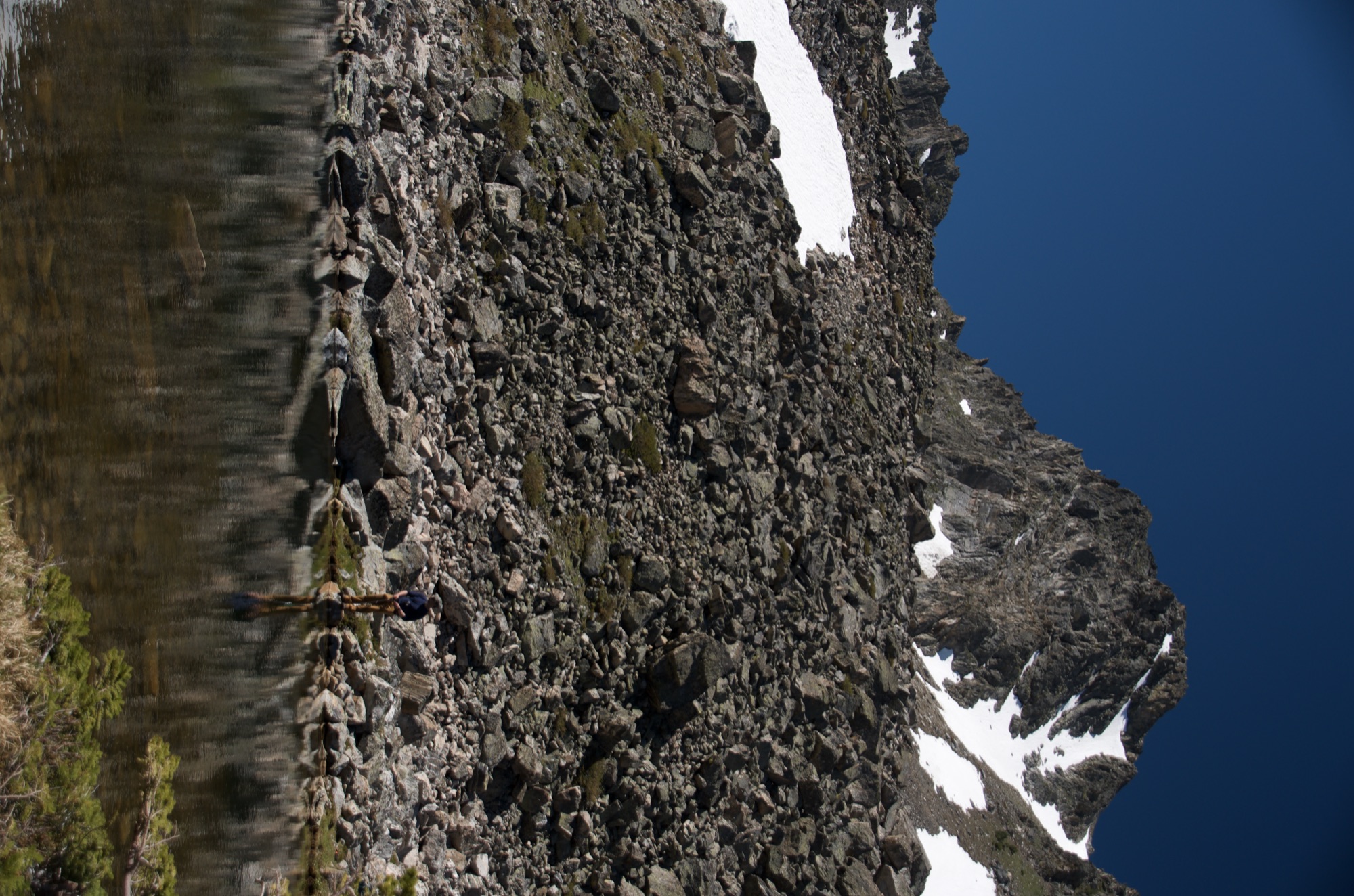
Spanish Lakes gets compared to Lava Lake constantly because they share the same trailhead region. The comparison is telling: Lava Lake fills up, Spanish Lakes does not. On our trip in late June we shared the entire lake basin with one other backpacker.
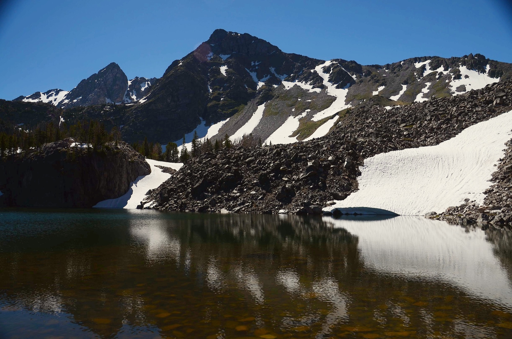
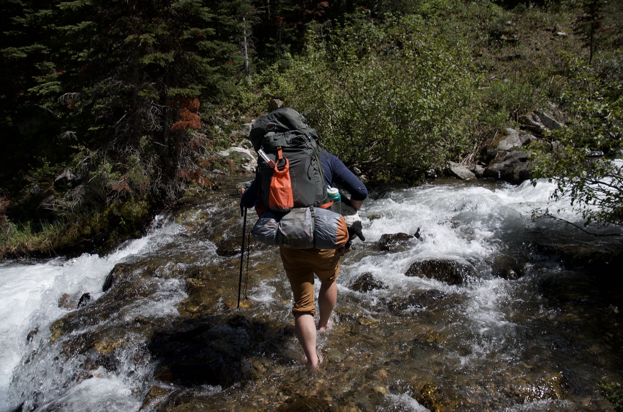
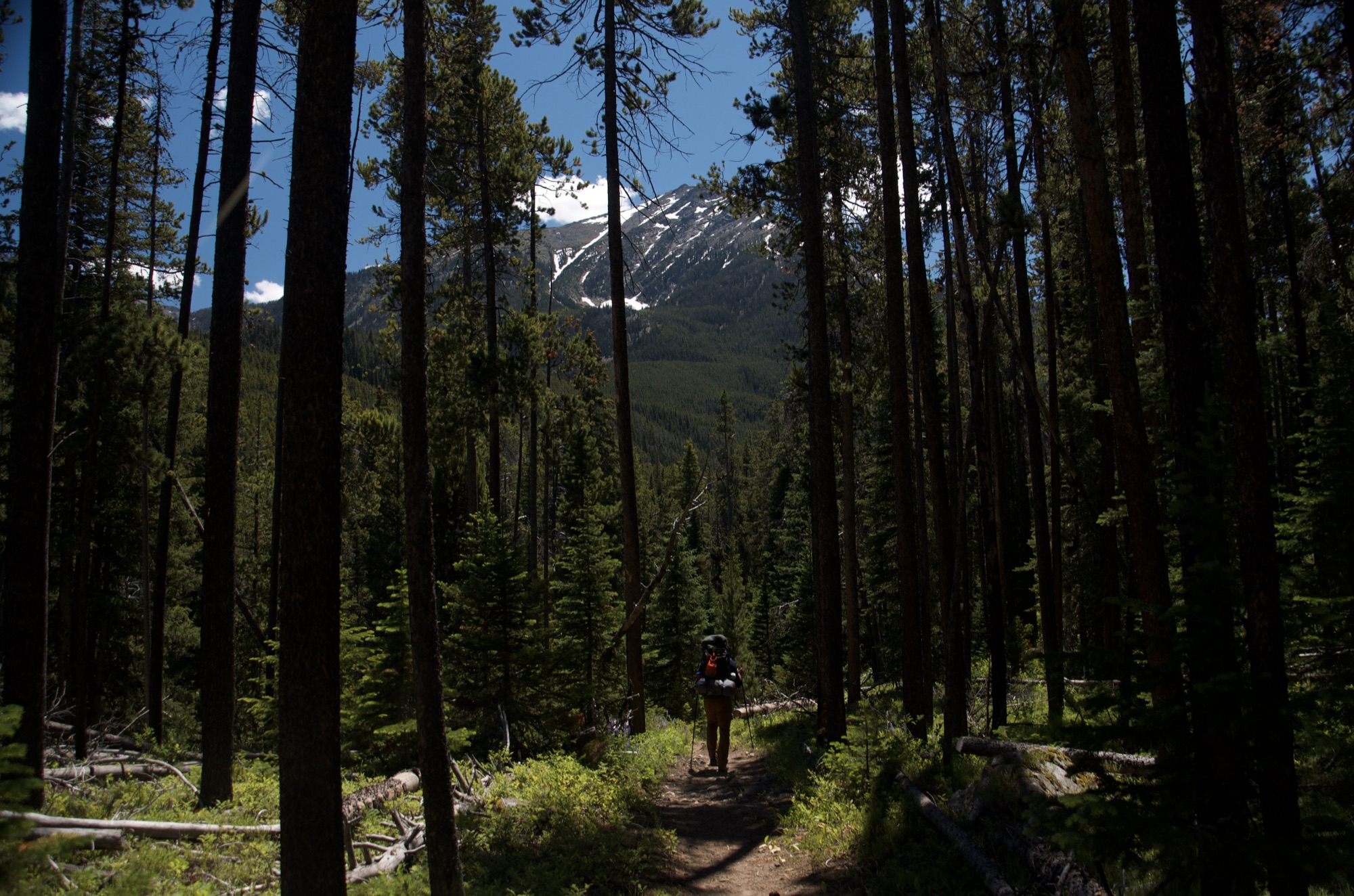
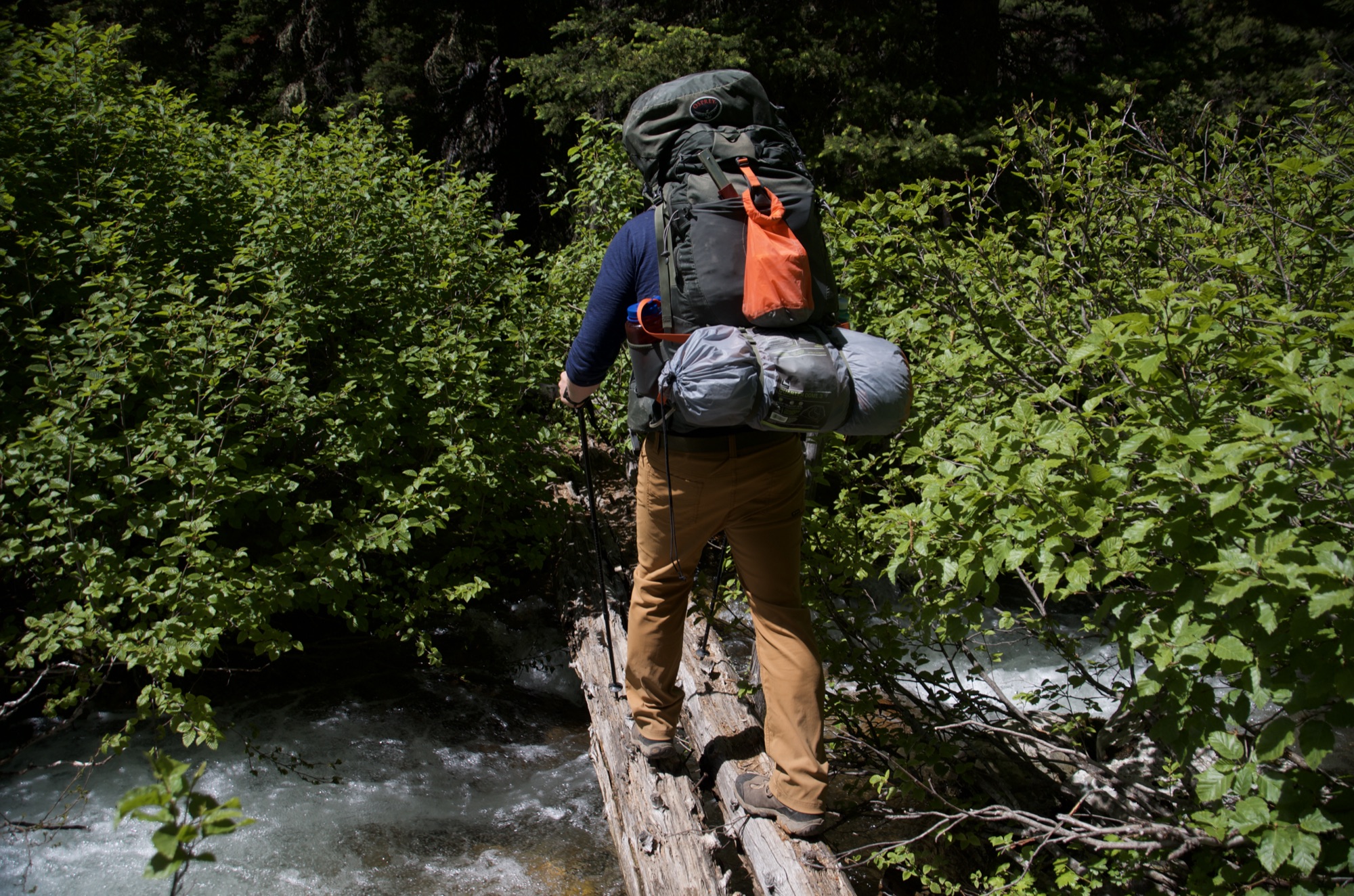
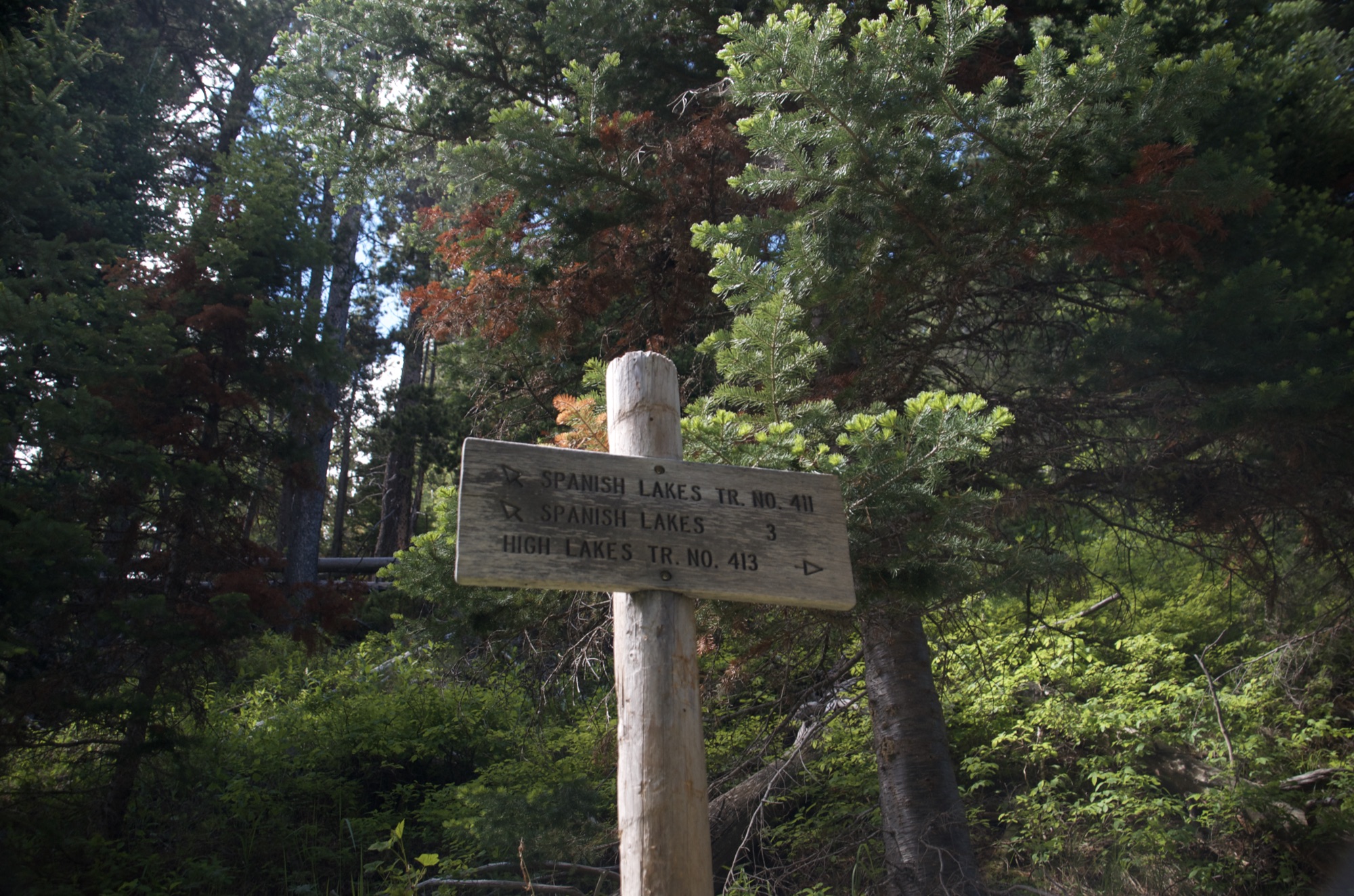
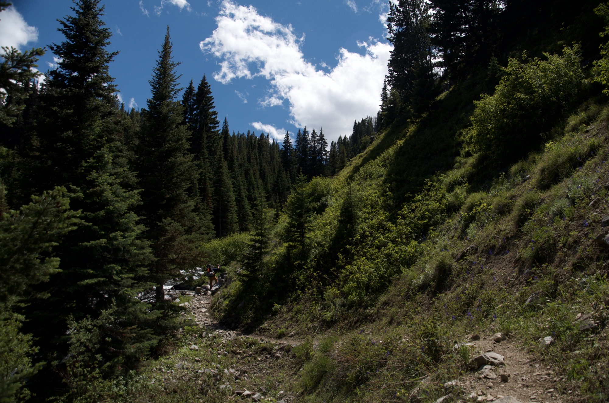
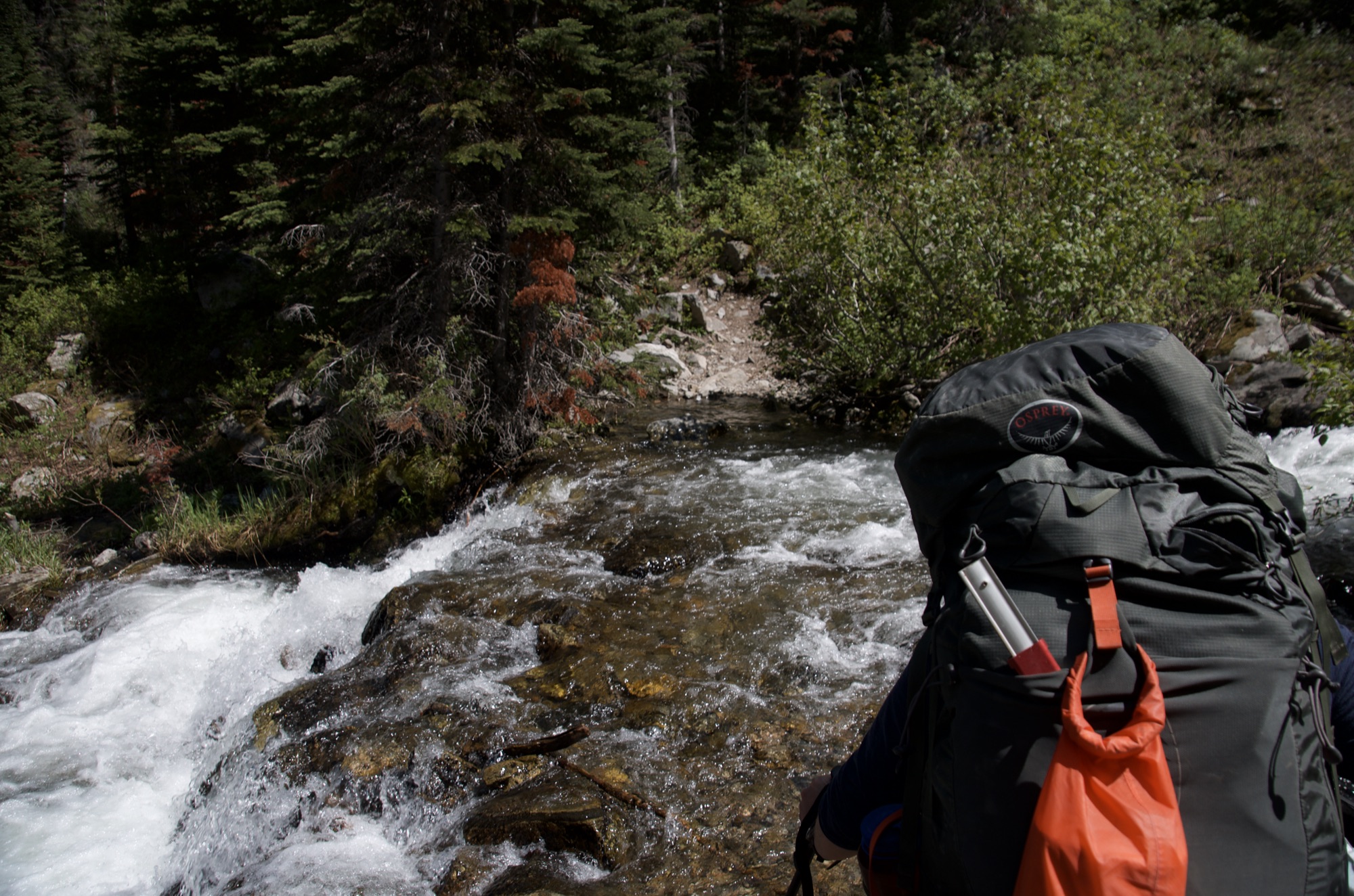
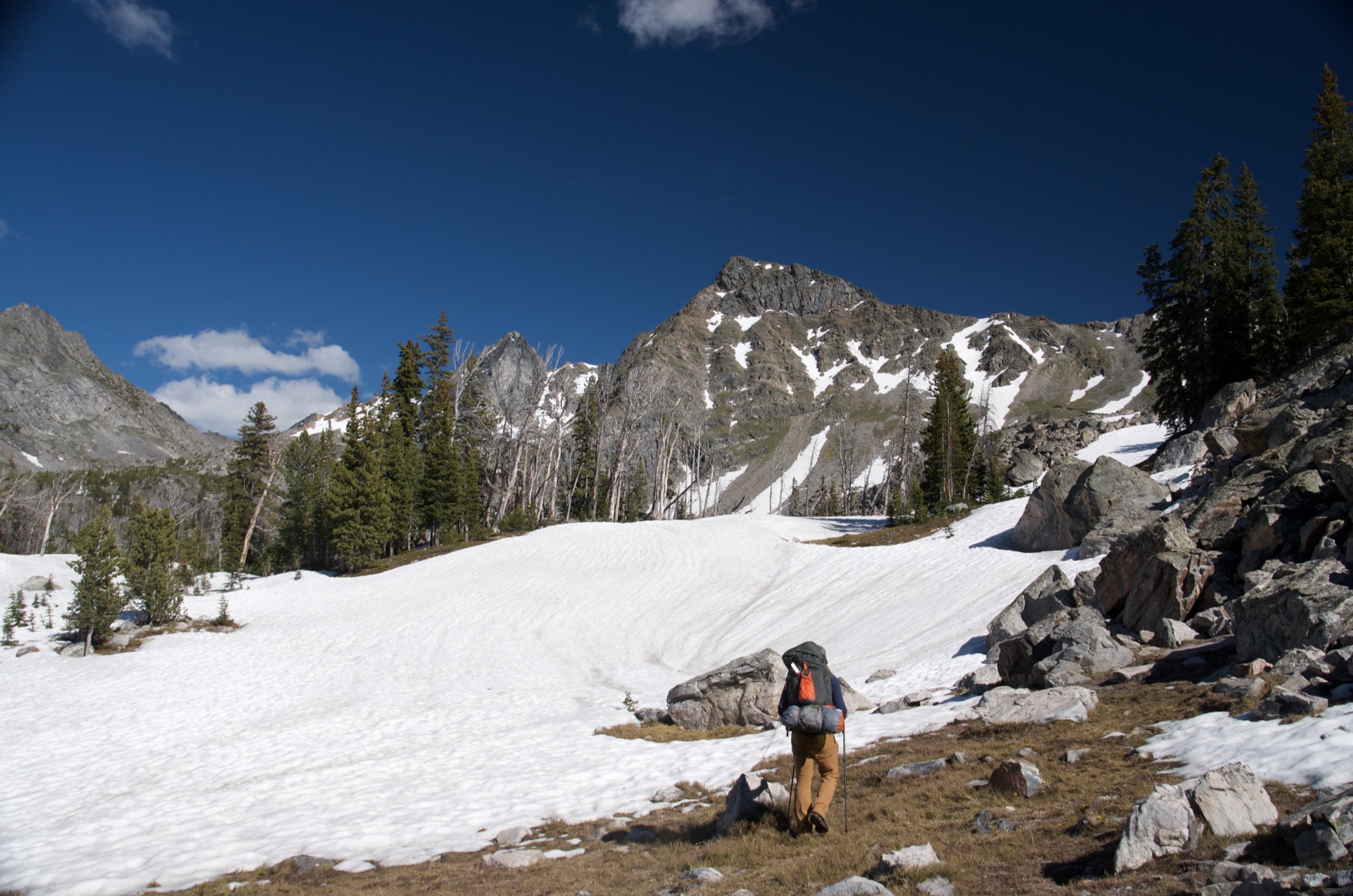
The lower trail along Spanish Creek is equestrian country, wide and dusty, and the first few miles can feel like a horse highway. Once you take the right fork onto Spanish Lakes Trail #411, you are on a different hike. The trail gets steep, the crowds disappear, and the upper miles through rocky alpine terrain feel genuinely remote. The lakes are clear, the peaks are above them on three sides, and the camping is excellent if you are willing to carry in a warm sleeping bag. The mandatory creek crossing that means removing your shoes and wading is just the price of admission.
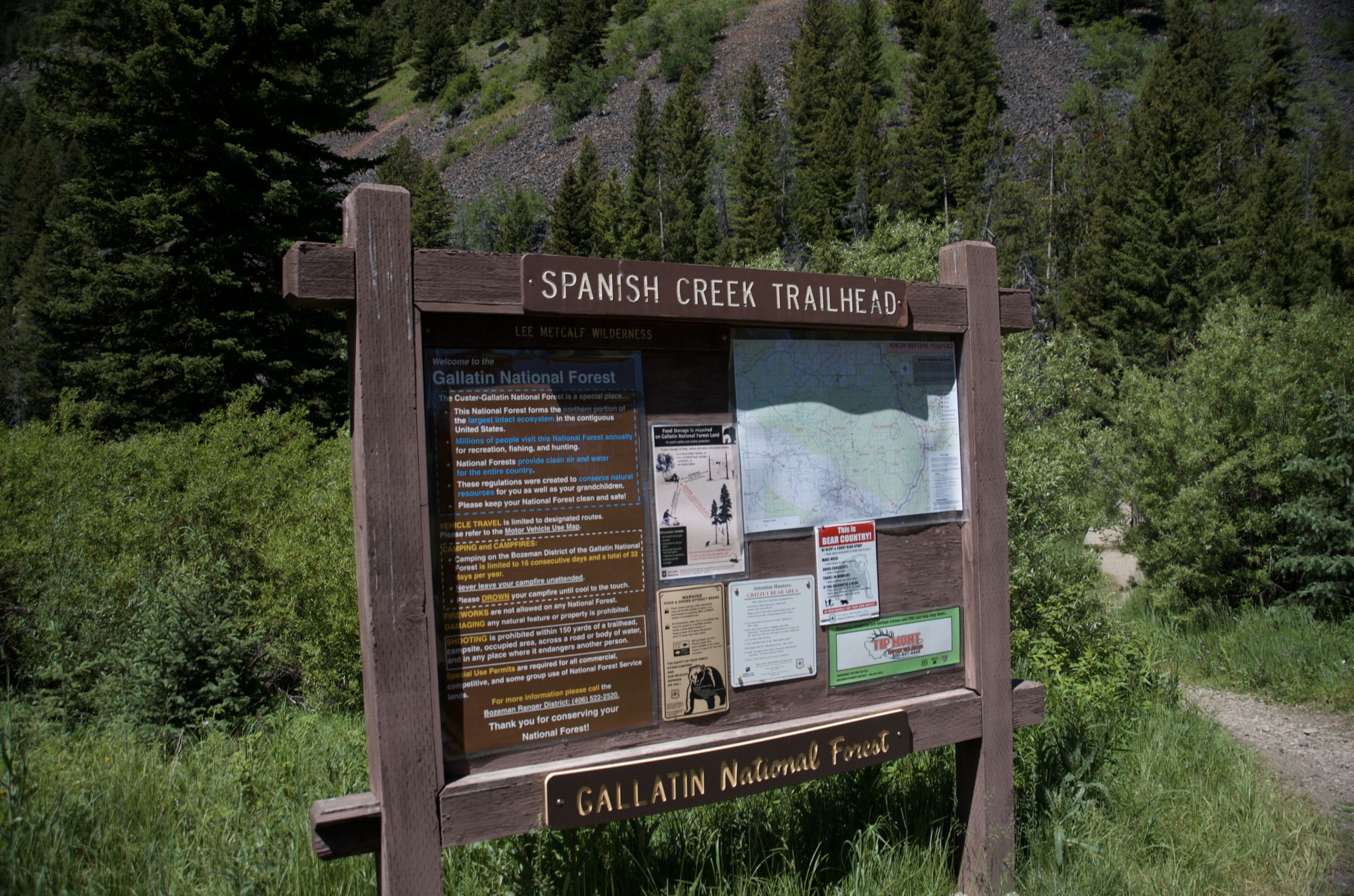
The trailhead has two parking lots with plenty of room for vehicles and horse trailers. You shouldn't have any trouble finding a spot.
There is a vault toilet at the trailhead near the parking area.
This trail sees a fair amount of equestrian use, so be prepared to yield to horse traffic. Foot traffic to the Spanish Lakes themselves is light compared to other destinations in the area. You'll see more people on the lower portion of the trail near the creek, but once you take the Spanish Lakes fork, expect to have the trail mostly to yourself.
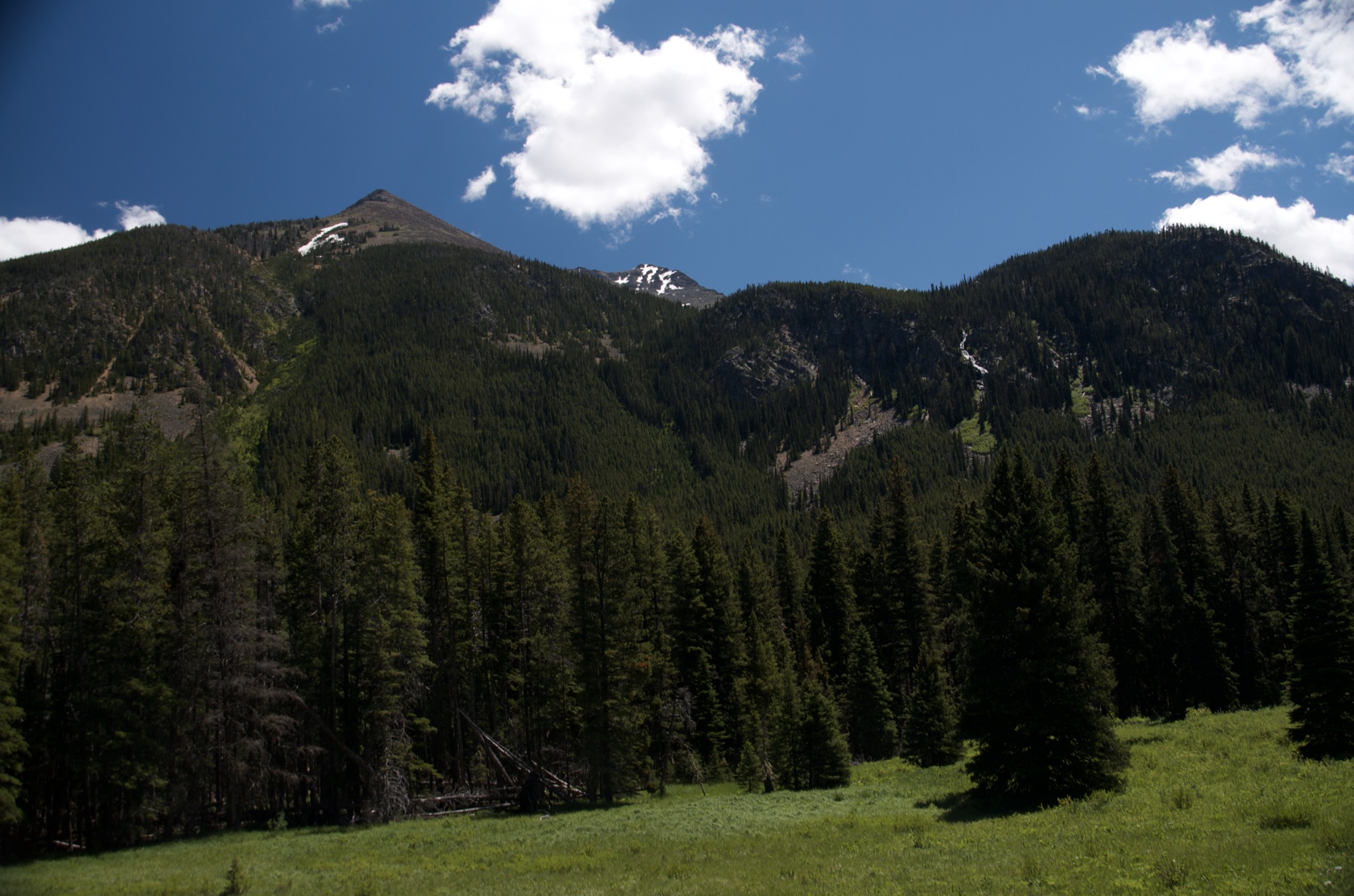
US-191 through the Gallatin Canyon is paved and well-maintained. Spanish Creek Road is dirt but smooth and passable in any vehicle. It's a pretty drive through the Flying D Ranch with views of the Spanish Peaks the whole way.
You won't have any cell service on this hike. Plan accordingly.
There is plenty of water and shade along the lower trail for your dog. The creek crossings and steep terrain higher up will be tough on smaller or less athletic dogs. The distance alone makes this a big ask for most dogs, so make sure yours is up for a long day or overnight trip.
30 Miles from Bozeman, MT. 62 Minutes
From Bozeman, head south on US-191 through Gallatin Gateway and into the Gallatin Canyon. Drive about 21 miles and watch for Spanish Creek Road on your left, shortly after crossing Spanish Creek.
Turn left onto Spanish Creek Road and follow it for about 9 miles. The road passes through the Flying D Ranch and is well-maintained dirt the entire way, no high-clearance vehicle needed. You'll dead-end at the South Fork Spanish Creek Trailhead which has ample parking, an outhouse, picnic areas and equestrian facilities.
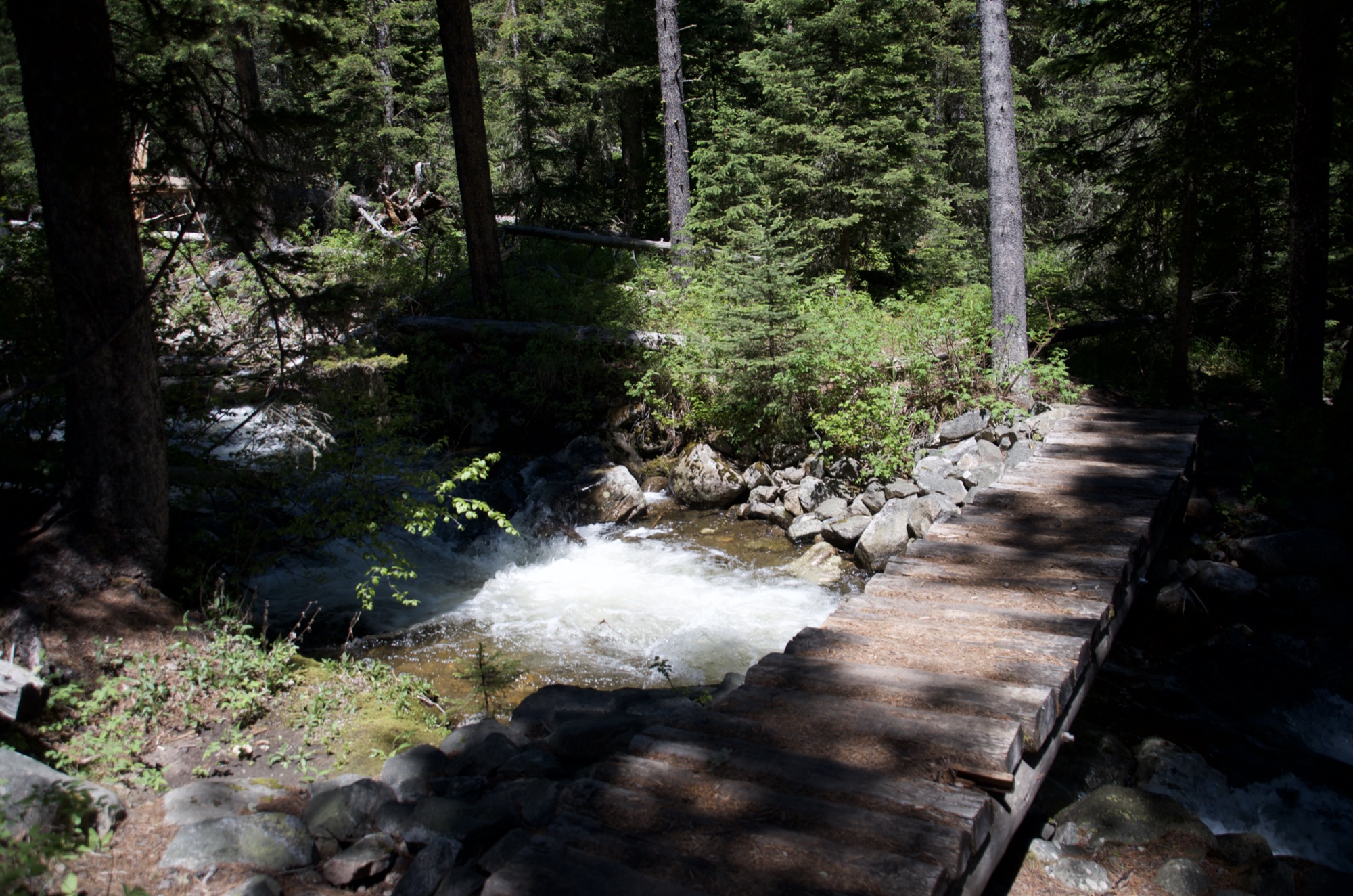
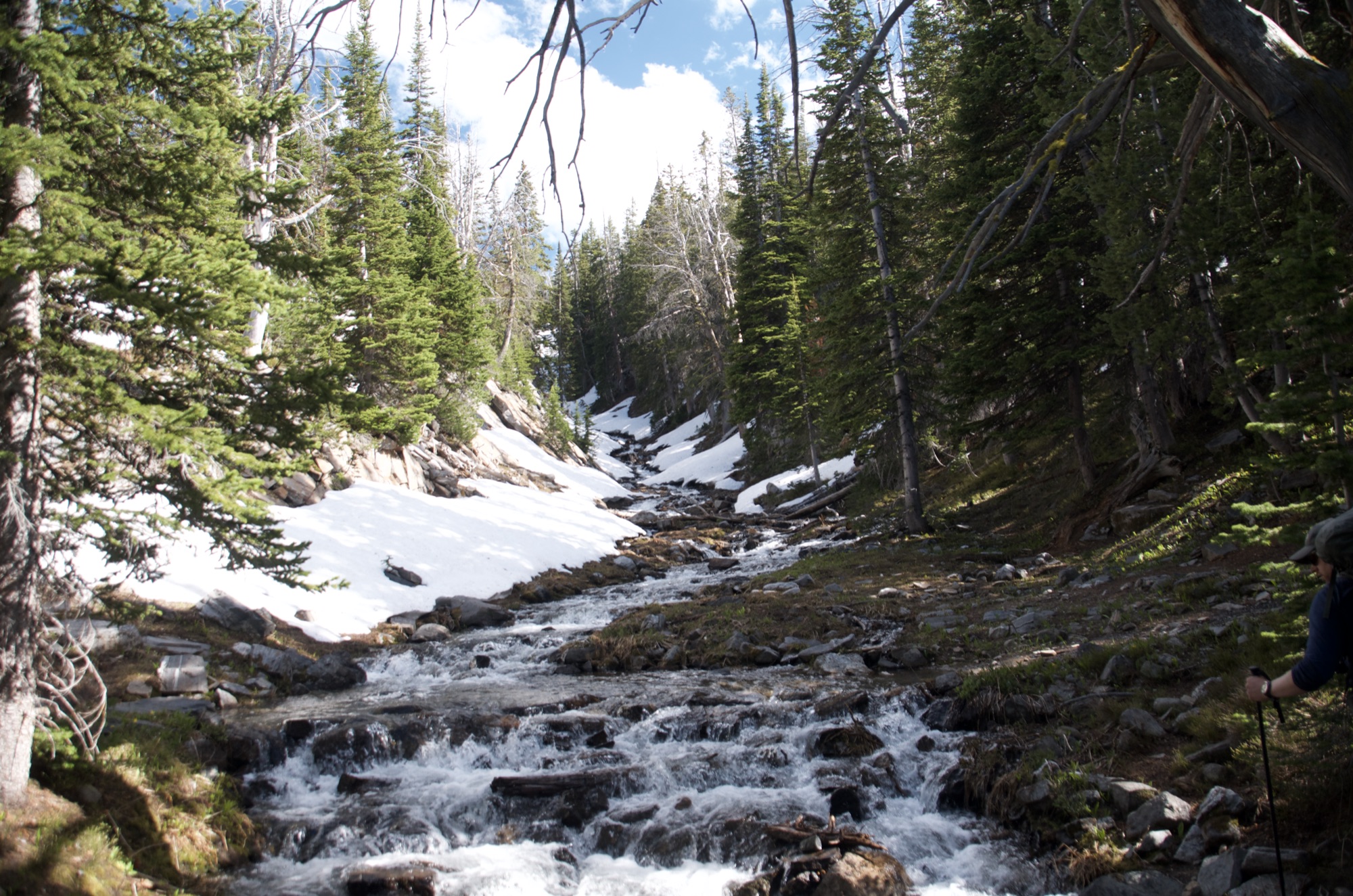
The trail follows Spanish Creek for the first few miles and crosses it multiple times. You'll have no shortage of water sources to filter from along the way, and of course the lakes themselves at the destination.
96 oz consumed per person
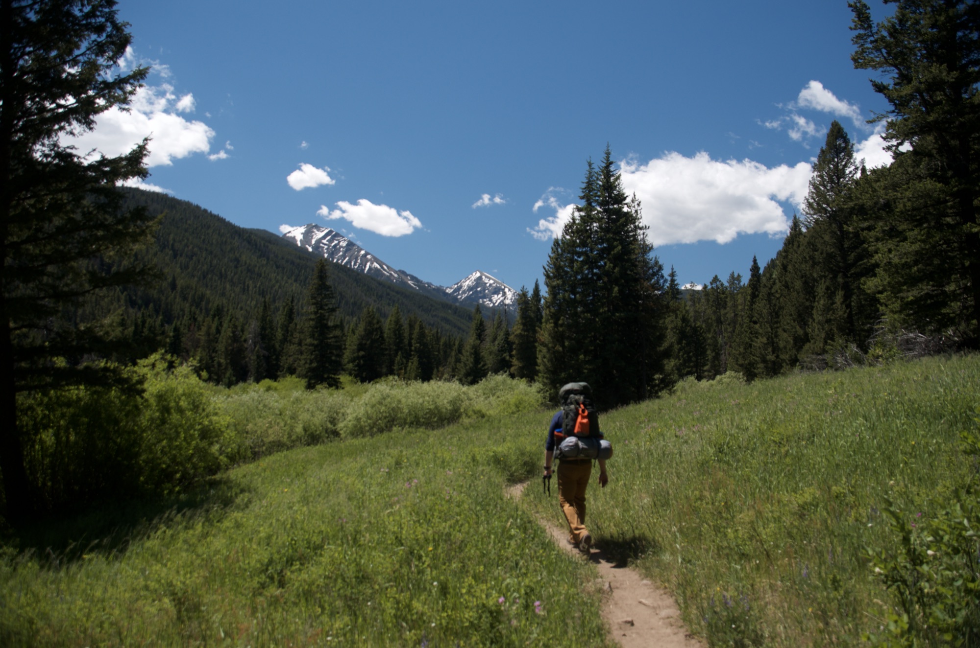
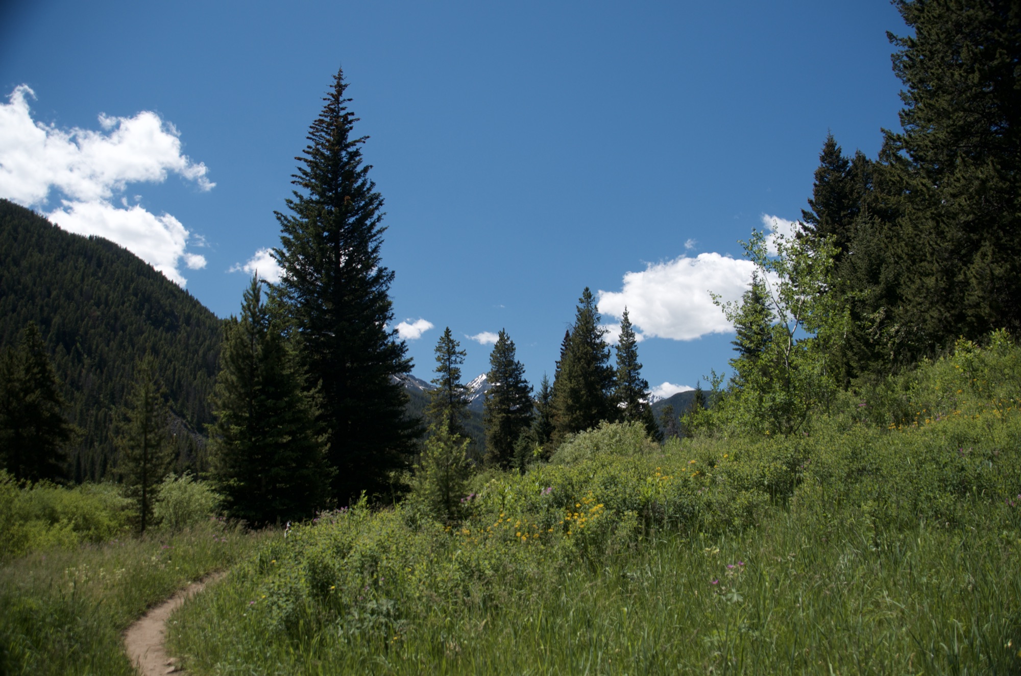
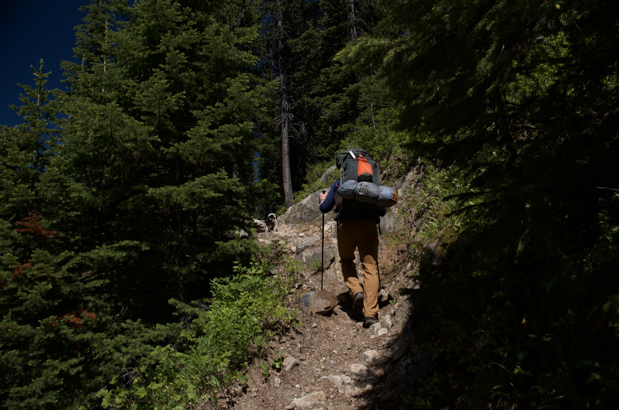
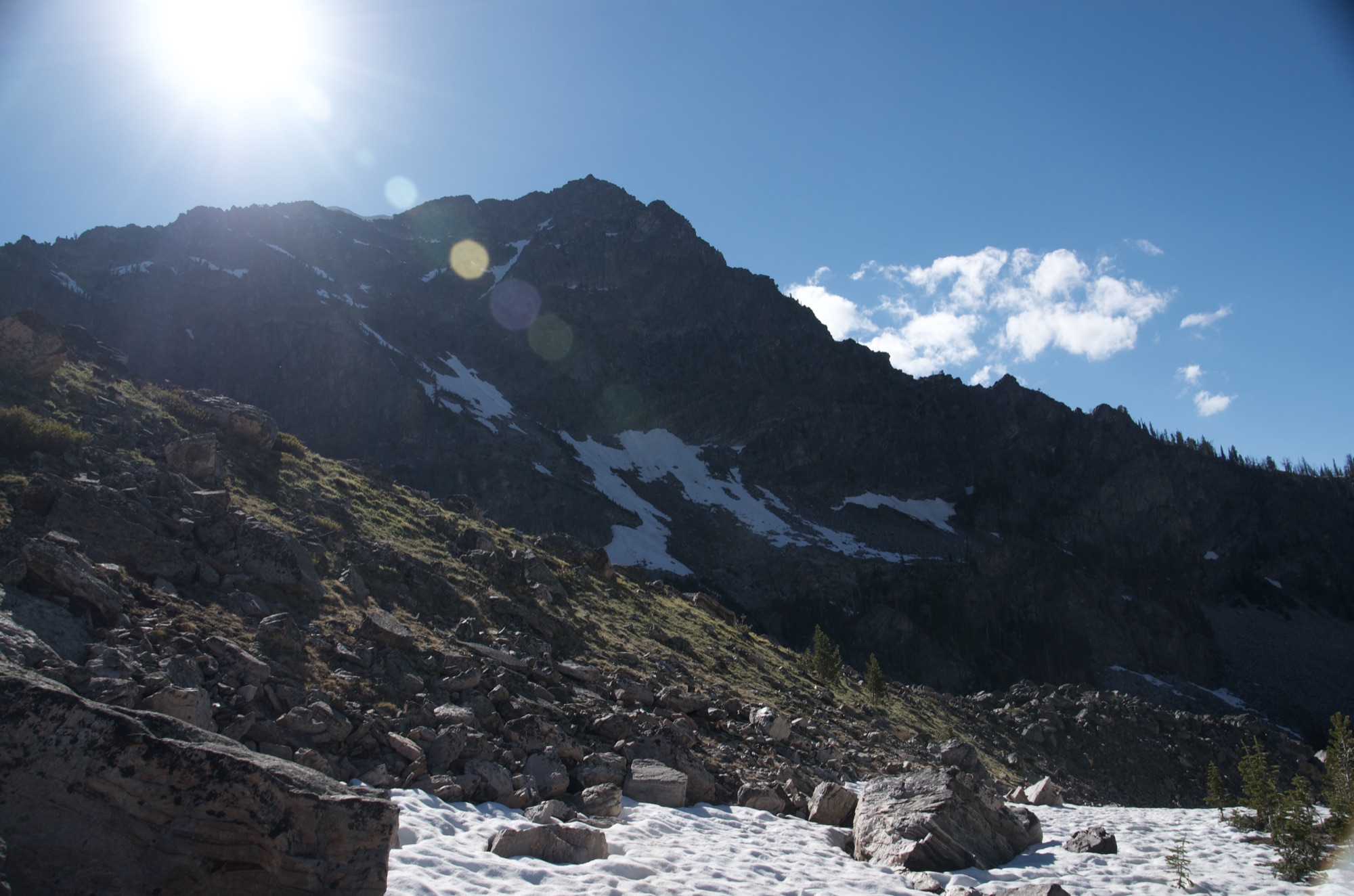
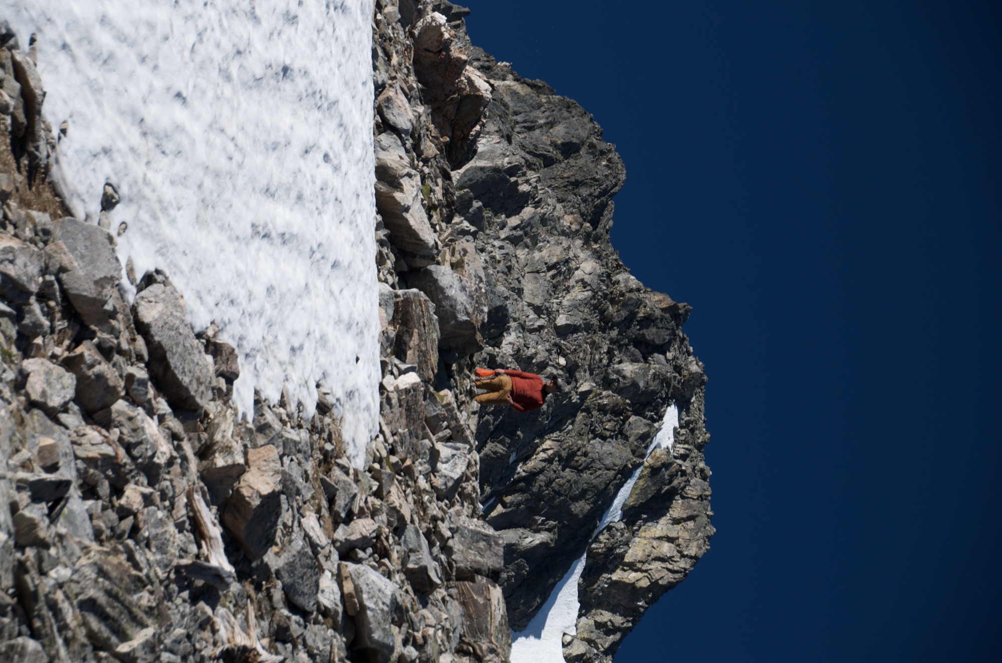
The lower portion of the trail along Spanish Creek is in good shape, wide and easy to follow. Once you take the Spanish Lakes fork, the trail gets rougher with steep rocky sections.
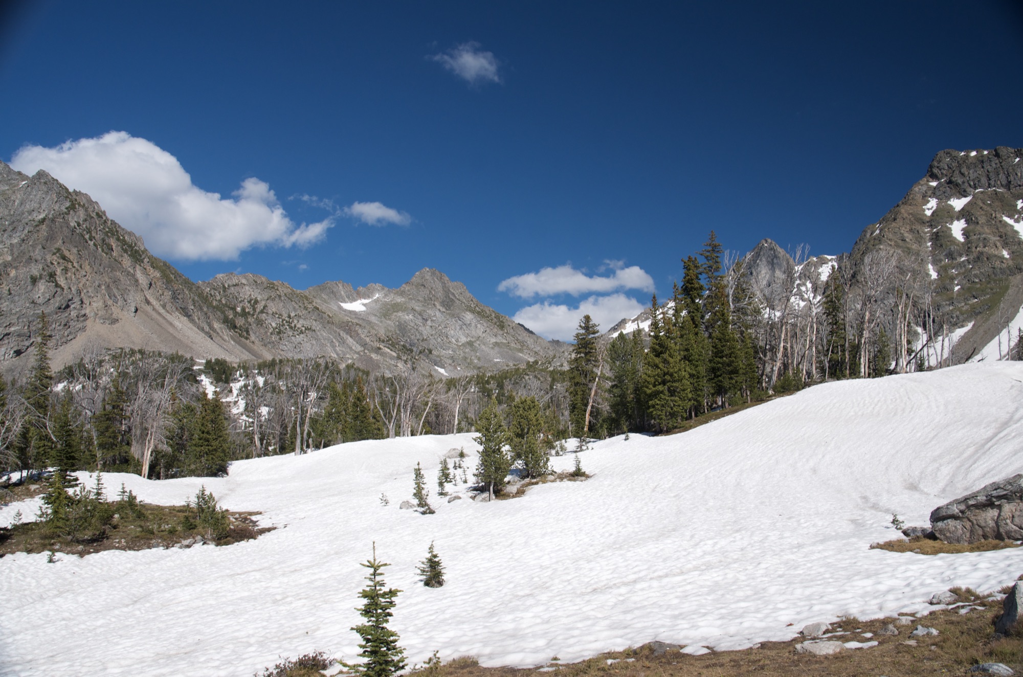
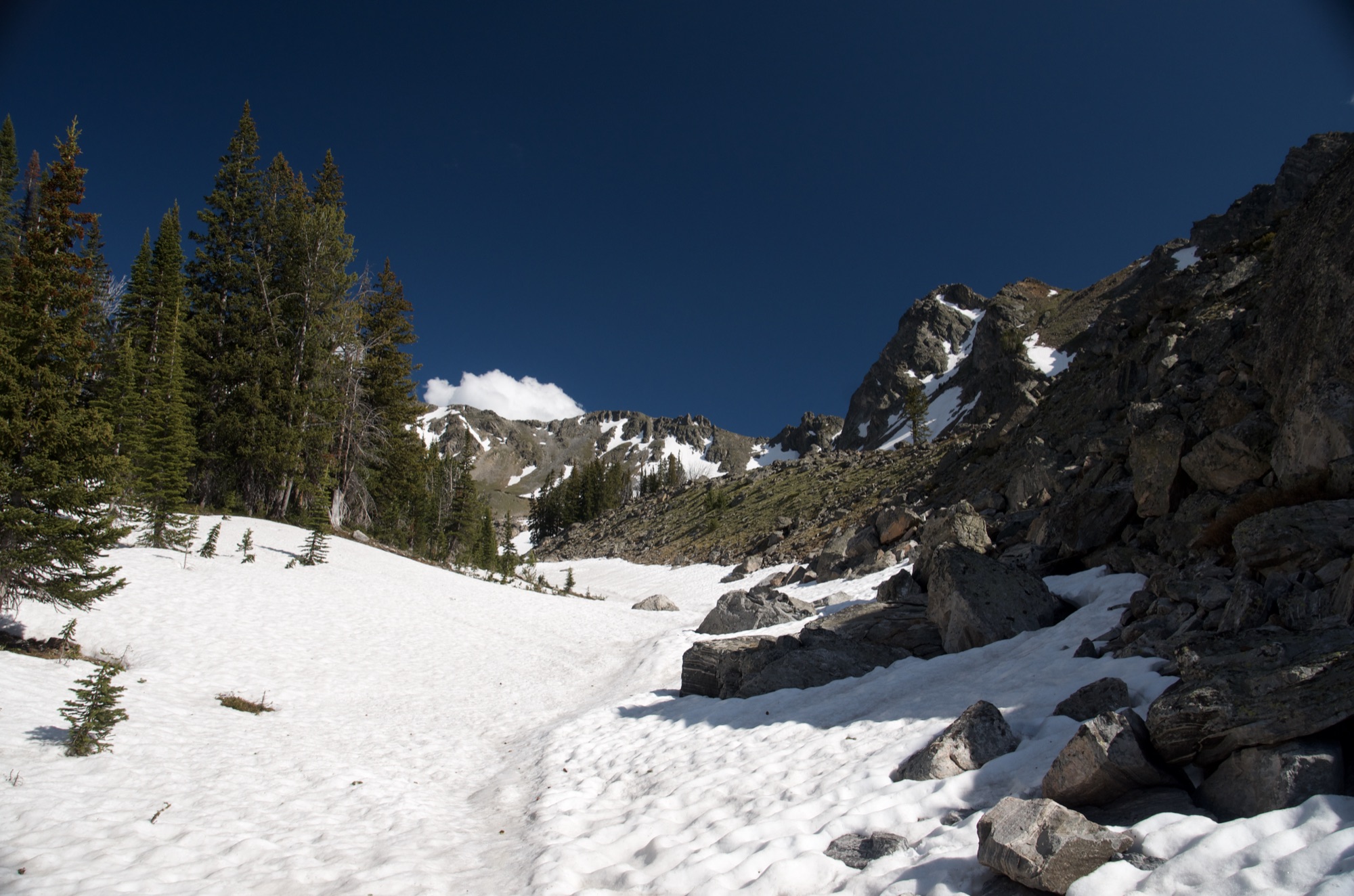
Expect at least one significant creek crossing that requires wading. Early in the season, the last couple miles can be buried under snow, making the trail difficult to follow. Bring a map and GPS, especially if you're going before mid-July.
This is a high-elevation overnight destination, so pack layers. Temperatures at the lakes can drop below freezing at night, even in late June. Bring a warm sleeping bag rated for at least 25 degrees if you're camping. For the hike itself, plan on getting your feet wet at the creek crossing. Water shoes, a small towel and trekking poles will help. The upper portion of the trail can be covered in snow, so gaiters are worth considering early in the season.
Footwear: Hiking Boots
This is a long hike and you'll need fuel. If you're backpacking, bring a full dinner and breakfast. If you're attempting it as a day hike, pack a solid lunch and plenty of trail snacks. There's no food available anywhere near the trailhead, so stock up in Bozeman or Gallatin Gateway before you go.
Expect mosquitoes near the creek and at the lakes, especially in June and July. Bring bug spray.
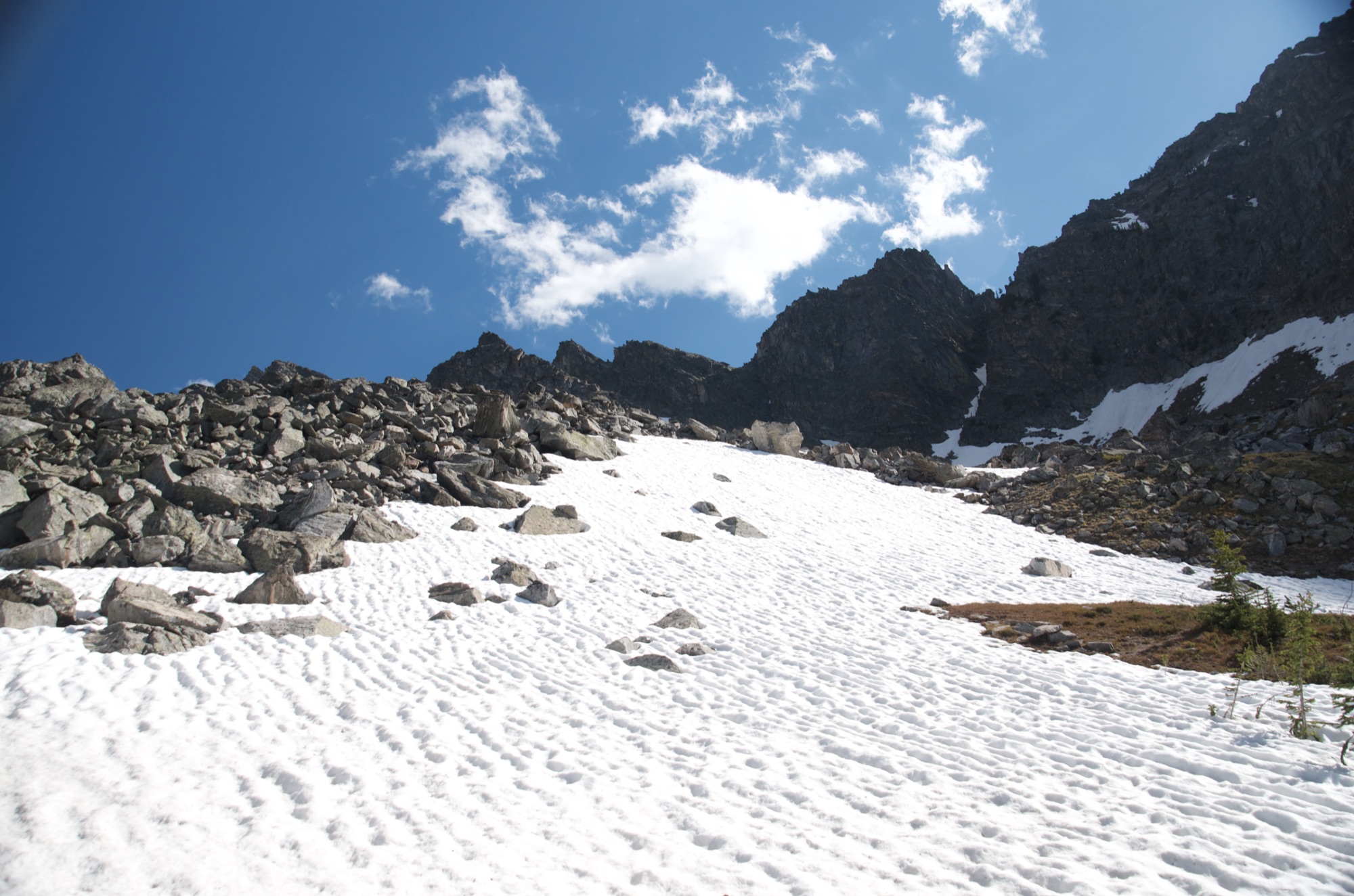
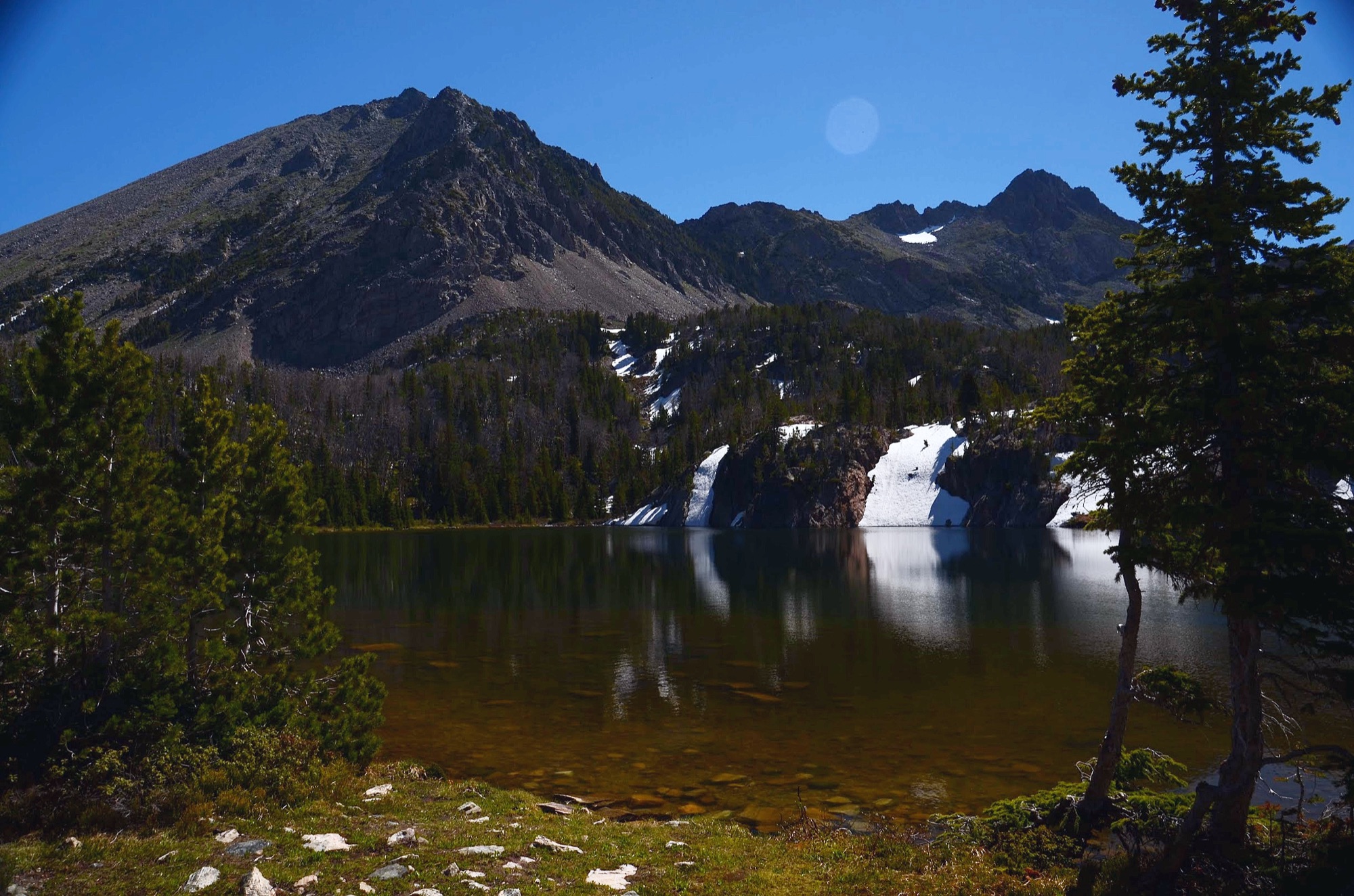
The lower trail has good tree cover through dense evergreen forest. As you climb toward the lakes, you'll break above the treeline into an open alpine basin. The lakes themselves have some scattered trees for shade, but you'll be fairly exposed.
This is an ideal backpacking destination. There are established campsites near the lakes with enough room to spread out. Given the 7.6-mile approach, most people spend at least one night. Bring a warm sleeping bag, as temperatures at the lakes can drop well below freezing overnight even in summer.
Be Advised: This is bear country. Bring a bear canister or hang your food properly.
Mirror Lake / Summit Lake
Instead of taking the right fork to Spanish Lakes, continue straight on the South Fork Spanish Creek Trail to reach Mirror Lake at 7.5 miles. See our Mirror Lake trail guide for details. From Mirror Lake you can continue another 2 miles to Summit Lake.
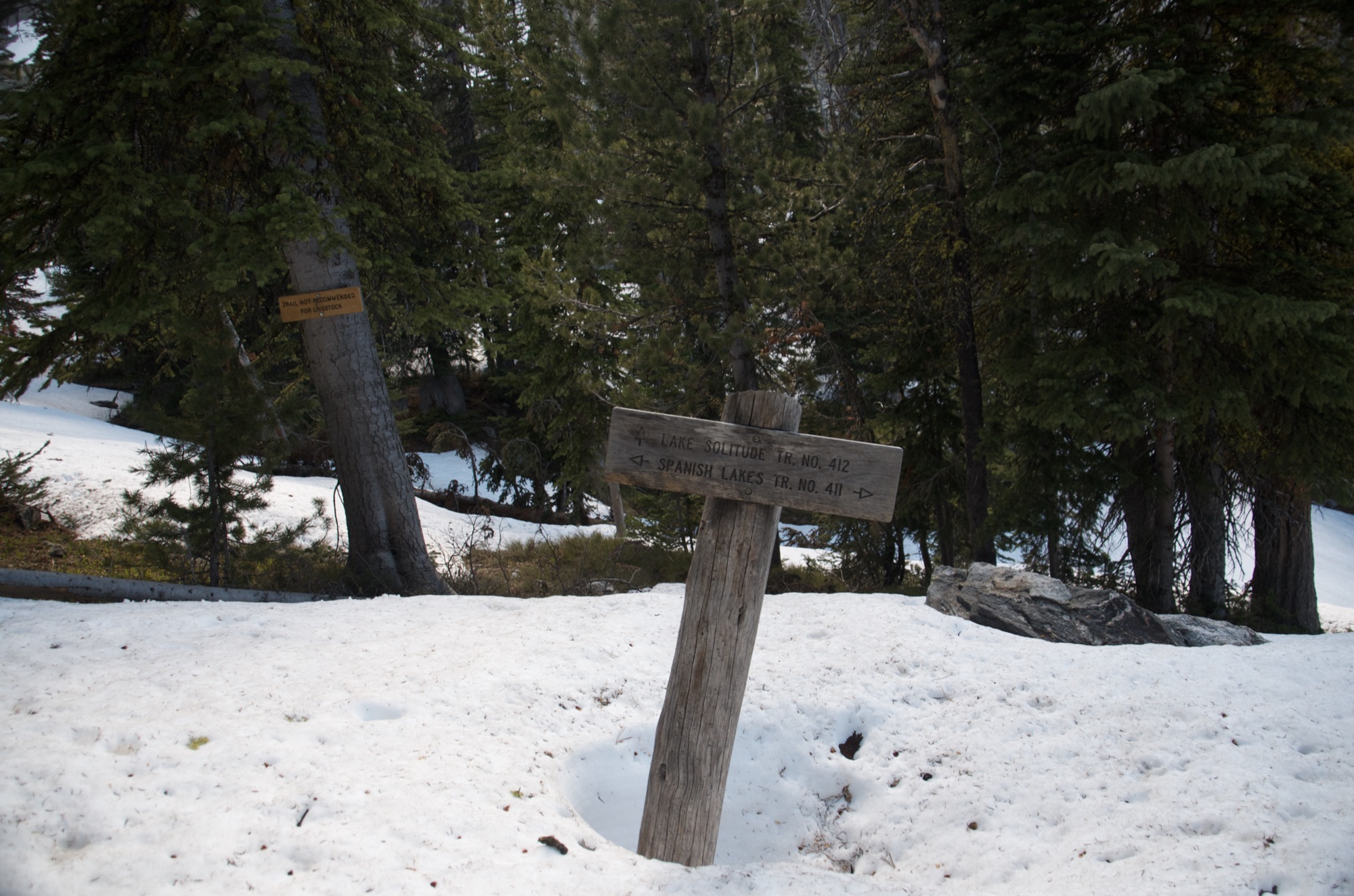
Lake Solitude
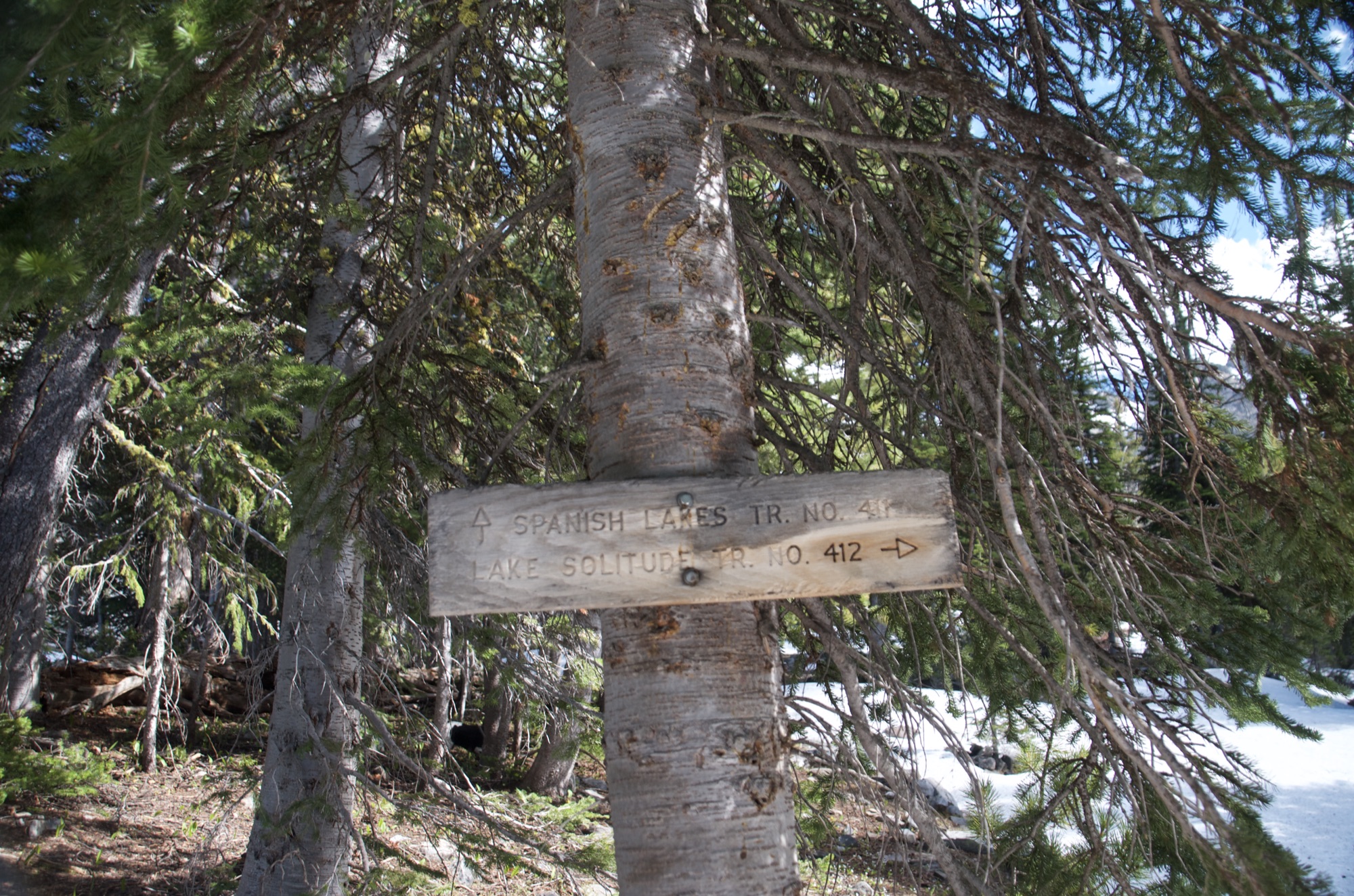
At the upper trail junction near the lakes, Trail #412 branches off toward Lake Solitude, another remote alpine lake destination in the Spanish Peaks.
Jerome Rock Lakes
At the first major junction about 2.5 miles in, you can take the Jerome Rock Lakes Trail for a shorter out-and-back to these lakes.
Beartooth Publishing's Big Sky Area map covers this entire trail and the surrounding Spanish Peaks Wilderness.
Mid-July through September. The final miles of the trail can hold snow into late June and the mandatory creek crossing runs knee-deep in early season. Spanish Creek Road is closed December 2 through May 15.
Late July through August: trail clear of snow, creek crossing manageable, lake basin accessible, cutthroat fishing active.
September: excellent conditions, almost no foot traffic, cooler temperatures that make the steep climb more comfortable.
Before mid-July: snow covers the final miles of trail and the creek crossing runs higher. The Spanish Lakes route is not appropriate for early season without snow travel experience.
Yes. There is at least one creek crossing that requires wading knee-deep, especially before late July. You cannot rock-hop it in early season. Bring water shoes or sandals and trekking poles. The crossing calms down by August but is still worth planning for.
Overnight is significantly better. At 15.2 miles with 2,858 feet of gain, doing it as a day hike is a very long, punishing day. Camping at the lake means you arrive with energy to explore and fish, and you hike out with fresh legs in the morning.
The road closes December 2 and reopens May 15 annually. No vehicle access during that window.
Much less crowded. Lava Lake fills on summer weekends. Spanish Lakes gets a fraction of that traffic due to the longer distance, more elevation gain, and the creek crossing. On a late June trip the entire lake basin had one other party.
Yes. The lakes are stocked and hold fish. Bring a lightweight rod and a Montana fishing license. The extra weight is worth it if you are backpacking and have time at the lake.
Plug 15.2 miles and 2,858 feet of elevation gain into our free hiking time calculator for a personalized estimate.