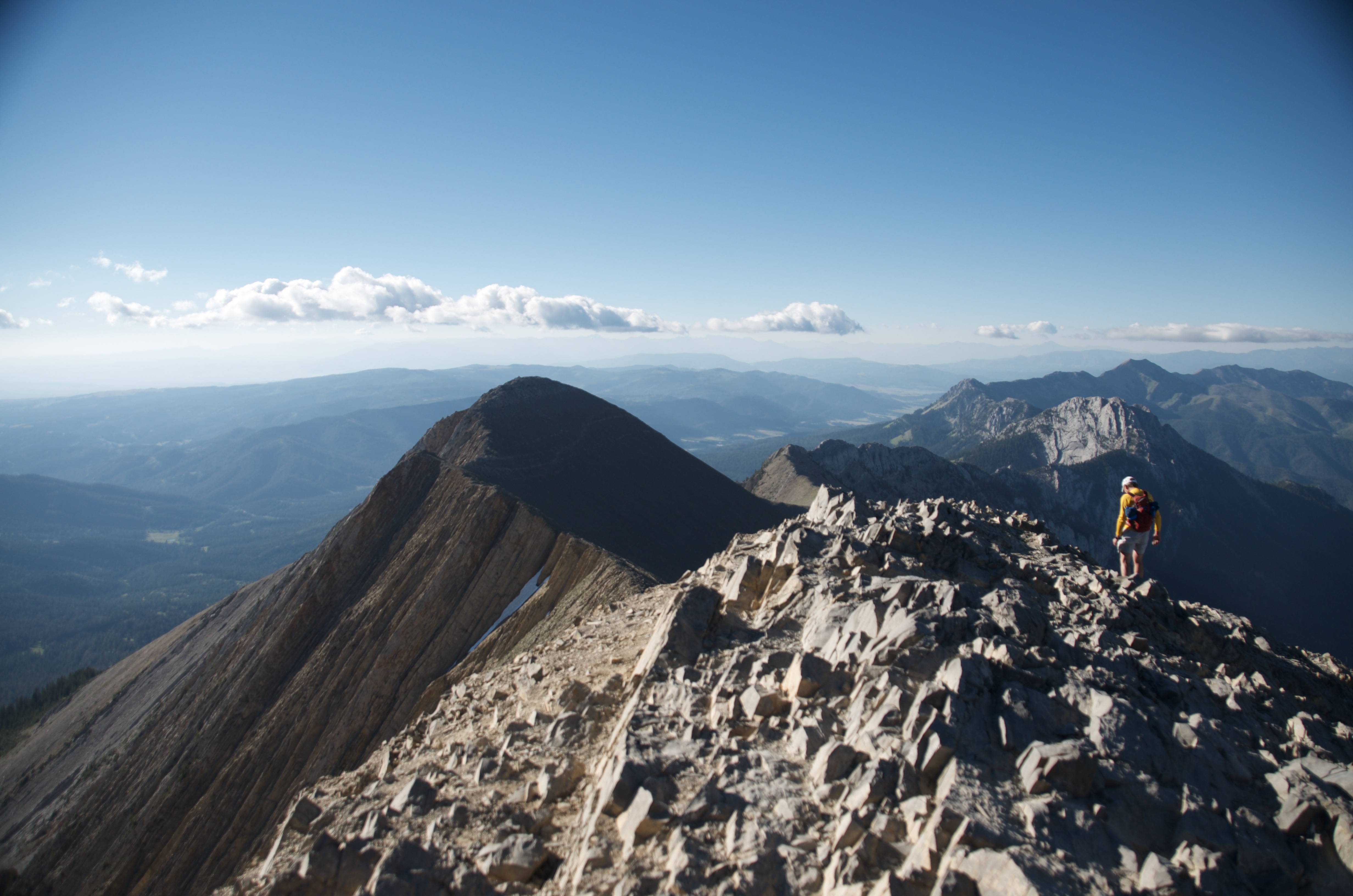
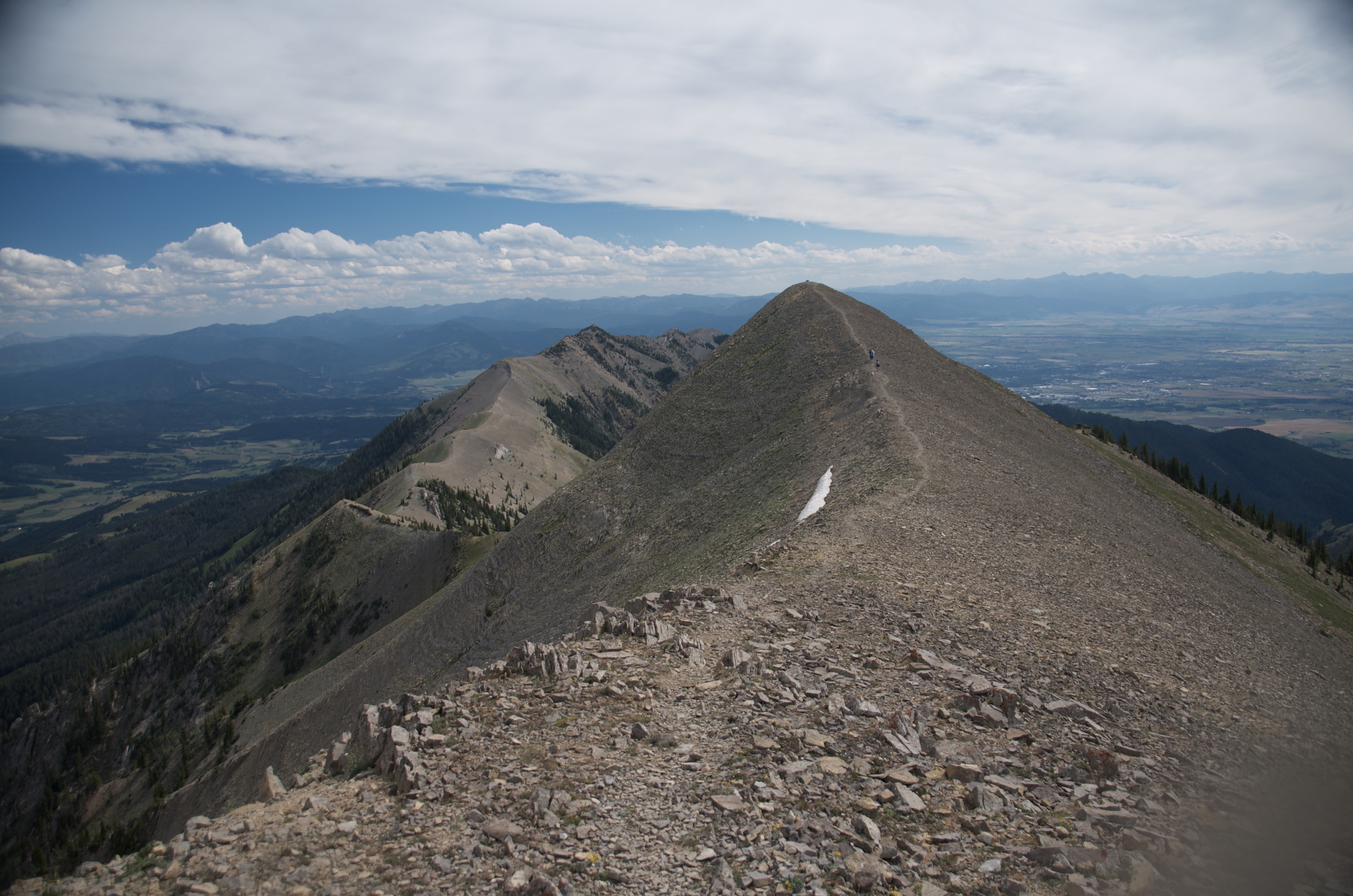
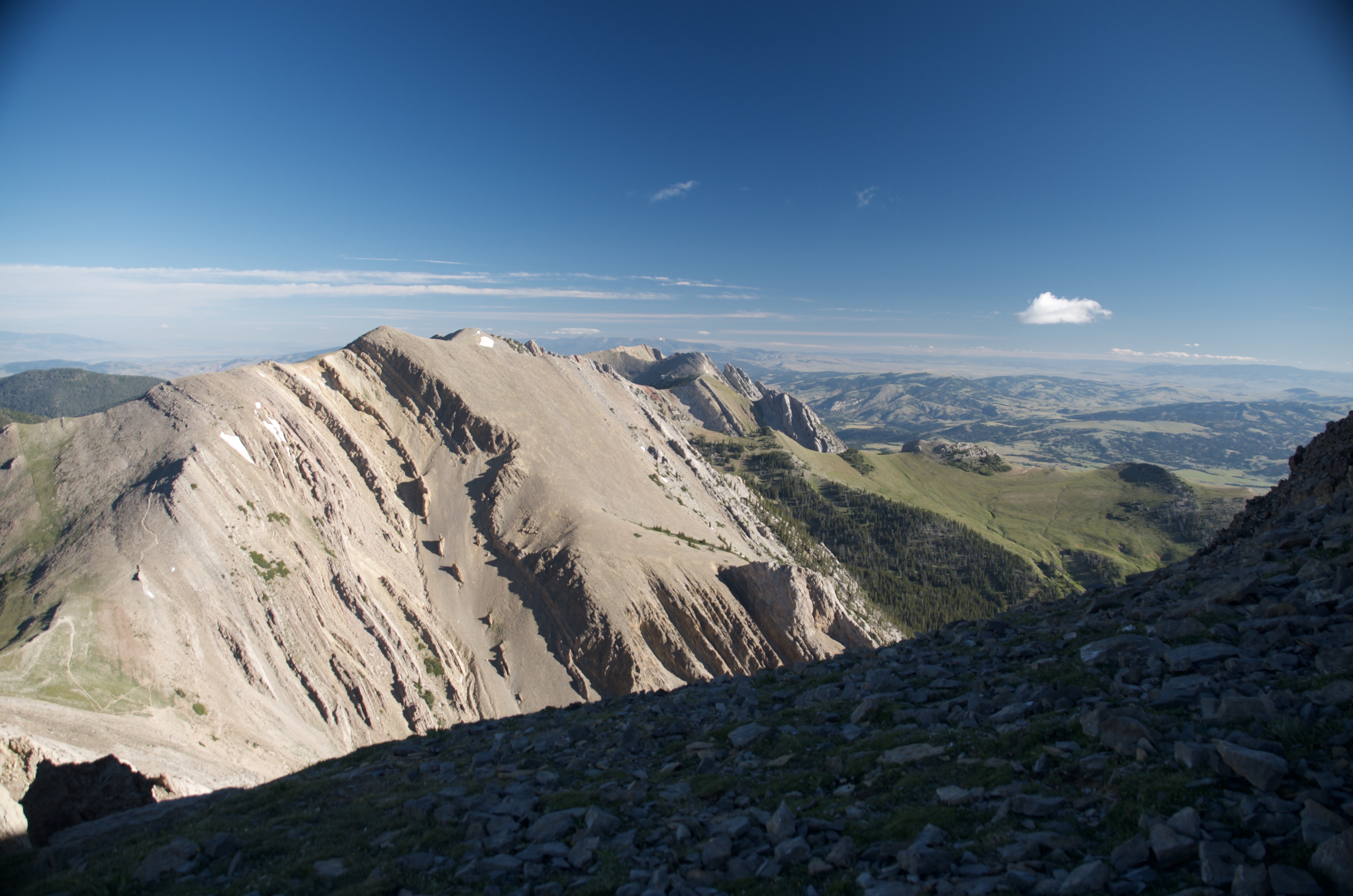
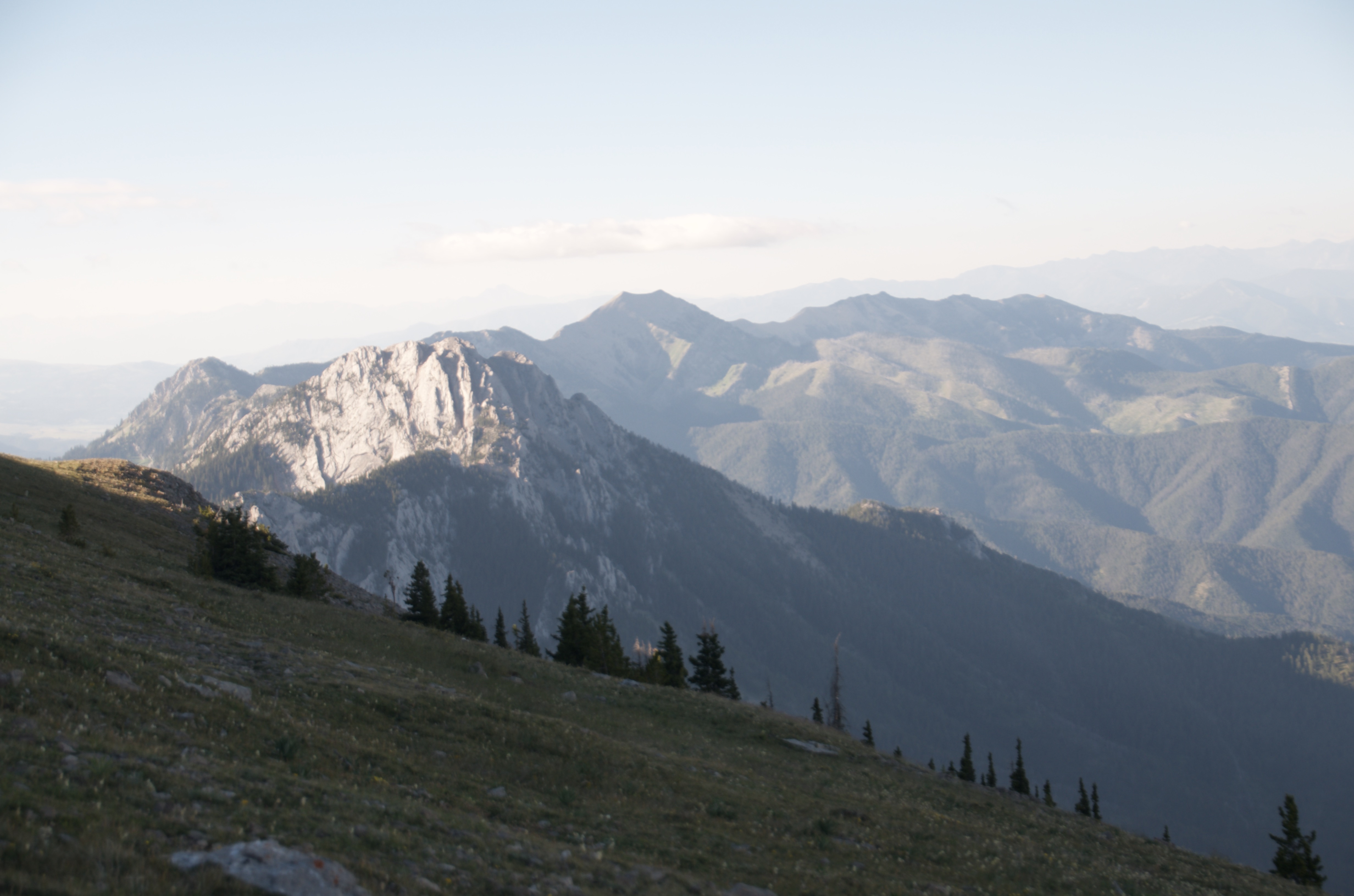
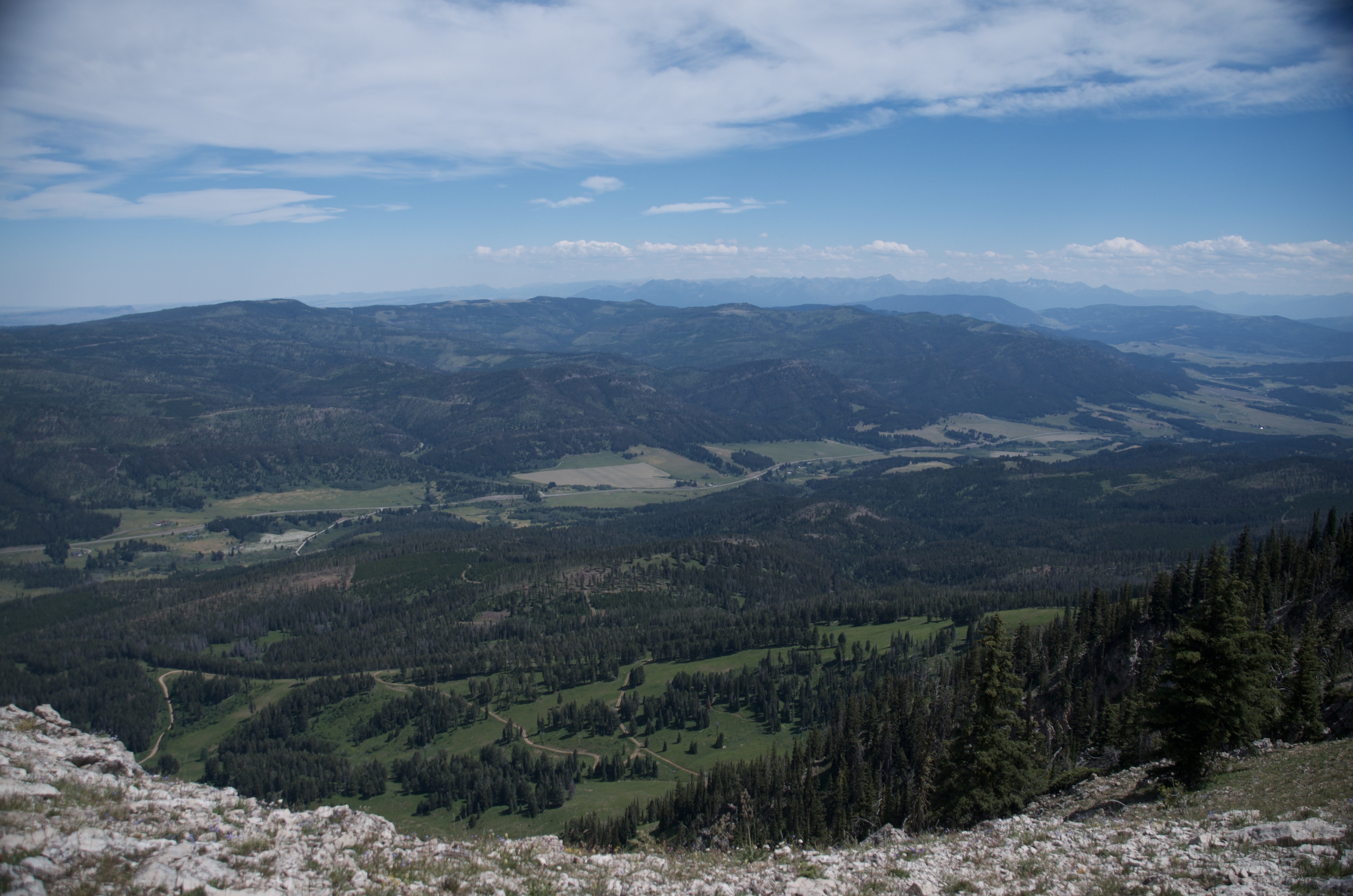
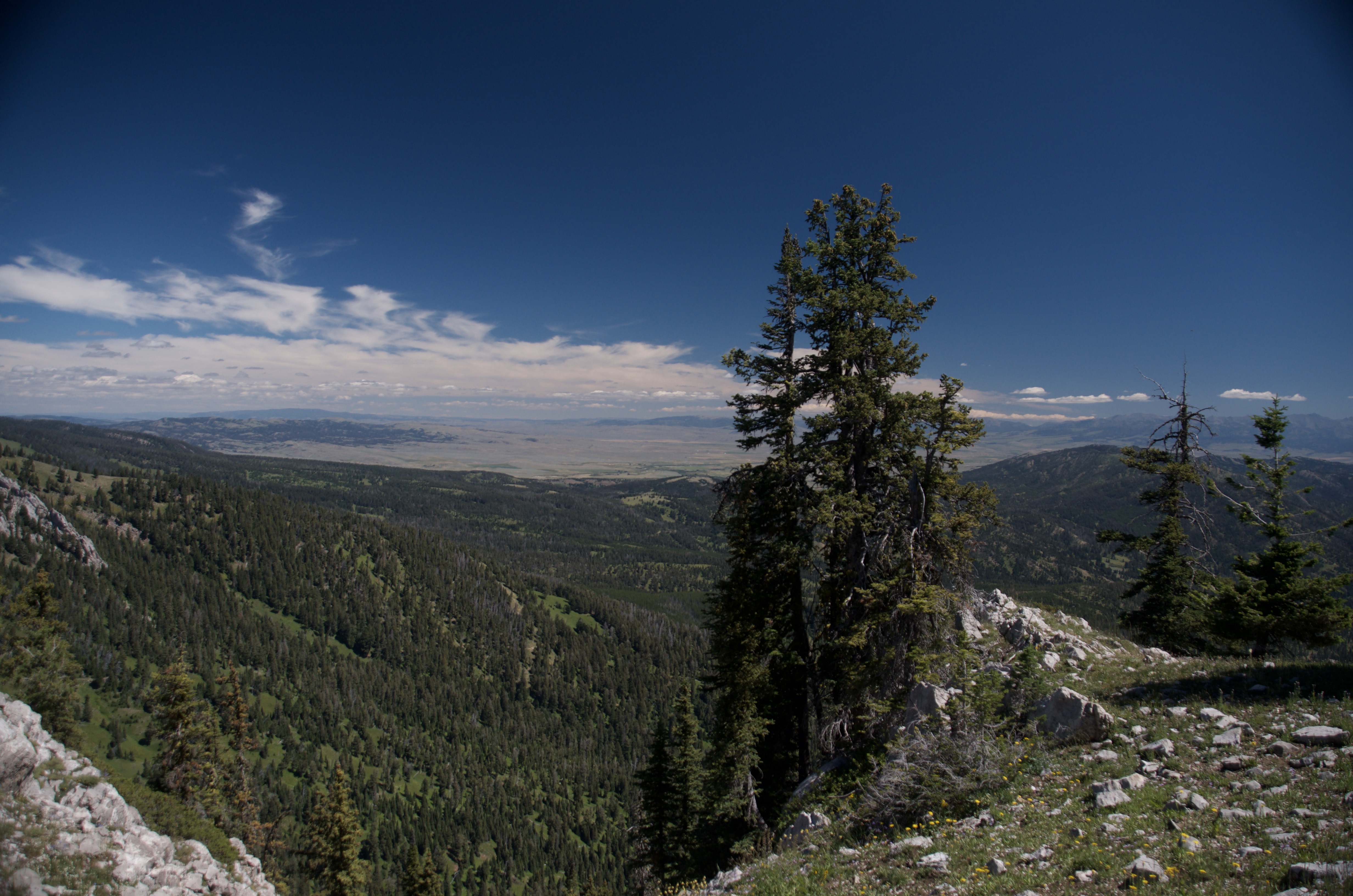
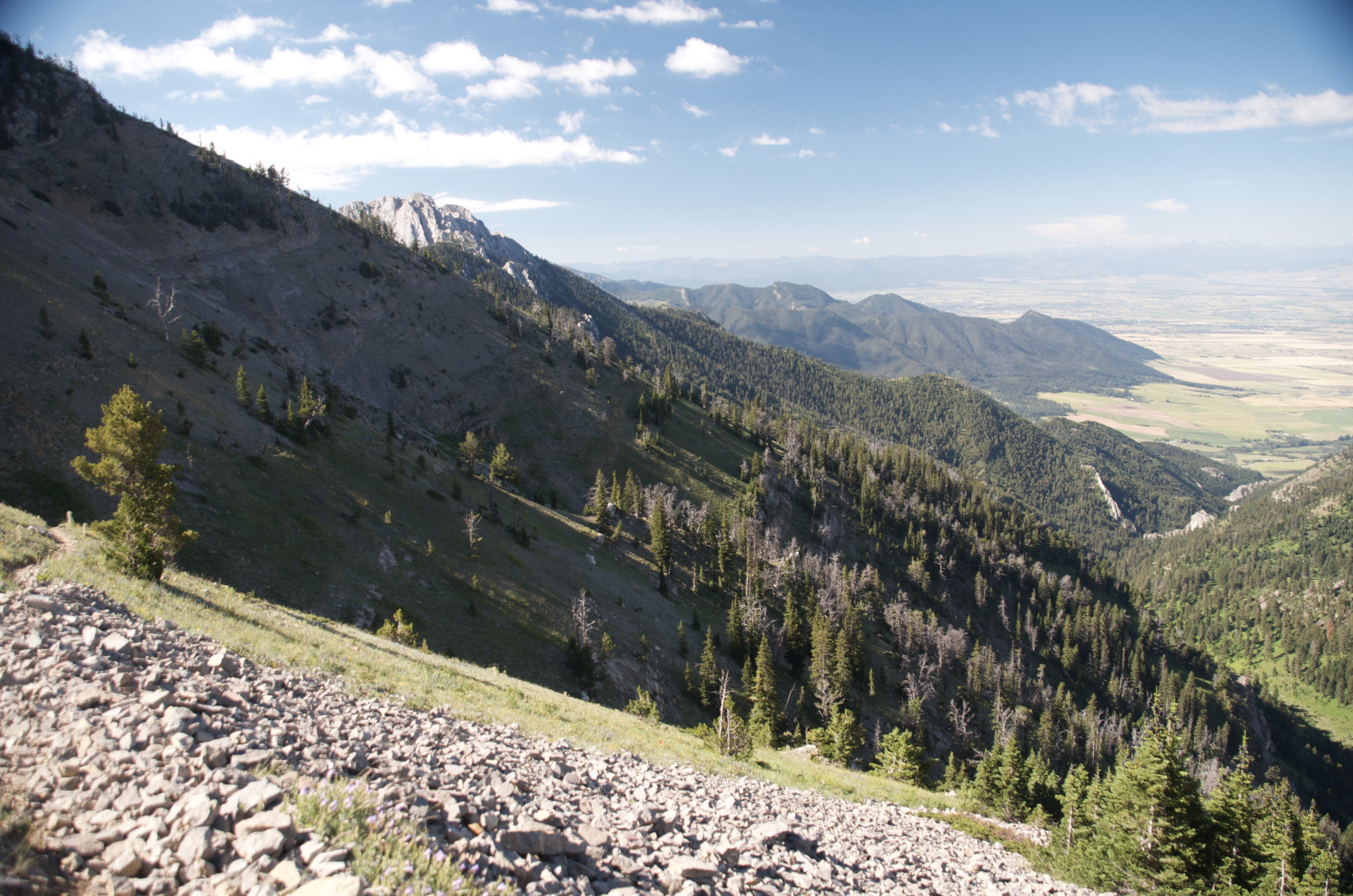
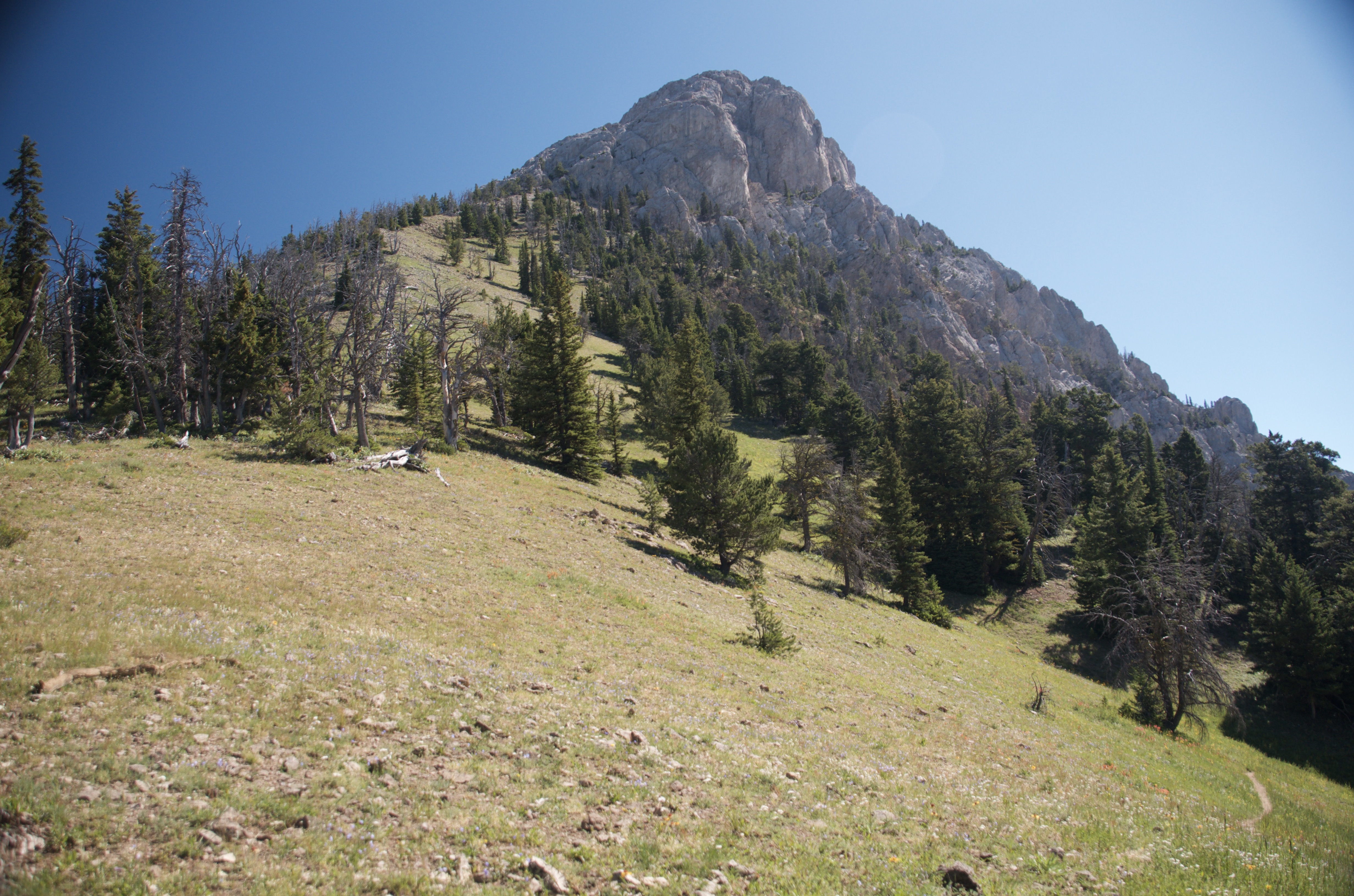
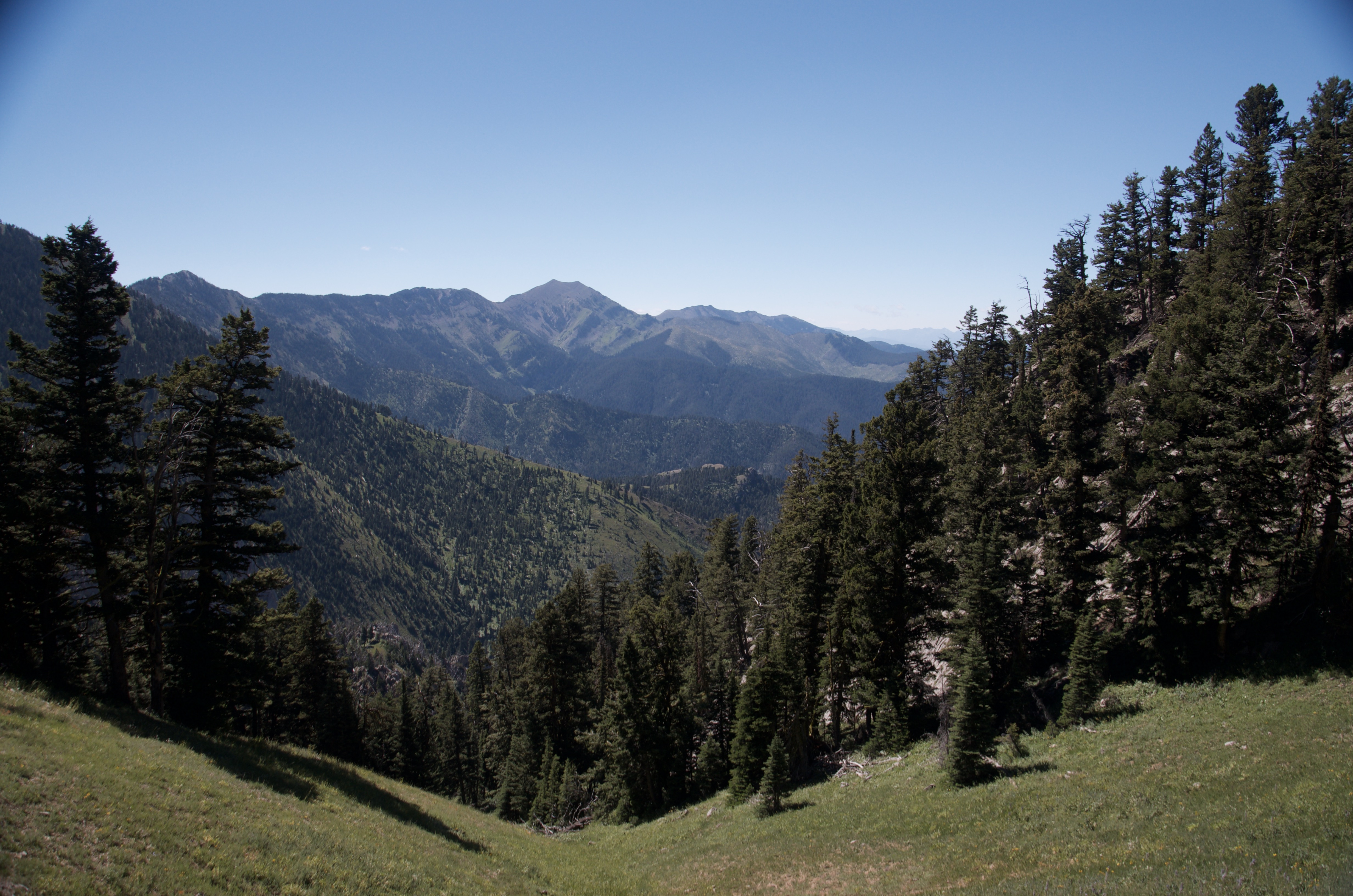
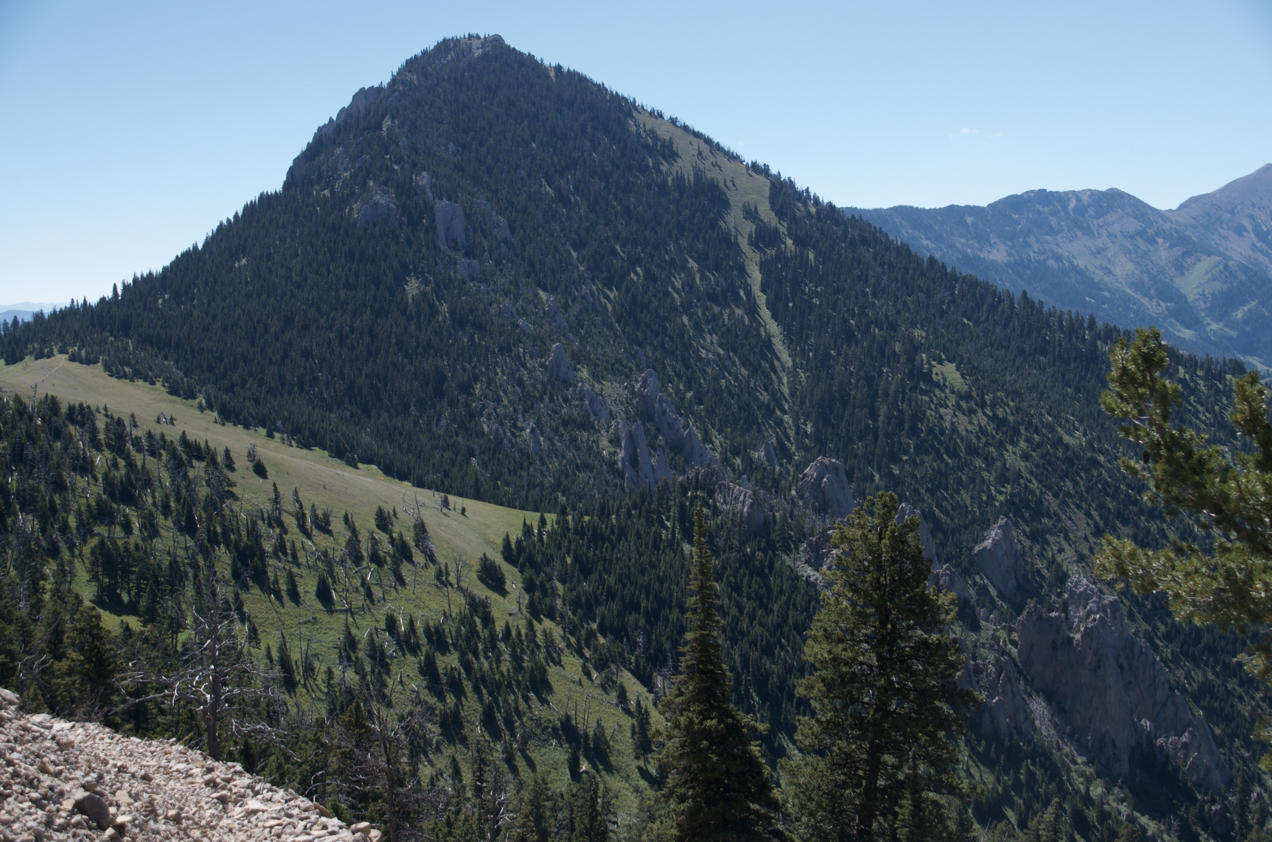
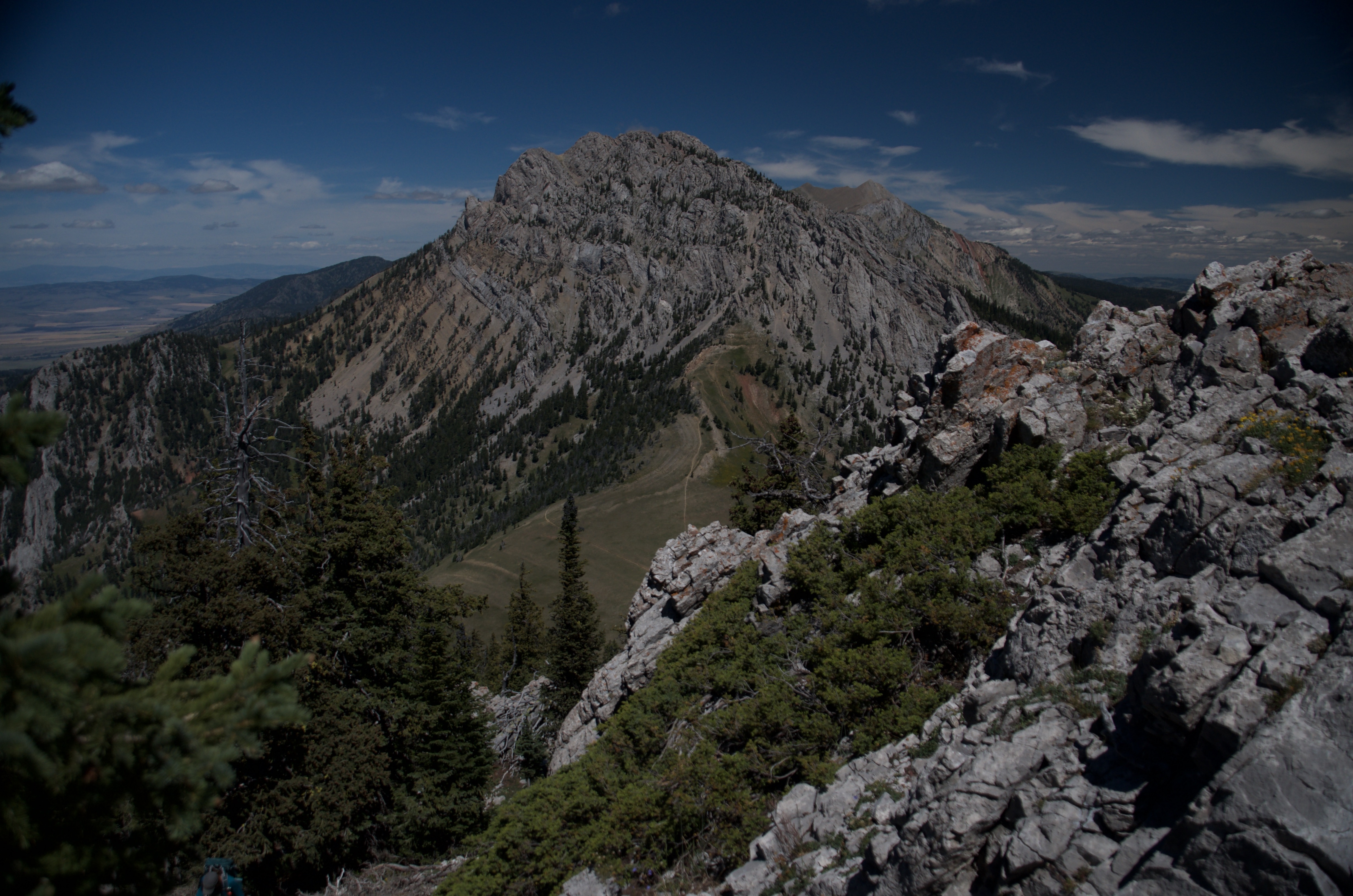
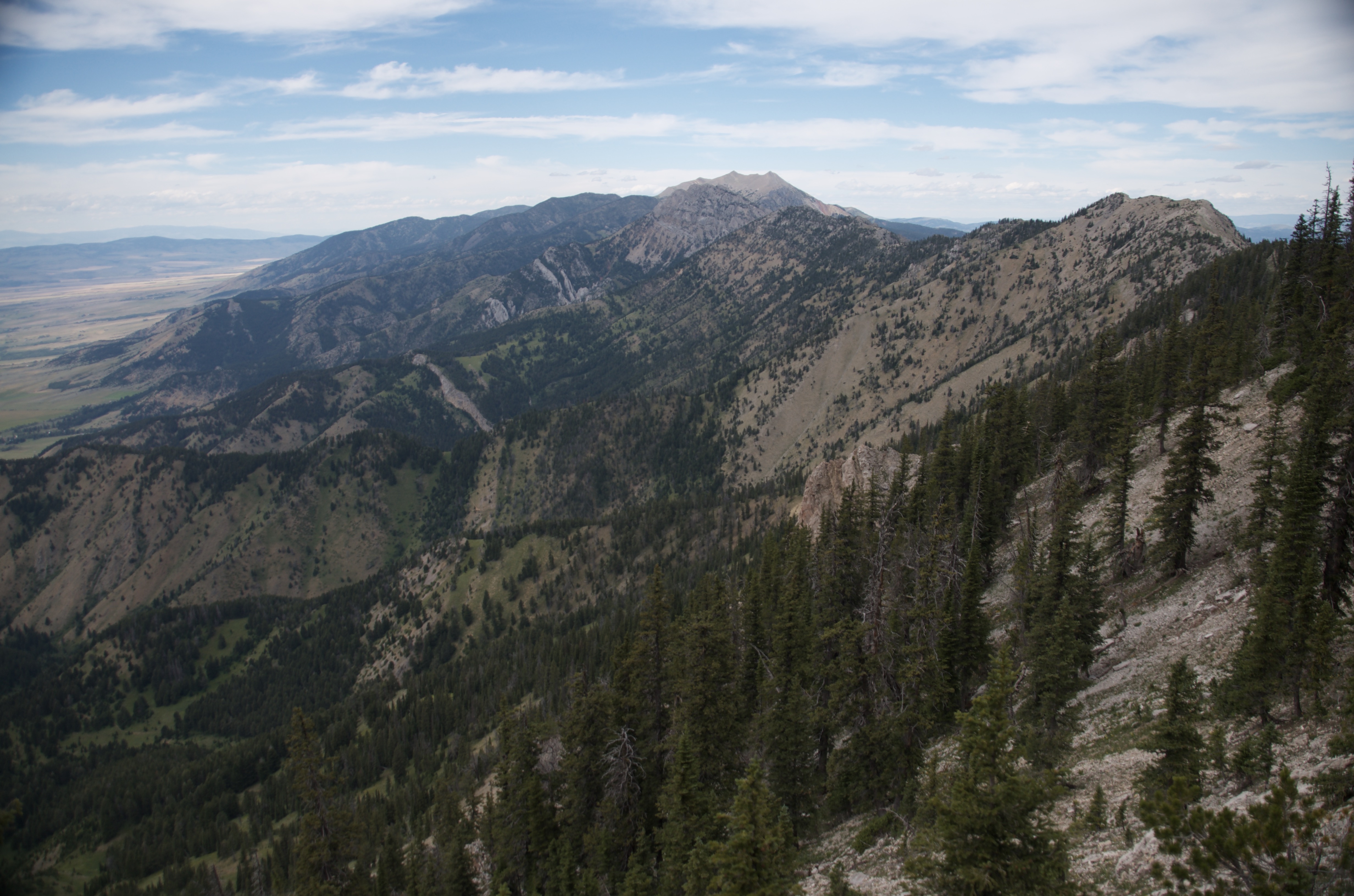
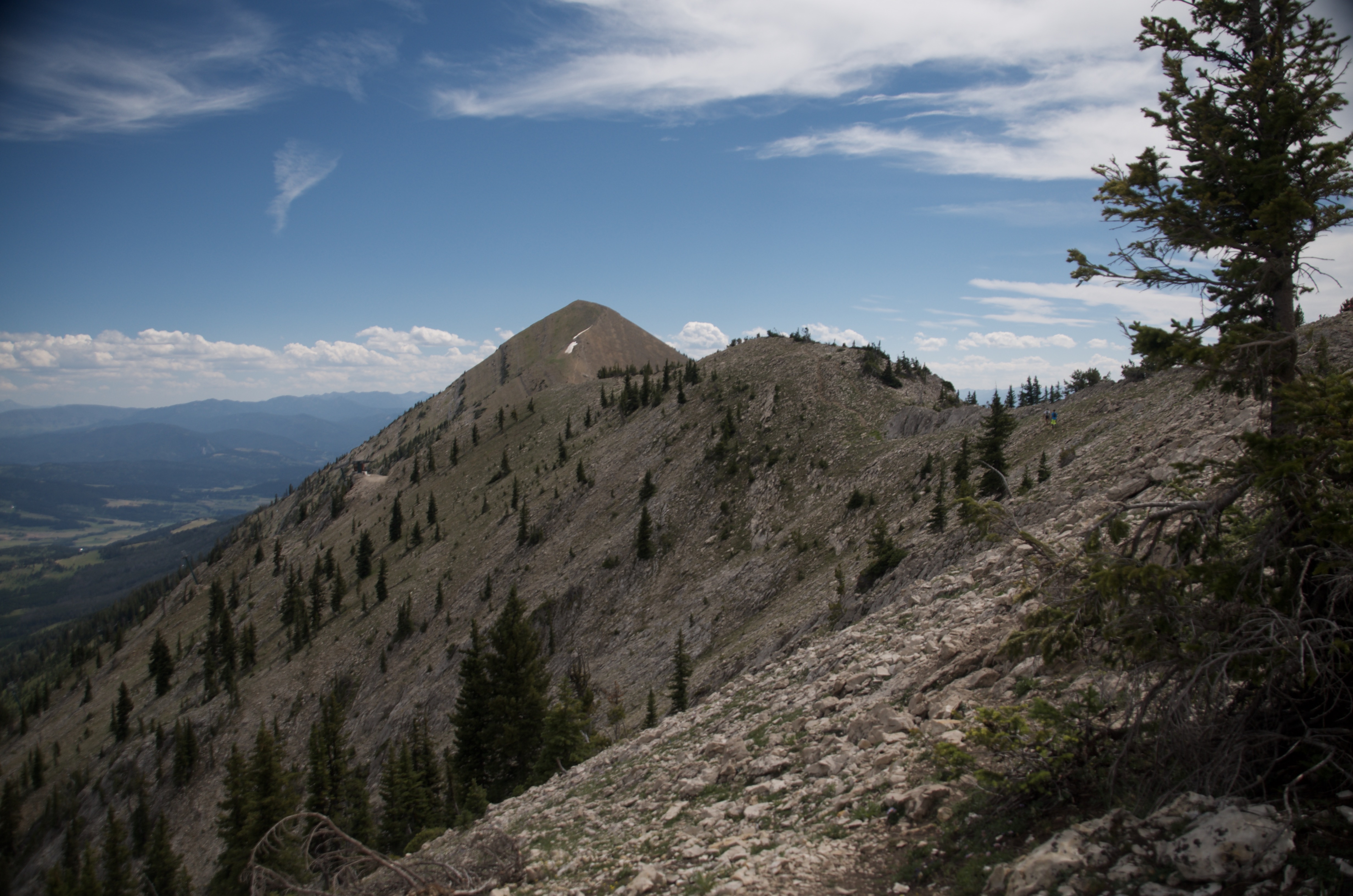
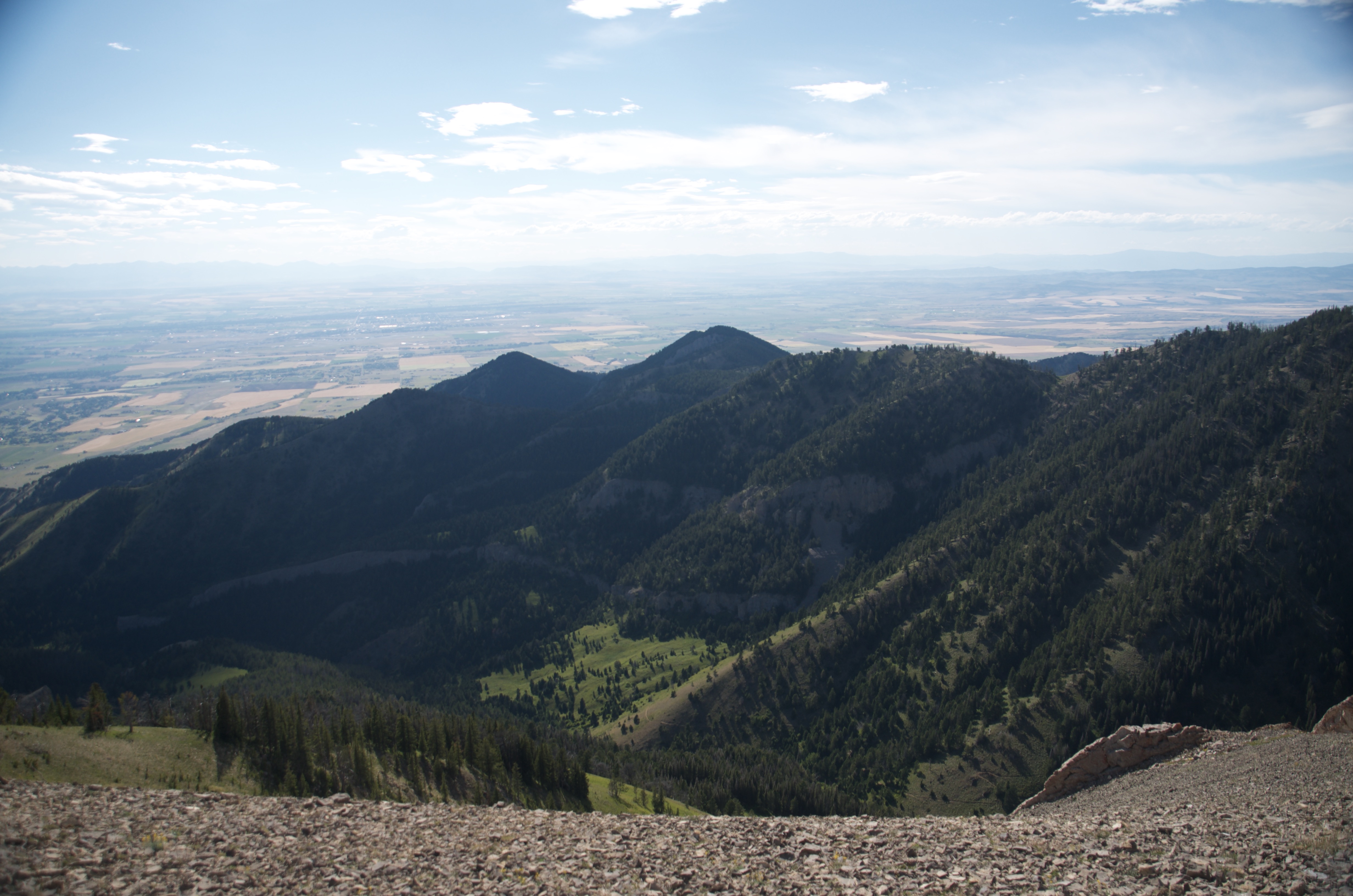
Almost every hike near Bozeman works the same way: you hike to something. A lake, a summit, a waterfall. The ridge is usually the reward waiting at the end. The Bridger Ridge Trail inverts that entirely. You're on the ridge from almost the first mile, and you stay there. The Gallatin Valley drops off one side, Bridger Canyon drops off the other, and you walk the spine for 18.7 miles. There is no building toward a view. The view is just the situation you're in the whole time.
That also means there's no moment where you can relax. You're exposed the whole time. The trail gets narrow, the rock gets loose, and at some point hands come off poles and you're scrambling. Not in a way that requires technical climbing, but in a way that requires actual attention. Wind is constant. Afternoon lightning is not a theoretical concern up here. You have to know where you are in the day and move accordingly.
The people who do this route are a self-selecting group: trail runners, endurance hikers, experienced scramblers. You won't find casual day-hikers on the ridge proper. That's not a gatekeeping observation, it's just accurate information about what kind of day you're signing up for. Come prepared for all of it and this is one of the best days you can have near Bozeman.
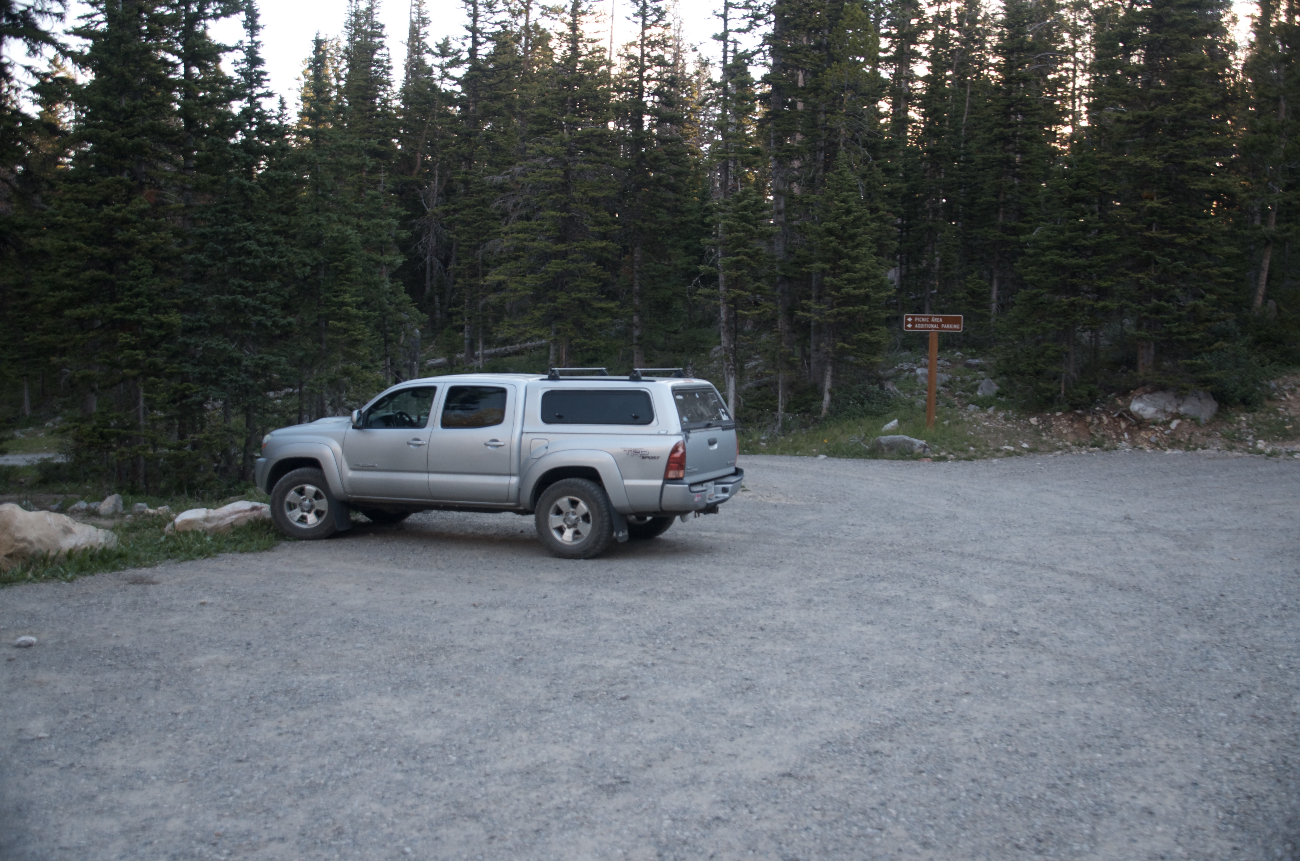
Fairy Lake Campground has a small day-use parking area that can fill on weekends in peak season. Arrive early. The M trailhead in Bozeman has a larger lot but also fills on busy days.
There is a vault toilet at Fairy Lake Campground. There is nothing on the ridge. Plan accordingly.
The full traverse sees very little traffic. You will see trail runners and endurance hikers, but not casual day-hikers. Sections near the M trailhead can be busier since that's a common out-and-back for Bozeman locals, but the ridge proper stays quiet.
The Fairy Lake Road gate is only open July 1 through September 15. Outside that window you would need to hike the road from the gate, which adds significant mileage to an already long day. When the road is open it's gravel and passable for most vehicles.
Spotty and unpredictable. High points on the ridge sometimes get signal, but you cannot count on it for navigation or emergencies. Download your map offline and tell someone your plan before you go.
The scrambling sections, full exposure, sustained sun, and lack of water make this a hard day for most dogs. Dogs that are exceptional on technical terrain might manage it, but for most dogs this is not the right route.
Fairy Lake Campground (north) to M Trailhead (south). Shuttle required.
This is a point-to-point hike that requires a car shuttle. Leave a vehicle at the M trailhead at the north end of Bozeman the evening before, then drive to Fairy Lake Campground to start. From Bozeman, take Bridger Canyon Drive north, then turn left onto Fairy Lake Road and follow it 6 miles to the campground. The Fairy Lake Road gate is only open July 1 through September 15, and that is a hard cutoff. The M trailhead is at the end of Bridger Drive off Story Mill Road in north Bozeman.
This is the most commonly underestimated part of this hike. Once you're on the ridge, water is essentially gone. There may be a few seasonal snow patches in early July near high saddles, but none of these are reliable. Carry everything you need from the trailhead, and plan for at least 80 oz per person, more in heat. On a 14-hour day in full sun, that's not conservative.
80 oz consumed per person
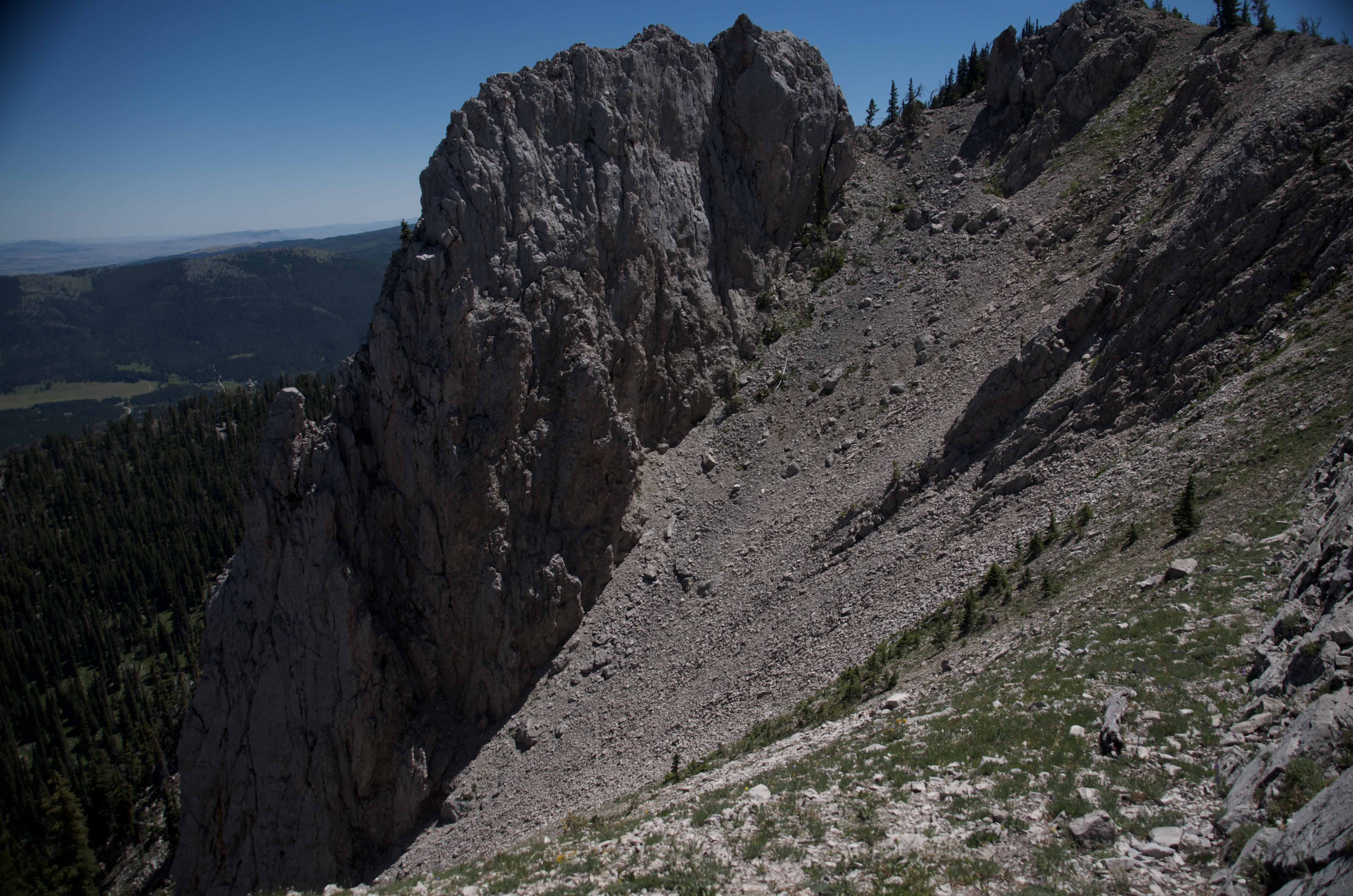
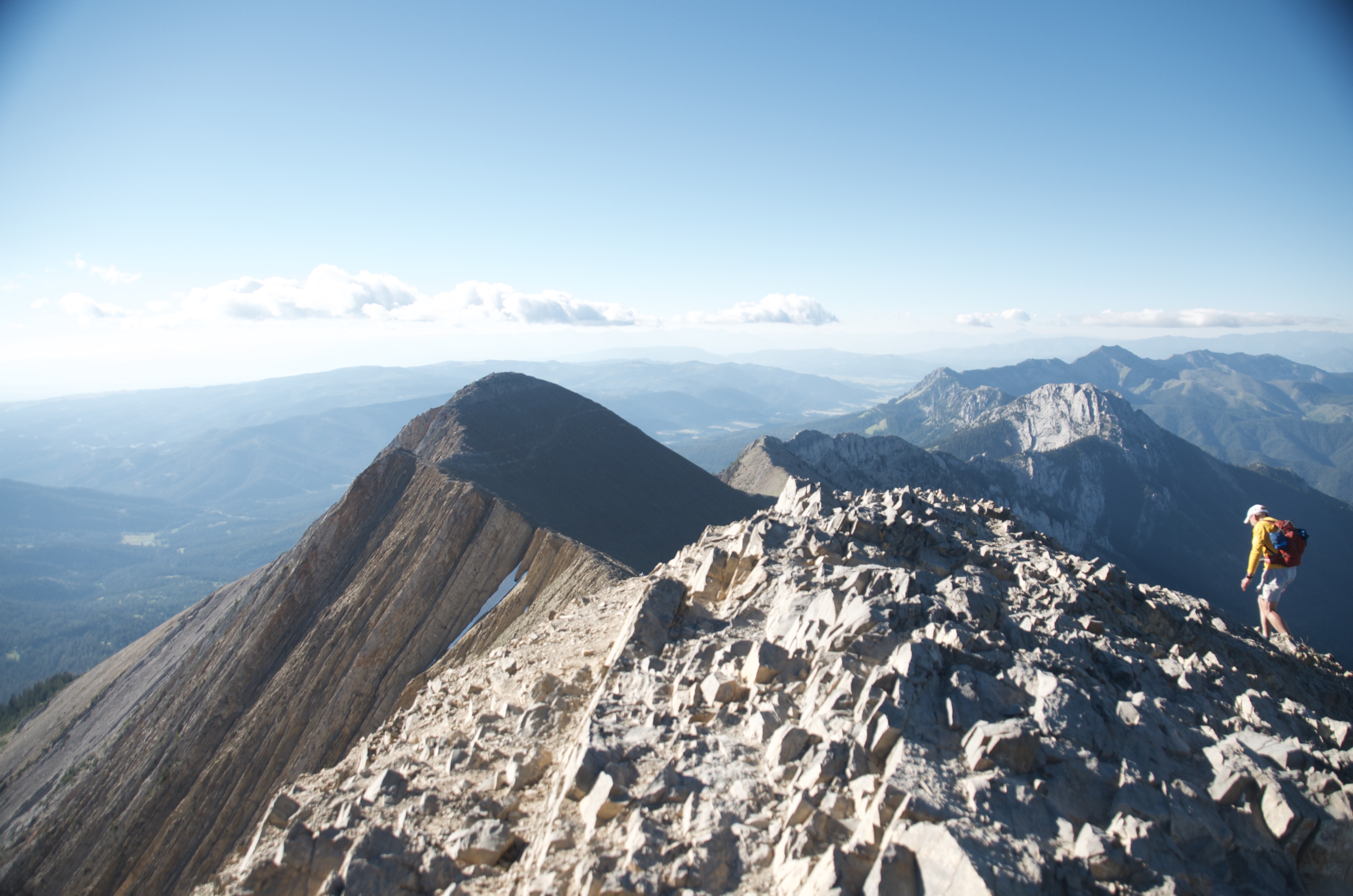
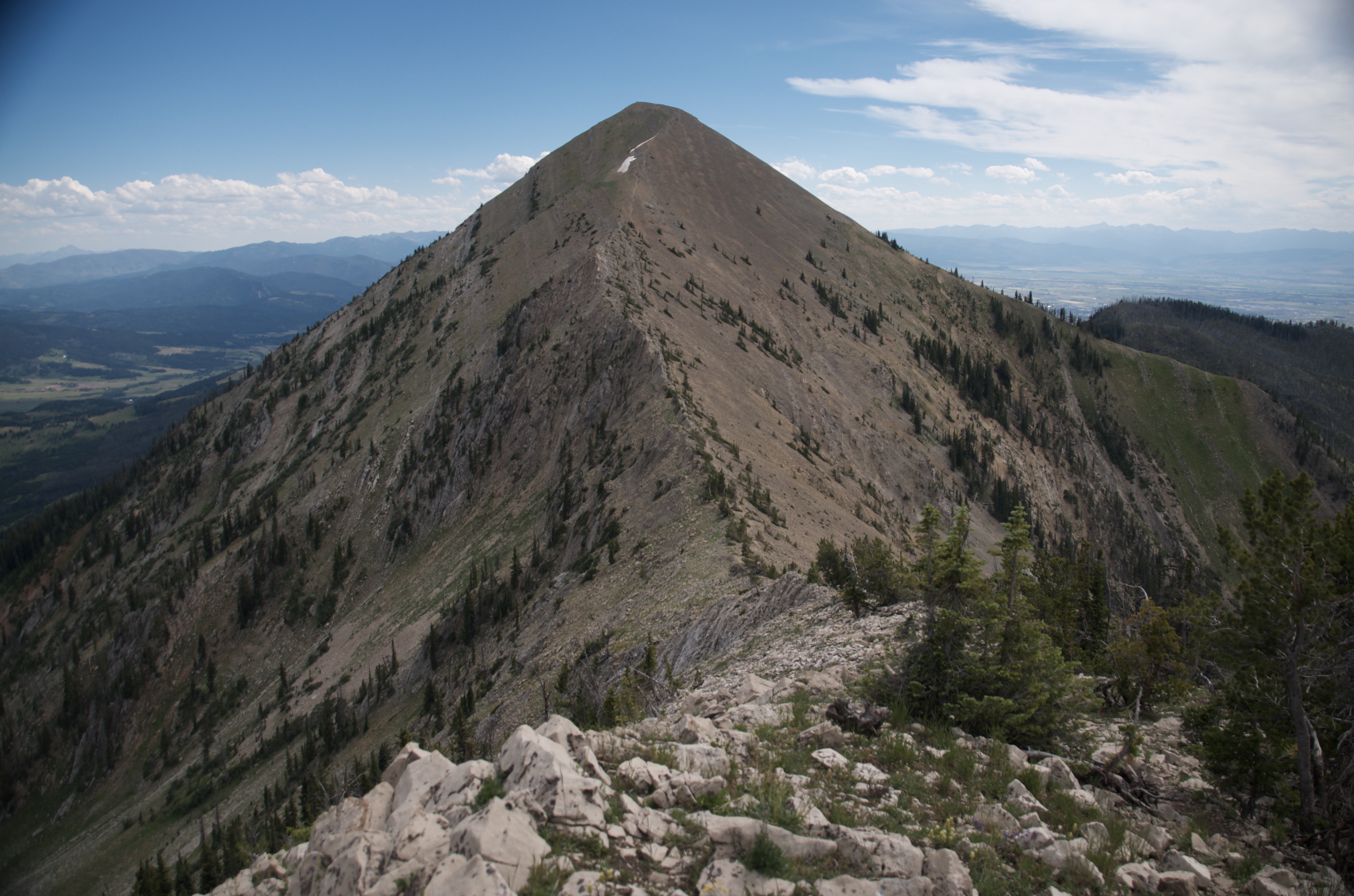
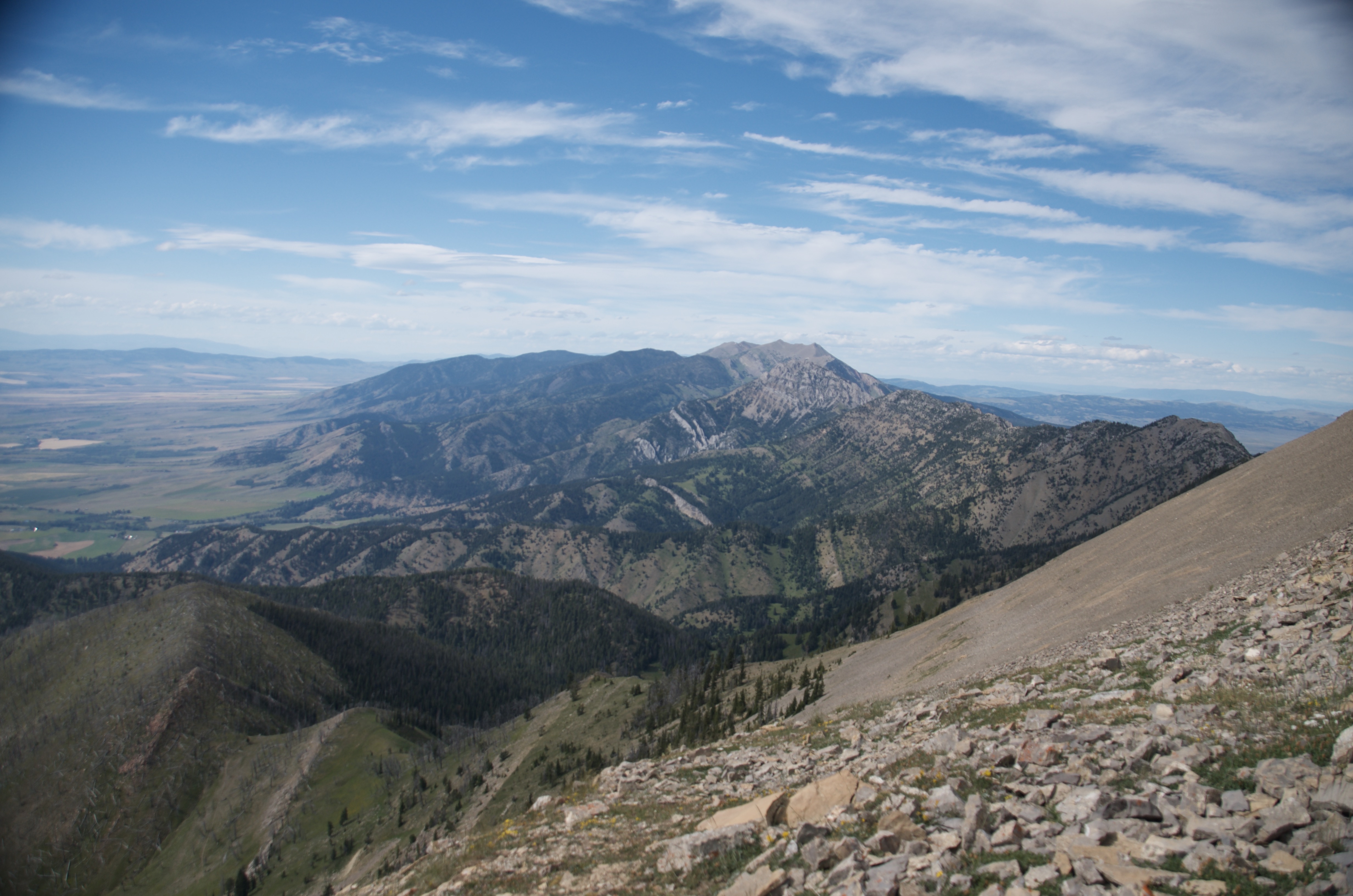
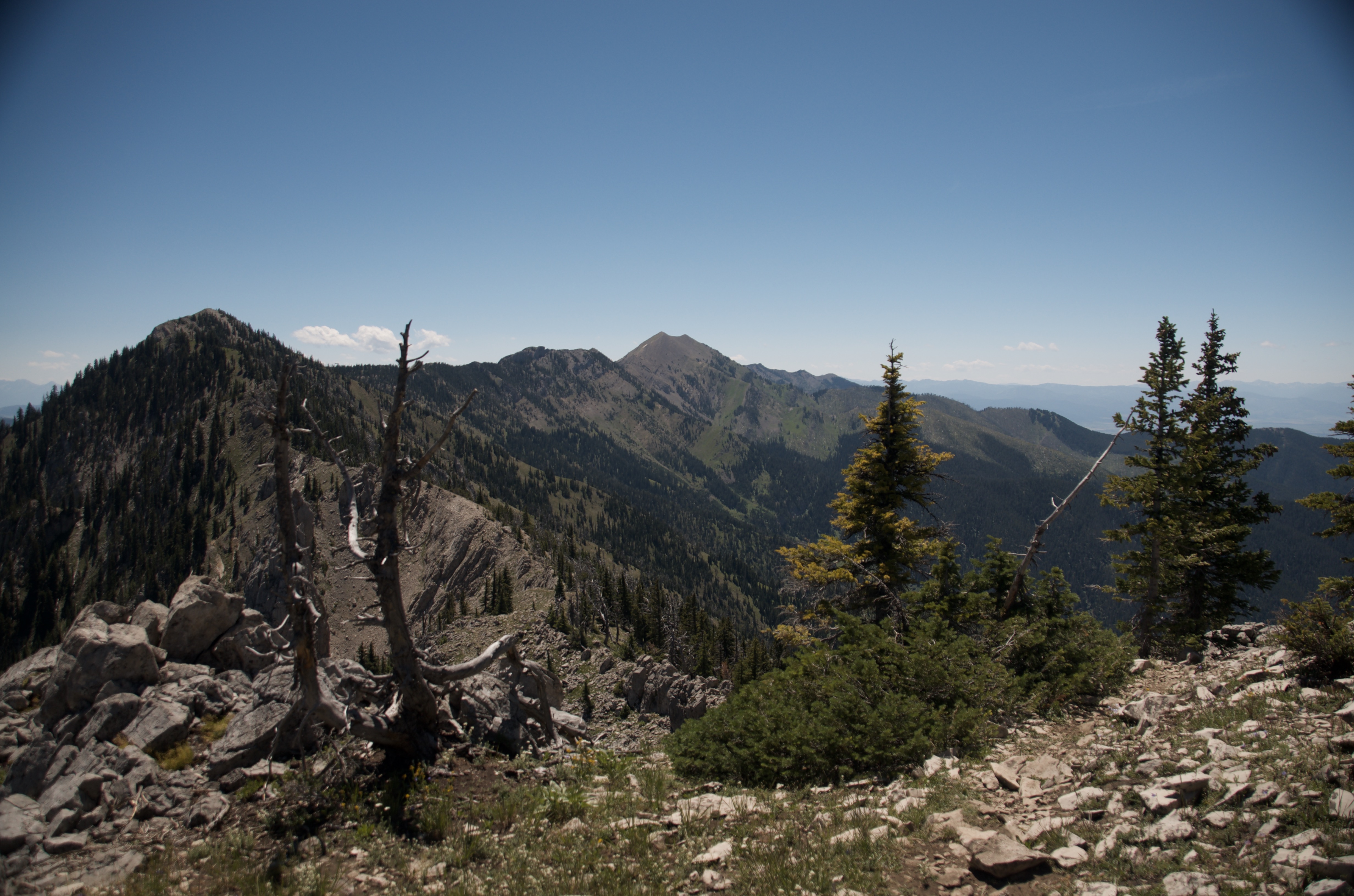
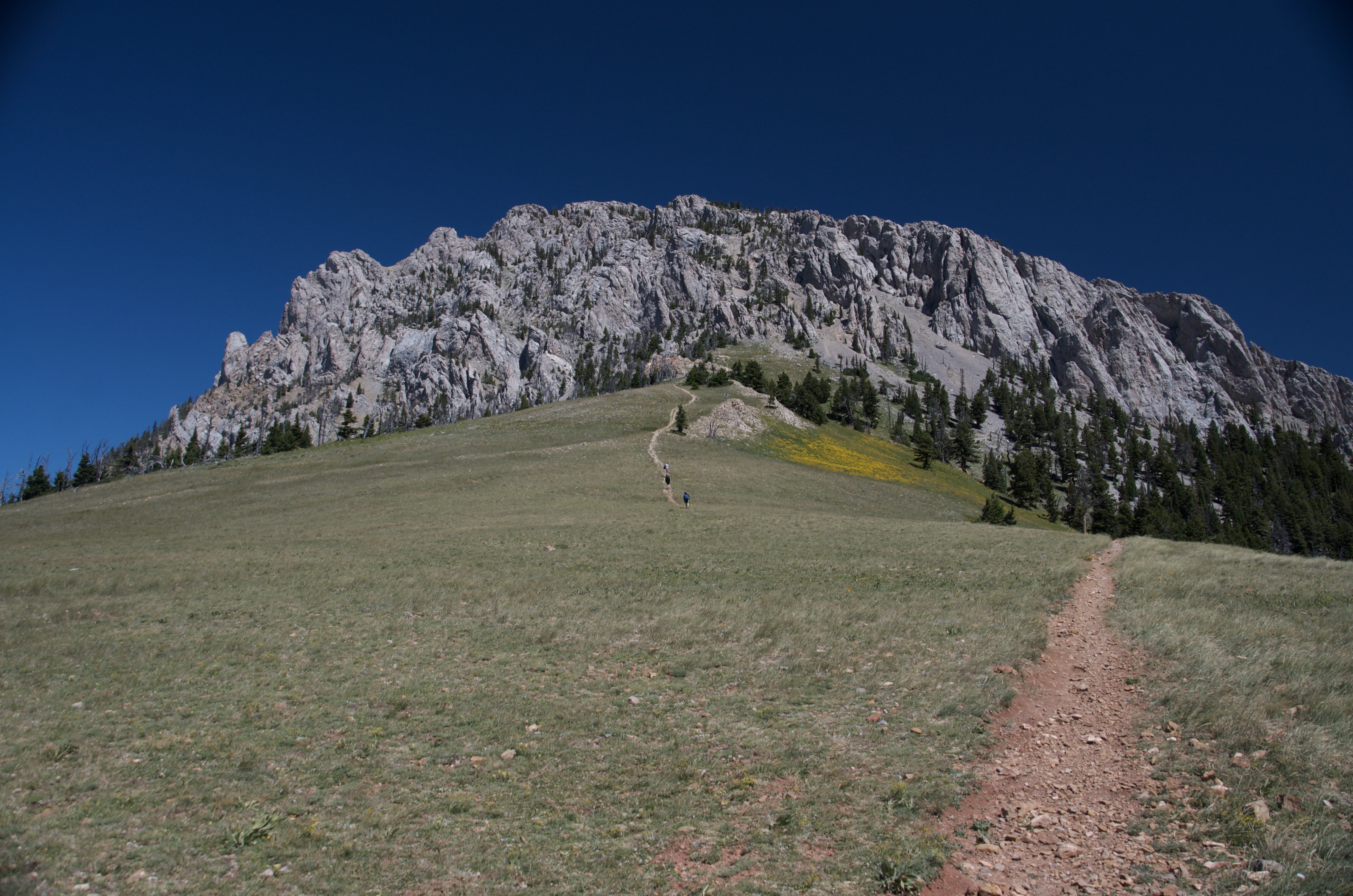
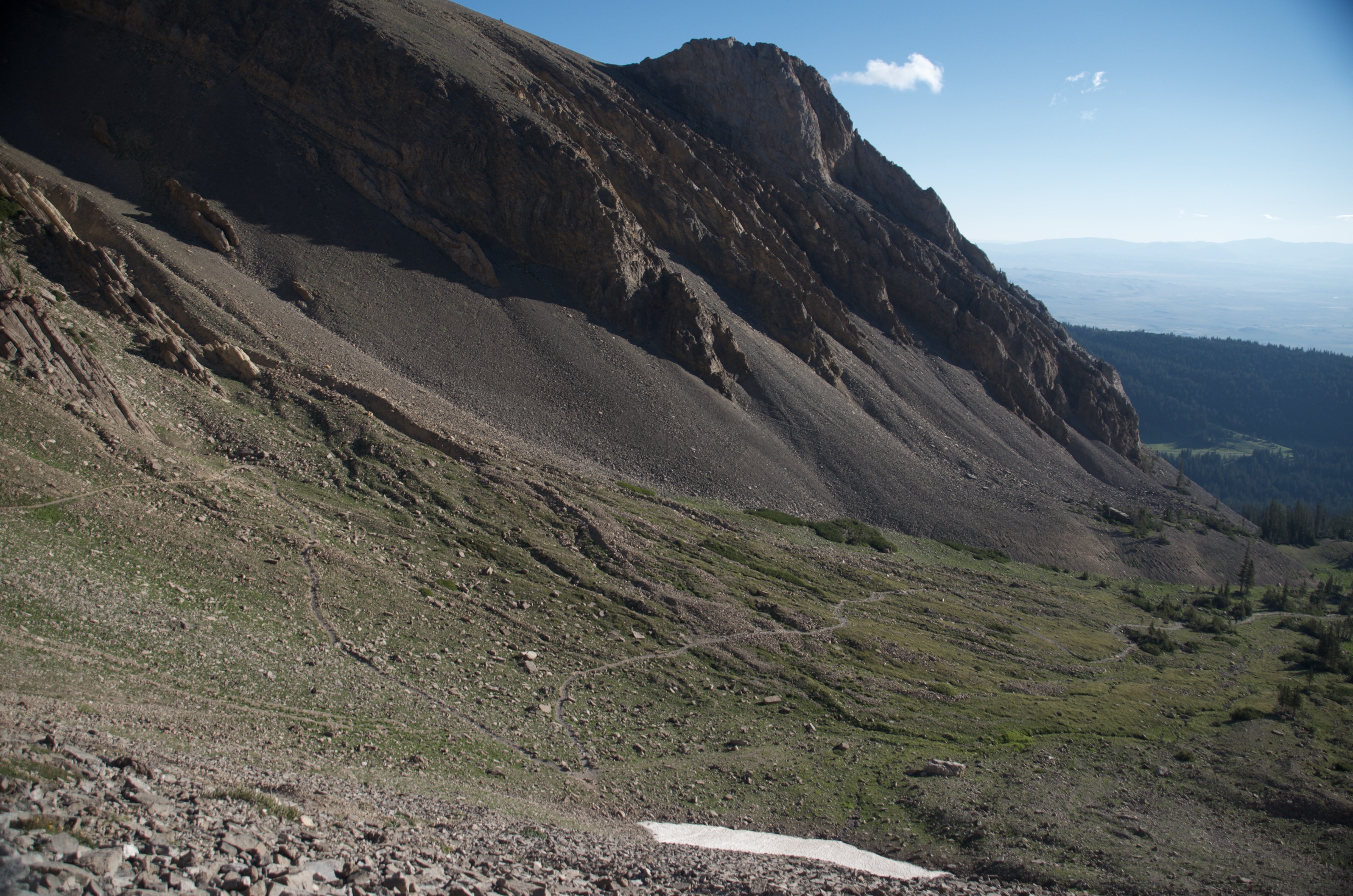
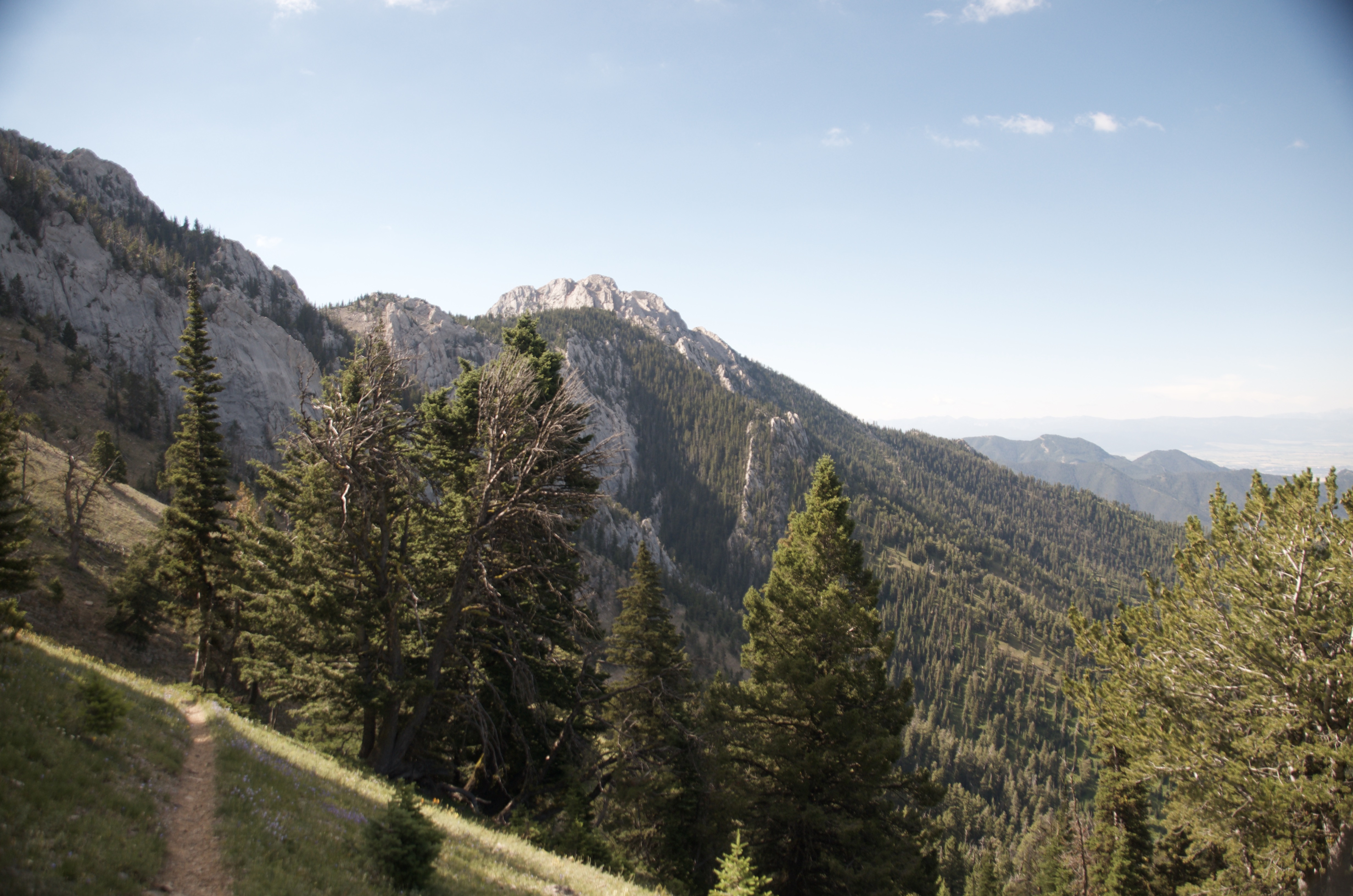
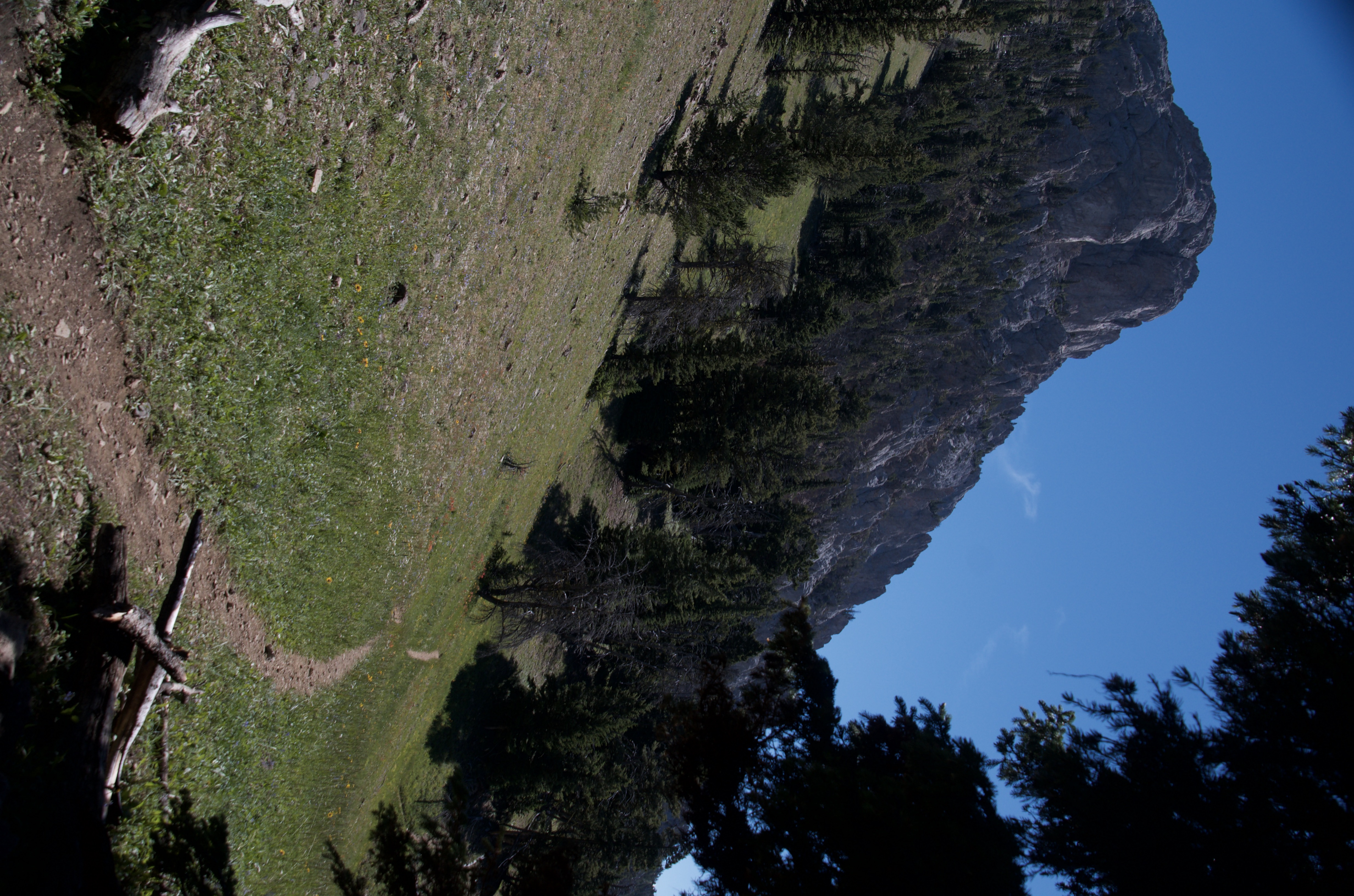
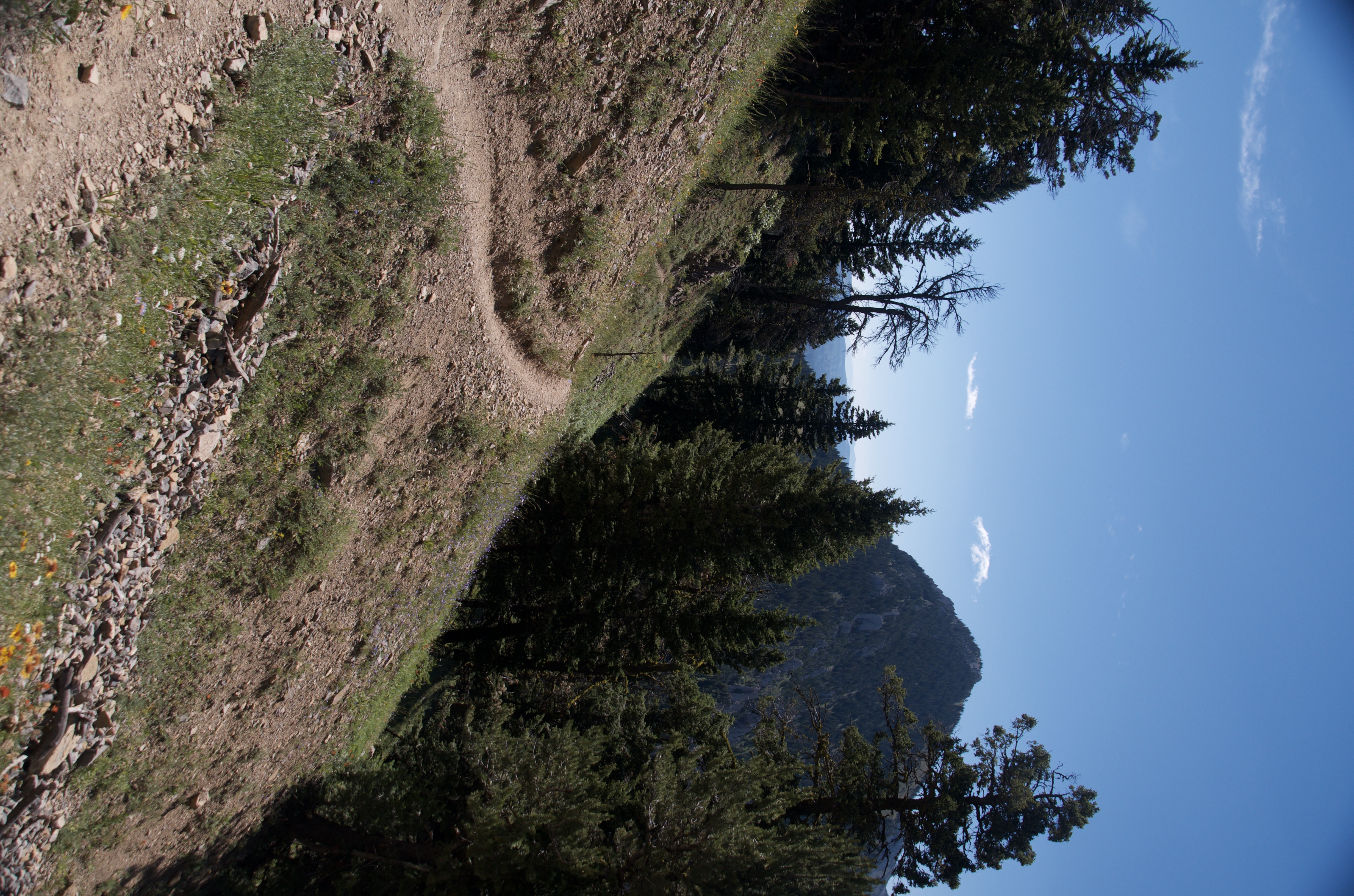
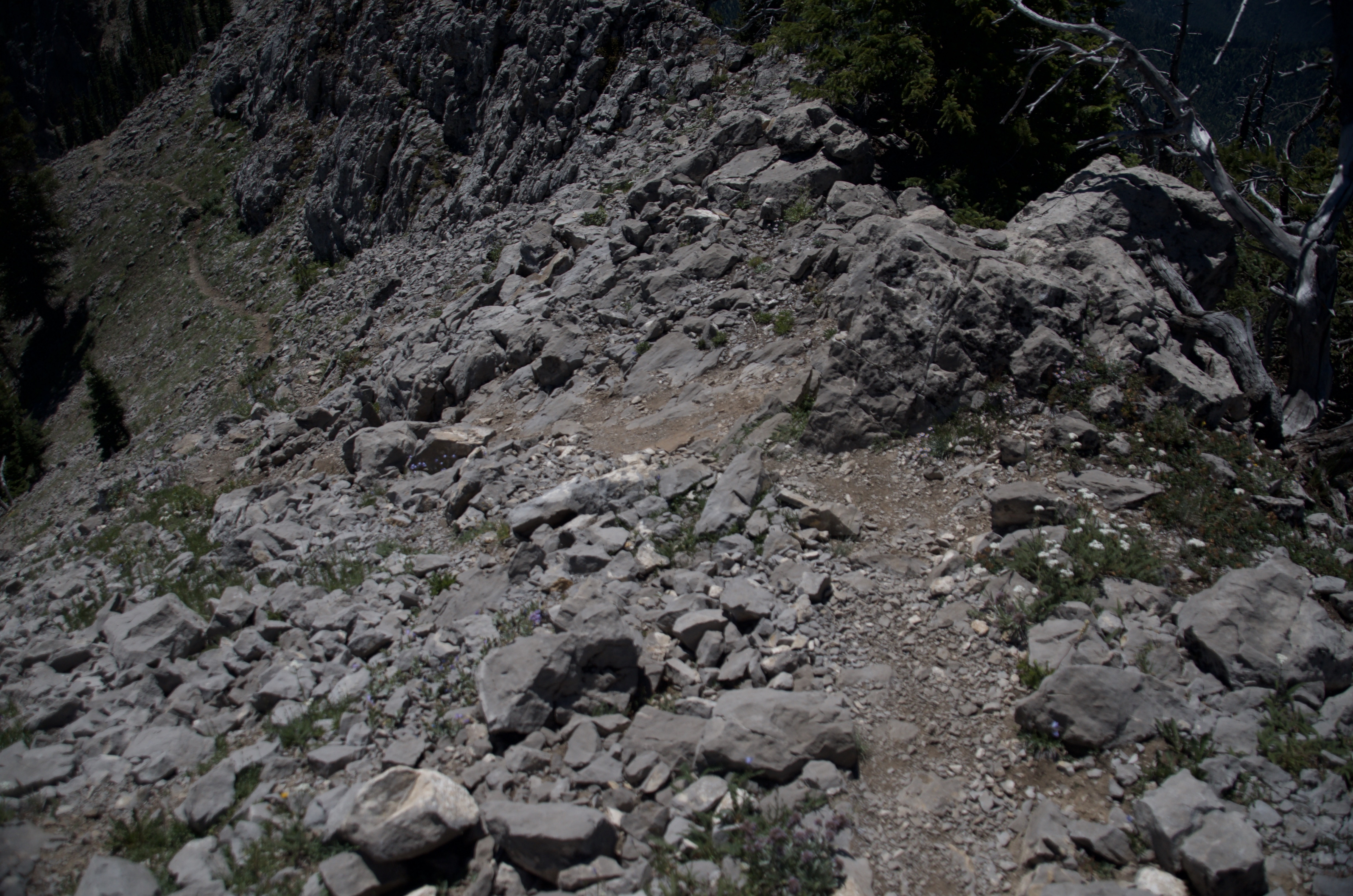
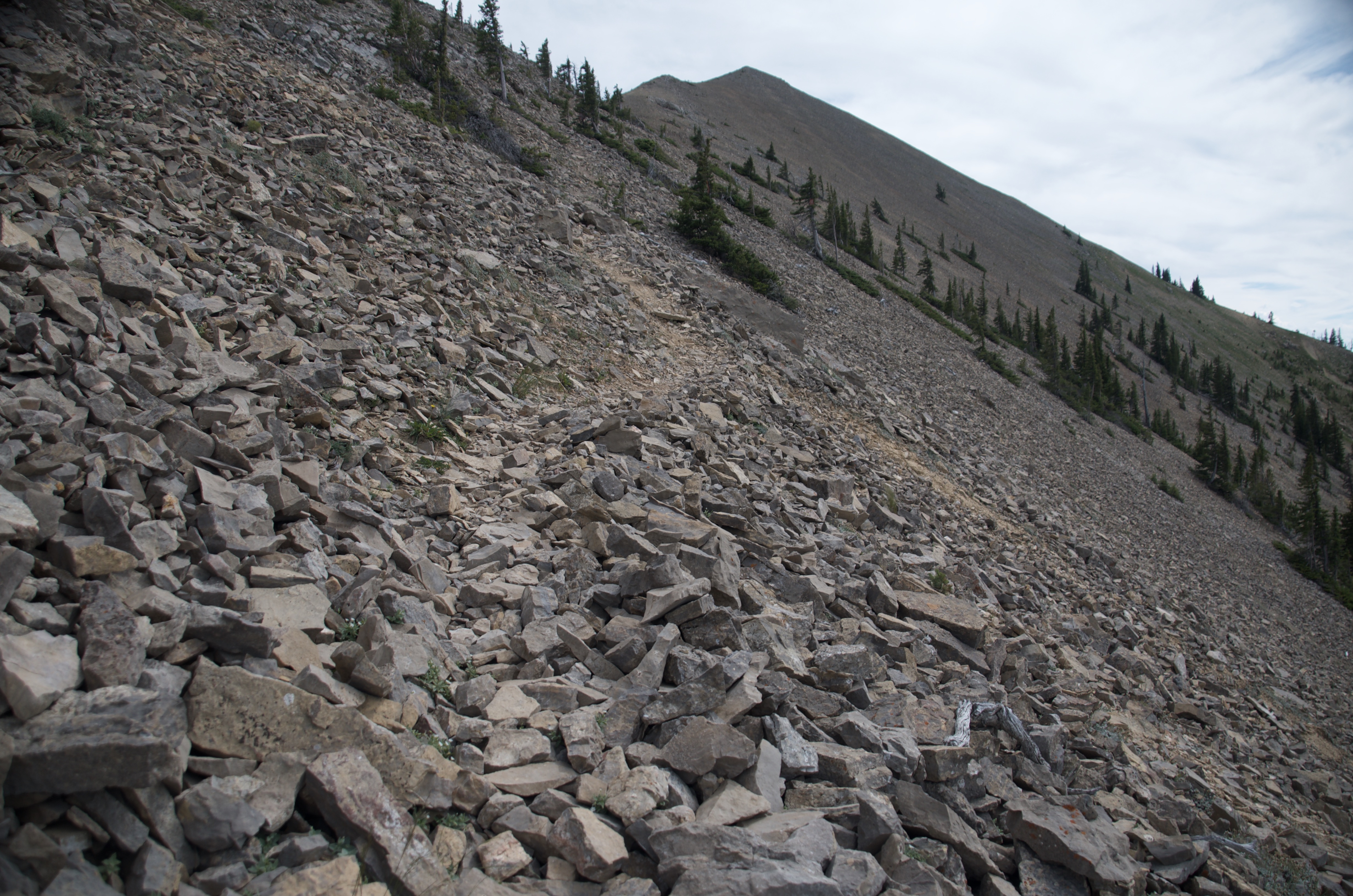
The lower sections approaching Sacajawea from Fairy Lake are well-defined trail. Once on the ridge proper, the trail narrows and gets loose. The middle section has Class 2-3 scrambling on exposed terrain with real drop-offs. Some sections require hands. Trail markers can be hard to follow on rocky sections, but navigation stays manageable because the ridge spine ahead is almost always visible.
Sun protection from head to toe is non-negotiable. You're above treeline for most of 14 hours with no shade. Bring a serious wind layer and a rain layer, both compact. Afternoon thunderstorms in the Bridgers are fast and serious, and the ridge offers nowhere to hide. Starting before 5am gives you the best chance of being off the most exposed sections before weather builds.
Footwear: Hiking Boots or Trail Runners with Ankle Support
You need real food on this one, not just a handful of bars. Plan for a full day of calories. The ridge has good spots to eat at saddles and summits. Eat before you get hungry, because once you're bonking at mile 16, there's no shortcut out.
Wind keeps insects off the ridge. Not a significant factor on this hike.
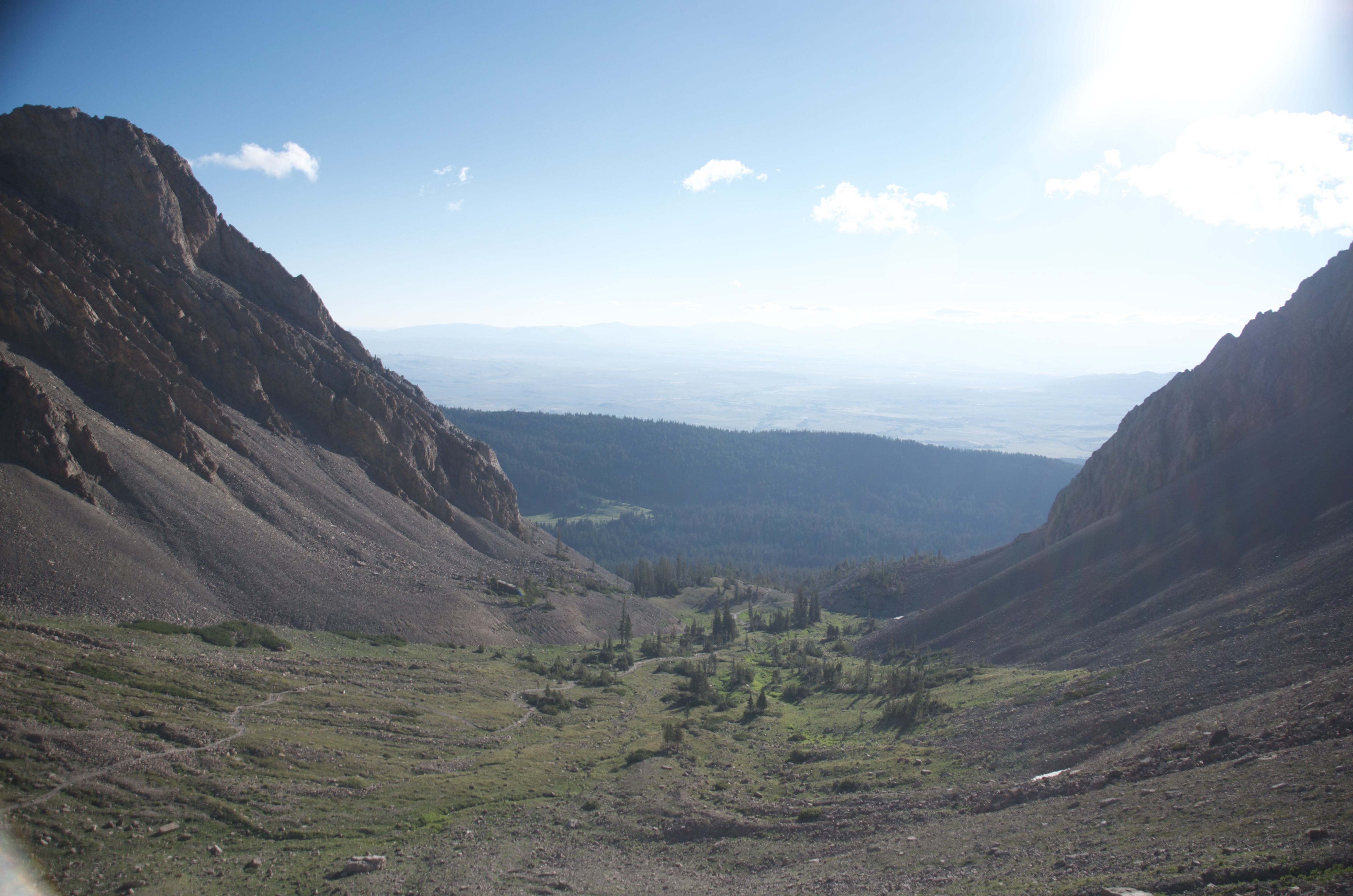
You are above treeline for the overwhelming majority of this route. There is no shade. Plan around this from the start.
Some hikers split this into a two-day overnight. Camping options are limited because most of the ridge is exposed with little wind protection or reliable water. Lower saddles offer the best spots. If you camp on the ridge, be prepared for serious wind. No permit is required for dispersed camping on National Forest land.
Fairy Lake to Sacajawea Peak
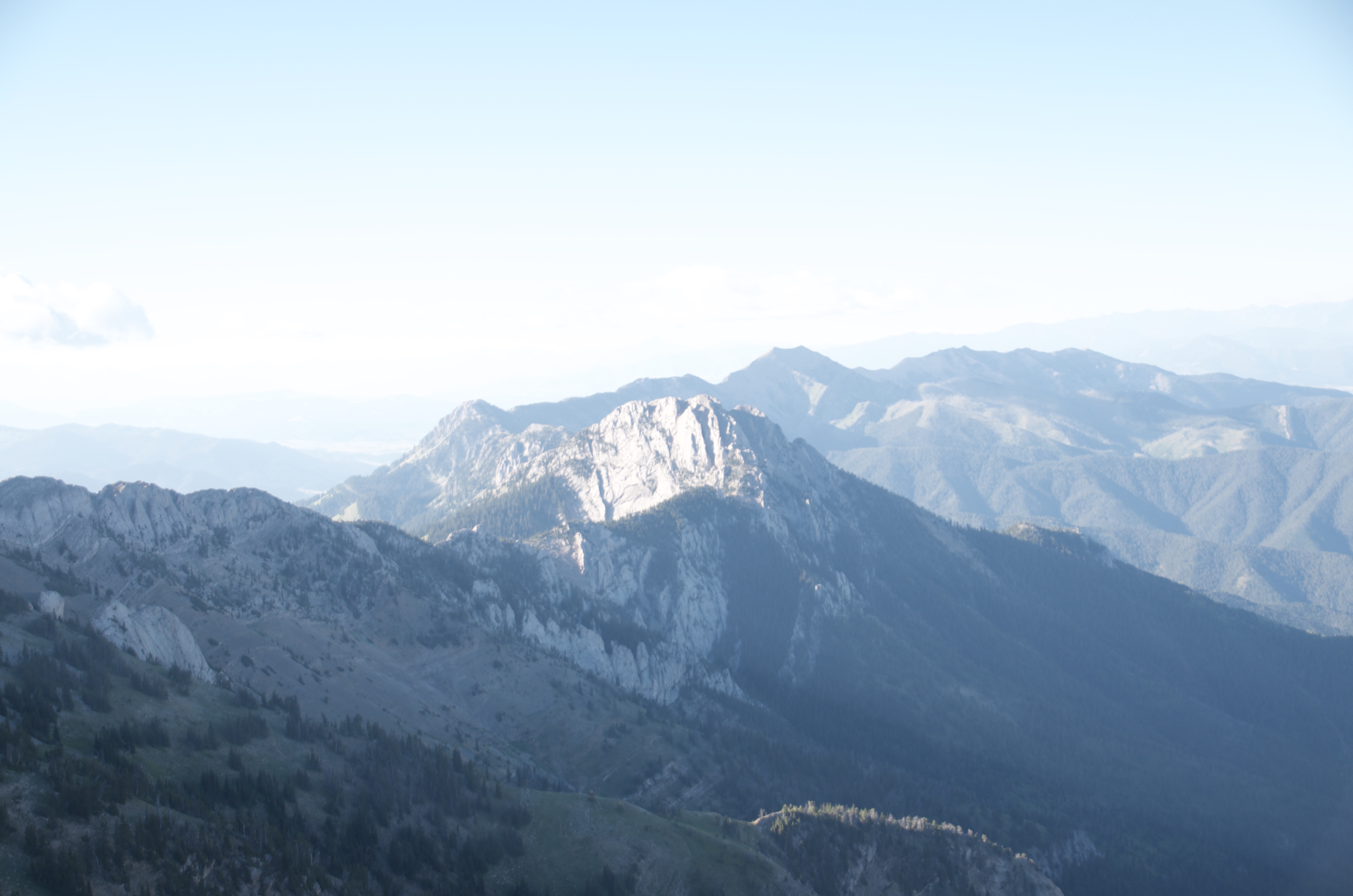
The northern trailhead and terminus of the traverse. Sacajawea Peak is a destination hike on its own and a good way to preview the northern section before committing to 18.7 miles.
Bridger Bowl to the Ridge
The Bridger Bowl ski area provides access to the middle section of the ridge from below, allowing shorter out-and-back ridge hikes without the full traverse logistics.
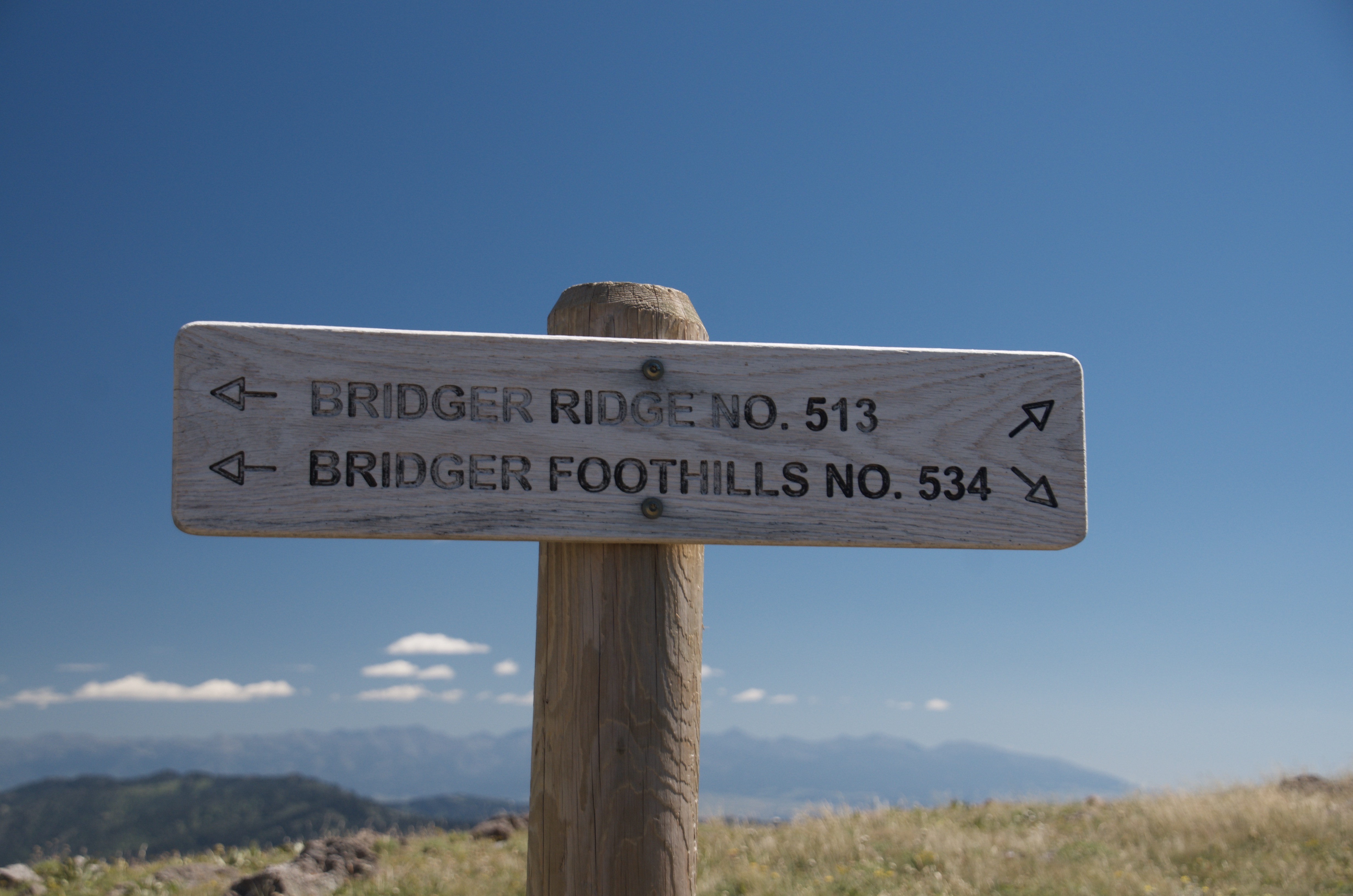
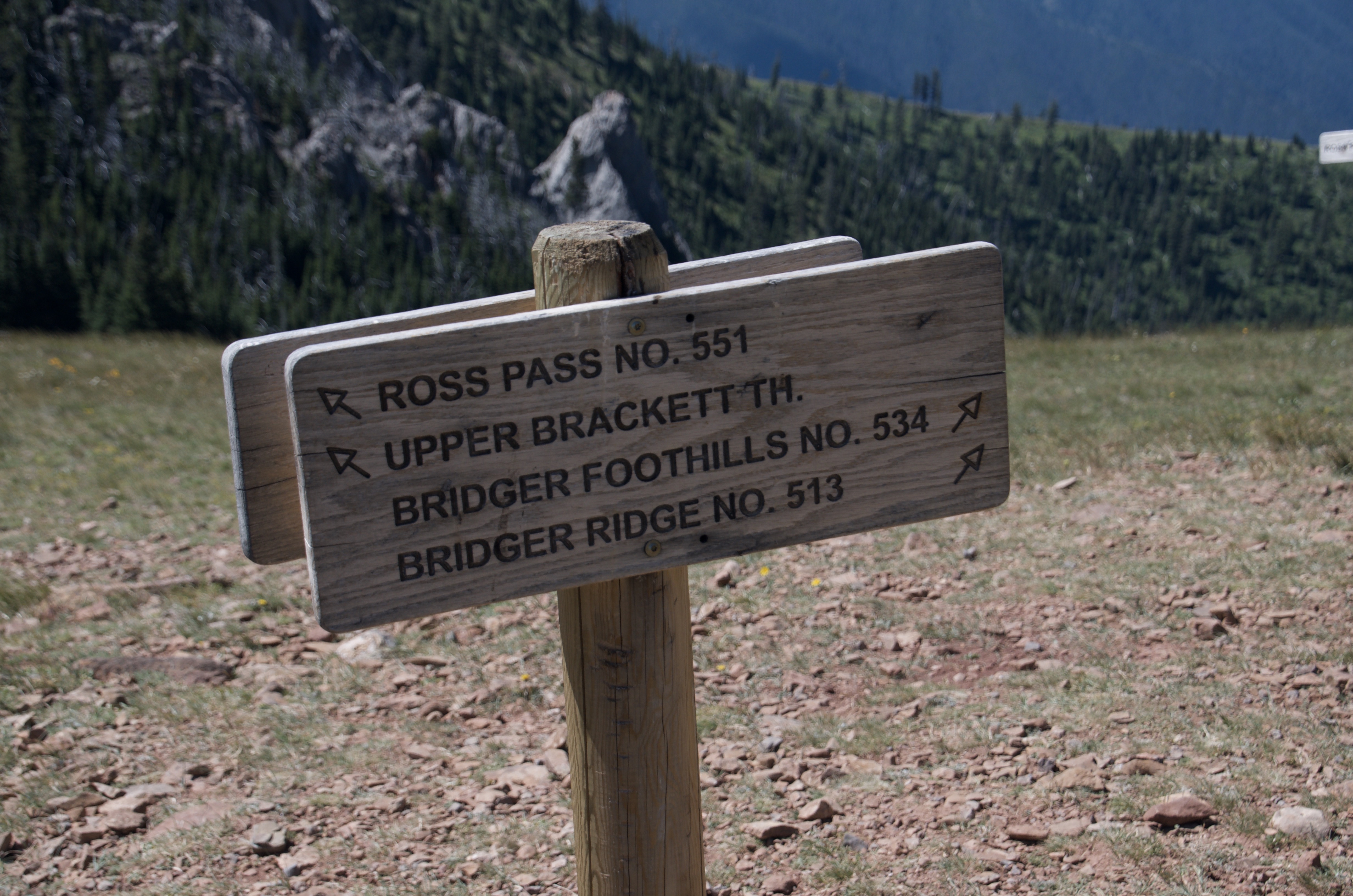
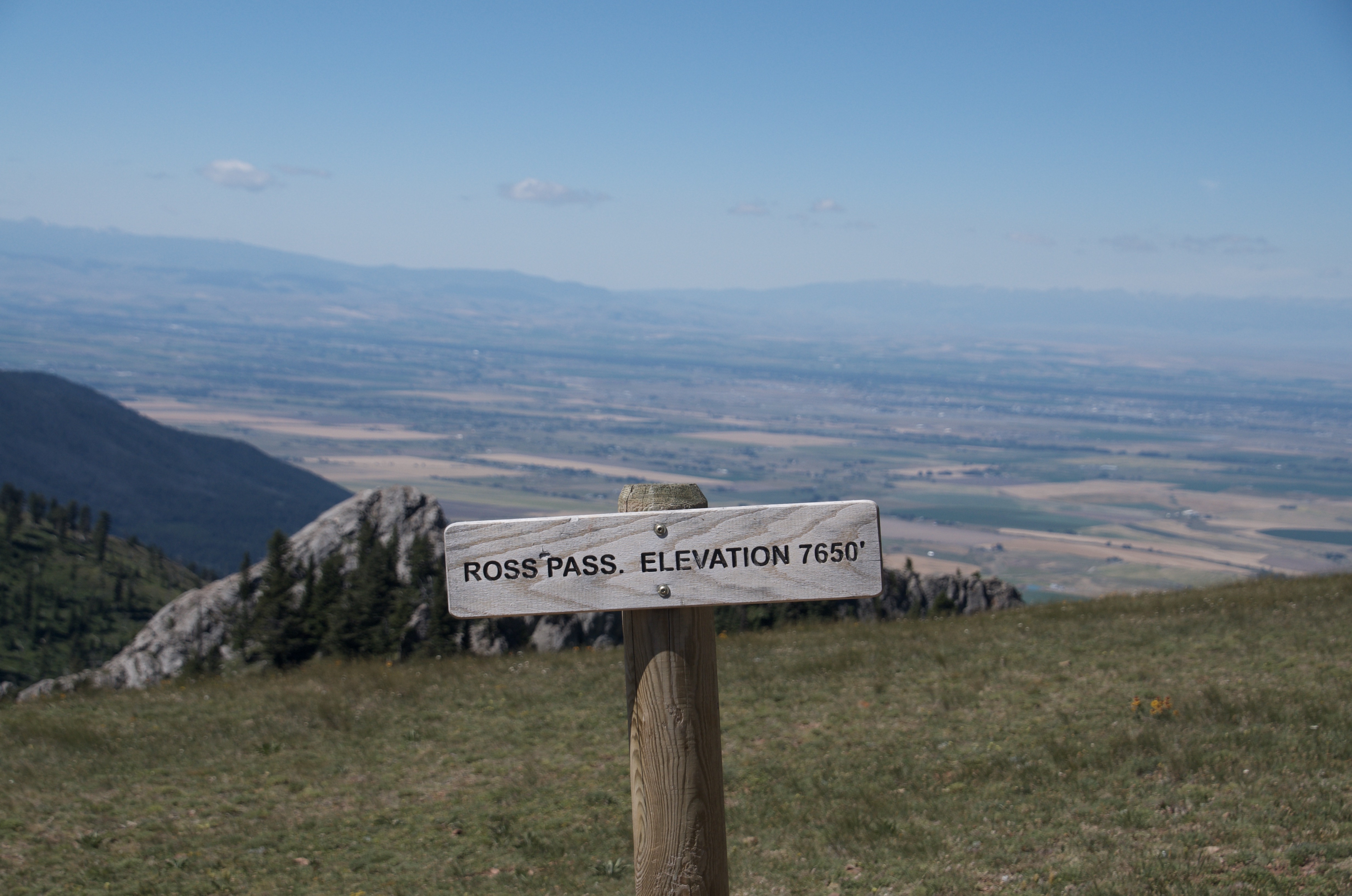
Ross Pass
A connector trail from Brackett Creek to a signed junction on the Bridger Ridge Trail, accessible partway along the traverse.
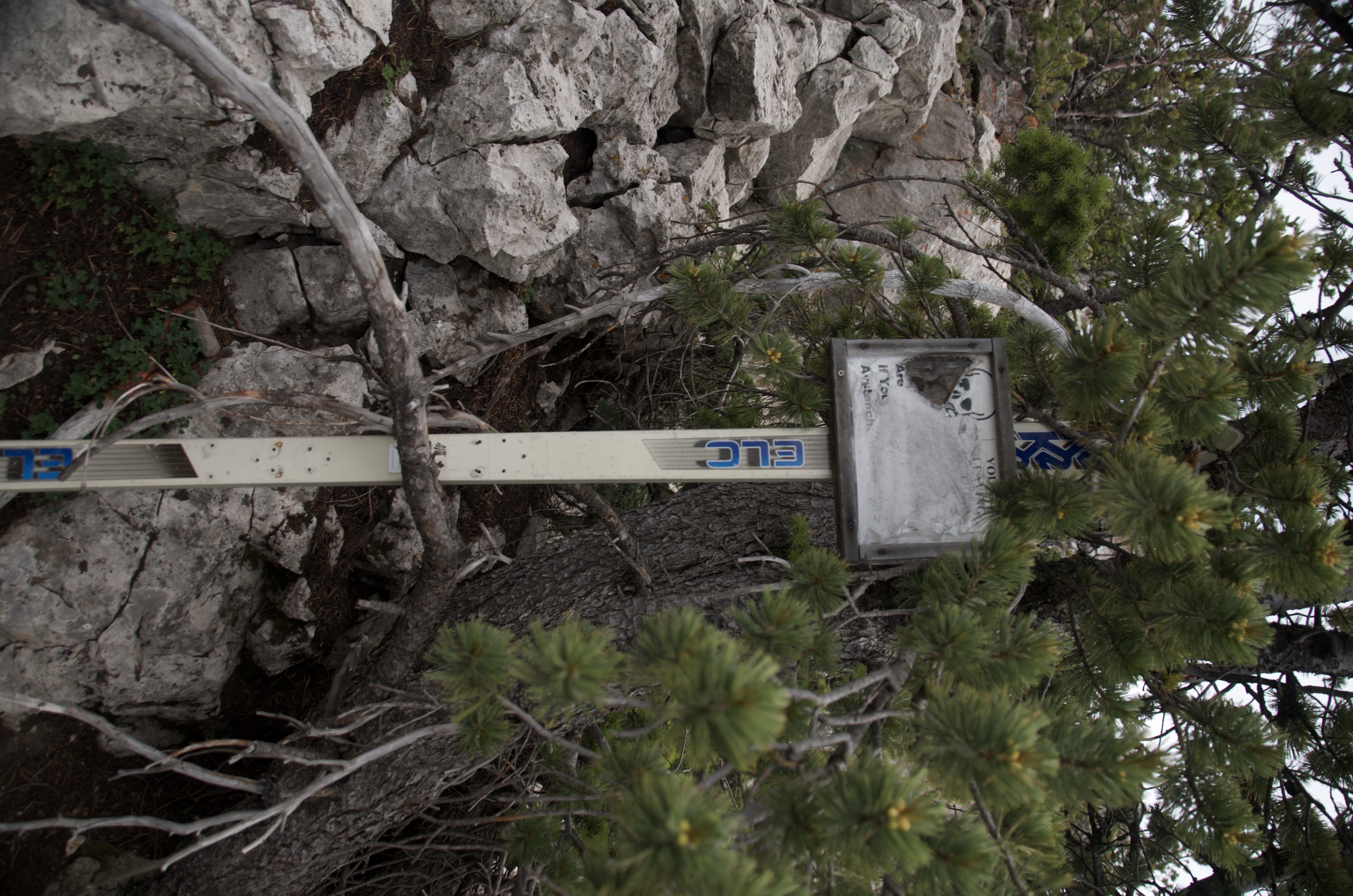
Beartooth Publishing's Bridger Range map covers the full ridge and is worth having on paper. Download Gaia GPS with the route loaded before you leave, and keep your phone charged. Do not attempt this route without a map.
July through mid-September is the reliable window, gated by the Fairy Lake Road opening on July 1. The road closes September 15, making that the practical cutoff for starting at Sacajawea. August offers the most stable weather and the best chance of dry trail conditions throughout the full route.
Late July to mid-August: road open, snow cleared from high saddles, stable weather windows most mornings
Early July and September: snow may linger in high saddles in early July, September brings cooler temps and shorter days that cut your margin thin on a 14-hour route
Before July 1 and after September 15: the Fairy Lake Road gate is closed and snow returns to the high sections
Most hikers take around 14 hours for the full 18.7-mile traverse. Trail runners can do it faster, but budget the full day regardless and start before 5am to give yourself a safety margin on weather.
North to south, starting at Fairy Lake and ending at the M trailhead, is the more common direction. You summit Sacajawea Peak early when you're fresh, then move south losing net elevation through the traverse. Going south to north means finishing on Sacajawea when you're exhausted, which is a harder way to end a 18.7-mile day.
Very little. Once you leave the Fairy Lake area, reliable water is essentially unavailable for the rest of the route. Some hikers find seasonal snowmelt at saddles in early July, but you cannot count on it. Carry at least 80 oz per person from the trailhead.
Yes. The trail is point-to-point with 18.7 miles between trailheads. Leave a vehicle at the M trailhead the evening before, then drive to Fairy Lake to start. You can also arrange a ride back from the M or coordinate with another group going the opposite direction.
Yes. There is Class 2-3 scrambling throughout the middle section of the ridge. The trail gets narrow, loose, and exposed with steep drop-offs on both sides. You will use your hands in multiple places. This is not a standard uphill trail.
Some people do. Camping options are limited because most of the ridge is exposed with little wind shelter and scarce water. Lower saddles offer the best spots. If you camp on the ridge, expect serious wind. No permit is required for dispersed camping on National Forest land.
July through mid-September is the practical window. The Fairy Lake Road gate opens July 1 and closes September 15, which defines your access to the Sacajawea starting point. Snow can linger in high saddles into early July.
It has real hazards beyond a standard strenuous hike. The main risks are lightning exposure on a ridge with no shelter, technical terrain requiring focus on every step through the middle section, and the commitment of a long route with very few exit options. Starting early to beat afternoon storms and carrying enough water are the two most important safety practices.
Plug 18.7 miles and 4,060 feet of elevation gain into our free hiking time calculator for a personalized estimate.