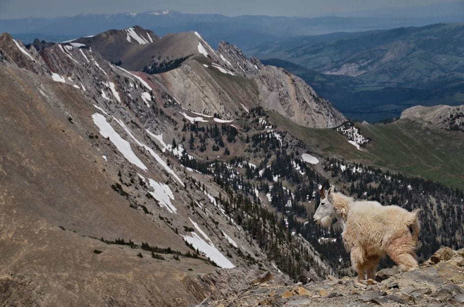
The Custer-Gallatin National Forest covers nearly three million acres of some of the most varied terrain in Montana. Waterfalls, river corridors, canyon views, wildlife. The problem is finding trails that are genuinely accessible. “Easy” covers a lot of ground in most trail guides, and “accessible” is a different question entirely.
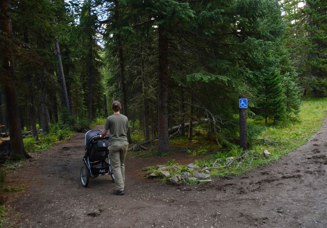
Most trail guides don’t make the distinction. “Easy” can mean a gentle two-mile paved loop or a rugged four-mile out-and-back with river crossings and roots across the path. Both get the same label. For anyone using a wheelchair, pushing a stroller, managing limited mobility, or dealing with a condition that changes what “manageable” means from one day to the next, that difference is everything.
This guide covers only confirmed, sourced information about accessible trails in the Custer-Gallatin. Where a trail has real limitations, I’ll say so directly. Call ahead before you visit, because conditions change seasonally and trails in Montana can degrade fast after a wet spring or a dry summer.
What “Accessible” Actually Means on a National Forest Trail
Before the trail breakdown, a quick note on terminology, because it matters here.
ADA (Americans with Disabilities Act) technically applies to built facilities like restrooms and parking lots, not to backcountry trails. When you see a trail described as “ADA accessible,” that phrasing is usually approximate, not official.
FSTAG (Forest Service Trail Accessibility Guidelines) is the Forest Service’s own standard for accessible trails on National Forest land. It sets requirements for grade, surface firmness, tread width, and rest areas. A trail that meets FSTAG is genuinely built with accessibility in mind.
When the USFS lists a trail on its Accessible Recreation Opportunities page, it means the trail offers some level of usability for people with disabilities. That doesn’t always mean full FSTAG compliance on every metric.
“Accessible-friendly” is the catch-all phrase that shows up in travel blogs. It can mean almost anything. Treat it as a starting point, not a guarantee.
The honest bottom line: call the ranger district before you go. Bozeman Ranger District: 406-522-2520.
Palisade Falls: The Most Accessible Trail in the Gallatin

Location: Hyalite Canyon, Bozeman Ranger District. About 20 miles south of Bozeman.
Palisade Falls is the real answer to the question of what accessible trail to do near Bozeman. It is a paved asphalt trail, paved all the way to the falls, 1.1 miles round trip with 319 feet of elevation gain. The USFS lists it on their Accessible Recreation Opportunities page, and it is also a designated National Recreation Trail (#433). There is an accessible vault toilet at the trailhead and a large parking lot with space for trailers.
The falls drop 80 feet off a volcanic rock wall and they are worth it. TripAdvisor ranks this the number five thing to do in the Bozeman area out of 46 options, and it earns the ranking. That being said, Palisade Falls is crowded, and if you are bringing someone with a mobility device, the crowds add a real layer of complexity. On a peak summer Saturday, the trail near the base of the falls can get backed up with people. Arrive early, especially in July and August.
A few honest notes on the accessibility. The trail is paved and the overall experience is genuinely manageable for most people. That said, portions of the trail have grades that approach or exceed what strict ADA standards allow for ramps, so some sections may require assistance depending on the individual. The USFS lists this trail as accessible without a formal FSTAG certification on every segment. It is the best paved accessible option in the Gallatin, but go in knowing it is not a perfectly flat loop.

Seasonal access: May 16 through late October or early November. Hyalite Canyon Road closes annually from April 1 to May 15. You cannot reach this trail by car during that window. In winter the paved trail is accessible on foot and the frozen falls are genuinely spectacular, but the surface gets icy and packed down fast. Not appropriate for wheelchairs or mobility aids in winter conditions.
Cost: Free. No parking fee.
The bottom line: this is the Gallatin’s most accessible trail and a legitimate destination. Go early.
Upper Deer Creek Trail #438: A Short River Walk
Location: Bozeman Ranger District, along Highway 191 in the Gallatin Canyon. Between Bozeman and Big Sky.
This one is short by design: 0.3 miles of gravel trail along the Gallatin River, connecting two improved parking areas. It was built as part of the Upper Deer Creek River-Access Restoration Project, a partnership between the Gallatin River Task Force, the Custer-Gallatin National Forest, and Montana Trout Unlimited. The project also added an accessible fishing platform with interpretive signage and a kayak launch point.
The gravel surface is the key caveat. Gravel compacts and degrades seasonally, and a well-packed surface in early summer is not the same trail by late August after heavy foot traffic. The USFS lists this trail on its Accessible Recreation Opportunities page, and the fishing platform is built to accessible standards, but call the Bozeman Ranger District before your visit to confirm current conditions.
Seasonal access: May through October.
This is a short walk, not a destination hike. But the Gallatin River is beautiful along this stretch, the accessible fishing platform makes it a legitimate option for anglers who need a stable launch point, and wildlife viewing along the river corridor is real. Moose, herons, and osprey all work this section of the canyon.

Grotto Falls Trail #432: Longer, but Know What You’re Getting Into
Location: Hyalite Canyon, Bozeman Ranger District. Near the Palisades Falls trailhead area.
Grotto Falls is listed on the USFS Accessible Recreation Opportunities page. The surface is gravel. The distance is 2.5 miles round trip. There is an accessible restroom at the trailhead. It is the longest option on this list.
The important caveat: this trail has sections that grade at 8 to 12 percent, which is steeper than what FSTAG considers accessible. These sections occur at roughly 0.1, 0.4, and 0.7 miles in, going uphill toward the falls. The USFS notes that “wheelchair users may need assistance along the entire route.” This is not a trail where an independent wheelchair user should assume smooth passage.
That said, some people will find this trail manageable with a capable companion and the right equipment. The gravel surface is generally wide. The falls at the end are worth the effort for the right group. Seasonal access is May 16 through late October.
This is not the trail to put at the top of the list for someone expecting a fully accessible, independently navigable route. Palisade Falls is that trail. Grotto Falls is the option for people who want more distance, are going with assistance, and can make an honest call about what the grade sections will require.


Yankee Jim Canyon Interpretive Trail #383: Worth Bookmarking
Location: Gardiner Ranger District. 7.5 miles north of Gardiner on US 89, accessed via the Old Yellowstone Trail north of Corwin Springs.
This trail is currently closed, but it belongs on the radar. A 0.3-mile paved interpretive trail with panels covering the history of Yankee Jim Canyon, it is exactly the kind of low-barrier accessible option that works well for a Yellowstone gateway trip. Gardiner is 55 miles from Bozeman and the natural base for the north entrance to Yellowstone.
The trail has been closed since the catastrophic June 2022 Yellowstone River flooding, which was the worst the region had seen in recorded history. The USFS Yankee Jim River Access page carries an active closure notice: “There is no vehicle access due to flood-related damage. Contact the district for information.” No reopening date has been published.
Contact the Gardiner Ranger District at 406-848-7375 to check current status before planning a visit.
When it reopens, this is a legitimate accessible stop for anyone doing the Yellowstone-Gardiner corridor, and it is worth tracking.
Planning Tips
Call first. Trail conditions in Montana are seasonal. Gravel degrades, roads wash out, and conditions that were fine in June may be different by mid-August. Bozeman Ranger District: 406-522-2520. Gardiner Ranger District: 406-848-7375.
Time your visit. The gravel trails on this list are accessible May through October. Crowds at Hyalite Canyon peak in July and August, which matters if you need clear path width. Early morning is the right call, especially on summer weekends.
Surface type matters. Paved is straightforward. Gravel can be firm and packed or loose and soft depending on the season and recent maintenance. Ask about surface conditions when you call.
Gear. If you are using a wheelchair or rolling mobility device on gravel, wider wheels handle loose surfaces better. Think through what the specific surface will require before committing to a trail.
Adaptive Equipment Near Bozeman
There is no track chair program at Gallatin National Forest trailheads or at state parks in the Bozeman area as of this writing. Track chair programs do exist at two Montana state parks: Lone Pine State Park in Kalispell (406-755-2706) and Lake Elmo State Park in Billings (406-247-2940). Both offer Action Trackchair reservations at no cost for visitors with disabilities who want to access trail systems that standard wheelchairs can’t handle. These are worth knowing about if your Montana trip takes you to northwest or south-central Montana.
For the Bozeman region, the most useful adaptive recreation resource is MonTECH, Montana’s Assistive Technology Program, operated through the University of Montana’s Rural Institute. MonTECH runs a free adaptive equipment lending library that loans gear for 30, 90, or 180-day periods, with free shipping anywhere in Montana. The library includes adaptive outdoor recreation equipment, and staff can help match the right gear to your planned activity.
MonTECH: montech.ruralinstitute.umt.edu, or call toll-free 1-877-243-5511.
The broader track chair gap in southwest Montana is real and worth noting to Montana FWP if accessible outdoor infrastructure matters to you. More programs like Lone Pine and Lake Elmo would change what is possible on trails throughout the Gallatin corridor. FWP welcomes feedback at fwp.mt.gov.
The Bottom Line
The Gallatin does not have a large inventory of formally accessible trails. What it has is a handful of genuine options, one of which is legitimately great, and a few others for people who understand the caveats going in.
Palisade Falls is free, paved, and worth every crowded Saturday morning it takes to get there. Go early. For related reading, see the full Palisade Falls trail brief, our wildlife viewing guide along Highway 191, and our free dispersed camping guide near Big Sky.